


Done
New York, NY, United States
Auction Details
16th-20th Century Antiquarian Maps
Explore both land and sea with this array of maps, which preserves the geography of nearly every region imaginable. Unlike modern maps, these original engravings trace borders as they evolved throughout history. Discover centuries-old views of every corner of America or a map of Portugal and parts of Spain from 1645! Not only will these maps serve as decorative pieces, but they also will reveal innumerable ways to view our world.
Auction Curator:
Steve Kovacs
Maps ExpertLot Number: Lowest
24
Sold
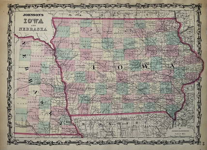
0001: 1863 Johnson Map of US West -- Johnson's California Territories of New Mexico Arizona ColoradoEst. $250-$300
See Sold Price


Sold
0006: 1650 Jansson Map of the Persian Empire -- Persia, sive Sophorum RegnumEst. $250-$300
See Sold Price

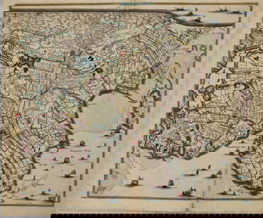
Sold![1863 Johnson's Western Hemisphere [on sheet with] Johnson's Eastern Hemisphere: Title: 1863 Johnson's Western Hemisphere [on sheet with] Johnson's Eastern HemisphereCartographer: Johnson and WardYear / Place: 1863, New YorkMap Dimension (in.): 14.7 X 26.1 in. This is a large](https://p1.liveauctioneers.com/5584/310081/165880221_1_x.jpg?height=310&quality=70&version=1700599538)
0009: 1863 Johnson's Western Hemisphere [on sheet with] Johnson's Eastern HemisphereEst. $120-$150
See Sold Price
0010: 1568 but 1595 Ortelius Map of Northern Netherlands -- Oost ende West Vrieslandts Beschrijvinghe.Est. $300-$350Lot Passed
Sold
0012: 1776 Zatta Map of South America -- America Meridionale divisa ne' suoi principali StatiEst. $150-$200
See Sold Price
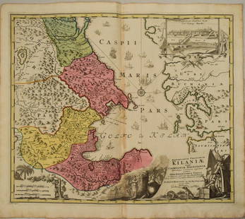
0014: 1720 Homann Map od the Caspian Sea Region -- Provinciarum Persicarum Kilaniae nempe ChirvaniaeEst. $350-$400Lot Passed

0016: 1630 Mercator Map of Northern Germany -- Saxonia Inferior et Meklenborg Duc:Est. $100-$120Lot Passed
Sold
0017: 1862 Johnson Map of Civil War Virginia East of Richmond -- Johnson's Map of the Vicinity ofEst. $120-$150
See Sold Price
Sold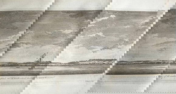
0018: 1756 Tinian. Pirate’s View of the Anchoring Place by the English pirate G. AnsonEst. $70-$80
See Sold Price

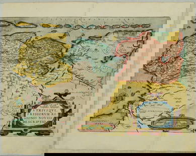
![1869 Mitchell Map of the Middle East [verso] Southeast Asia to China -- XXXVII Turkey in Asia,: Title: 1869 Mitchell Map of the Middle East [verso] Southeast Asia to China -- XXXVII Turkey in Asia, Persia, Arabia, Afghanistan, Beloochistan and Turkestan [verso] XXXIX India, China, Thiber &](https://p1.liveauctioneers.com/5584/310081/165880233_1_x.jpg?height=310&quality=70&version=1700599538)
0021: 1869 Mitchell Map of the Middle East [verso] Southeast Asia to China -- XXXVII Turkey in Asia,Est. $50-$60Lot Passed

0022: 1756 Saipan. Northwest View of the Largest Mariana Island by the English pirate G. AnsonEst. $50-$60Lot Passed

0023: 1671 Ogilby Map of Venezuela -- Venezuela, cum Parte Australi Novae AndalusiaeEst. $250-$300Lot Passed

View:
24
Auction Details

Bid Increments
PriceBid Increment
$0$1
$10$5
$100$10
$200$20
$500$50
$1,000$100
$2,000$200
$5,000$500
$10,000$1,000
$20,000$2,000
TOP