Sold2020Vintage Montana Maps (3)Three vintage Montana maps. They measure 11-in. x 17-in. to 15.25-in. x x22.75-in. VG-EX/EX condition. Unframed, loose and not glued or mounted. If lot is absent of a condition report a condition repoSee Sold Price
Sold2022Chicago, Ohio Vintage Map Lot (3)1928 Pictorial map: Illinois, Its Geography Its History. 1933 Pictorial Cartograph of Ohio. 1933 Map: Chicago and the Century of Progress. Folding as issued..See Sold Price
Sold2021Group of 3 Vintage MapsOhio/Indiana map (1921) measures 26.5 x 22.5 inches, Illinois/Missouri map (1921) measures 29 x 23.5 inches, Military map (1861) measures 29.5 x 23 inches with mat included. All maps are on heavy stocSee Sold Price
Sold20233 Vintage MapsOverall with frames 13" to 16-1/2" high X 16-3/4" to 21-1/2" wide. EL IMPORTANT: Before bidding, please read the terms and conditions. When you registered for the auction you agreed to these terms andSee Sold Price
Sold2018Lot 3 Vintage Map And EtchingsLot 3 Vintage Map And Etchings. Unframed and unmatted paper with reproduction of color map of the North American continent, marked as North America, by Matthew Seutter, 1735. Print date unknown. Two rSee Sold Price
Sold2021NY World's Fair and Transit Map , 3 Vintage Pipes ,Vintage Smalls Lot incl NY World's Fair and Transit Map , 3 Vintage Pipes , Vintage Ephemera Condition: The pipe with the bearded guy looks to have been repairedSee Sold Price
Sold2023Album containing 33 pcs of ephemera related toDighton, MA, to include: 3 vintage maps taken from an early map book, brochures for Mt Hope finishing Co. , Dighton Unitarian cemetery, stereoptic card of Berkley Bridge, Dighton Bi-centennial celebraSee Sold Price
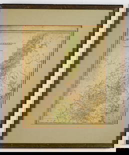
Sold20173 Framed Vintage Maps Navigational & Geological3 Framed Vintage Maps, both Navigational & Geological in nature. Representing the Atlantic Ocean, Barre, VT, and Biddeford, ME, containing Kennebunkport. All measure 21 x 17 inches.See Sold Price
Sold2018WW1 EASTERN FRONT.Romania Hungary Ukraine MoldovaTITLE/CONTENT OF MAP: 'Eastern Front (South)' DATE PRINTED: 1920 IMAGE SIZE: Approx 22.0 x 32.5cm, 8.5 x 12.75 inches (Large) TYPE: Vintage colour map; Scale 1:3,000,000 CONDITION: Good; suitable forSee Sold Price
Sold2020(3 Pc) Framed Vintage MapsDESCRIPTION: A lot of three vintage maps depicts Asia, Africa and the Mediterranean. Provenance: Purchased from Neville Sargent Gallery CIRCA: Early - Mid 20th Cent. DIMENSIONS: H: 15" W: 18" CONDITIOSee Sold Price
Sold2021Vintage Invasion World War Maps and 3 Photos all 8x10Vintage Invasion World War Maps and 3 Photos all 8x10See Sold Price
Sold2017TWO ANTIQUE BENTWOOD EASELS & MAP PRINTSEasels measure approx. 21 1/8" w x 55 3/4" h. Maps are vintage reproductions of the World & Europe compliments of Sanka Coffee.See Sold Price
Sold2021Fascinating and scarce 1876 map of Montana TerritoryTitle: Fascinating and scarce 1876 map of Montana Territory Description: "Historic vintage map of the Montana Territory published the year of Custer’s massacre near the Little Big Horn River. This mSee Sold Price
Sold2023BRITISH/US VIRGIN ISLANDS Tortola Virgin Gorda St Croix St Thomas/John 1931 mapThe Virgin Islands; Inset map of St. Croix' by Sifton, Praed & Co. Ltd, St. James's St. London S.W. (1931). Vintage colour map, 8.0 x 14.0cm, 3.25 x 5.5 inches Reserve: $30.00 Shipping: Domestic: FlatSee Sold Price
Sold2023HISPANIOLA. Haiti & Santo Domingo (Dominican Republic) Vintage map 1931The Republics of Haiti & Santo Domingo' by John Bartholomew & Son (1931). Vintage colour map, 9.0 x 15.0cm, 3.5 x 6 inches Additional Information: TITLE/CONTENT OF MAP: 'The Republics of Haiti & SantoSee Sold Price
Sold2023HISPANIOLA. Haiti & Santo Domingo (Dominican Republic) Vintage map 1927The republics of Haiti & Santo Domingo' by Sifton, Praed & Co. Ltd, St. James's St. London S.W. (1927). Vintage colour map, 8.5 x 14.0cm, 3.25 x 5.5 inches Additional Information: TITLE/CONTENT OF MAPSee Sold Price
Sold2023HISPANIOLA. Haiti & Santo Domingo (Dominican Republic) Vintage map 1927The republics of Haiti & Santo Domingo' by Sifton, Praed & Co. Ltd, St. James's St. London S.W. (1927). Vintage colour map, 8.5 x 14.0cm, 3.25 x 5.5 inches TITLE/CONTENT OF MAP: 'The republics of HaitSee Sold Price
Sold2021Lot of Walt Disney World Vintage Ephemera. Included areLot of Walt Disney World Vintage Ephemera. Included are 2 1970's WDW Magic Kingdom Maps, 3 Mickey Mouse Weekly's Epcot Brochere, It's a Small World Souviner Guide, Pictoral WDW Guide, Small World RecoSee Sold Price
Sold20222 VINTAGE MAPS19th century Chicago map, 23 3/4" x 15 1/8", and a Illinois map in the Chicago Sunday Tribune, "Illinois 100 Years Ago", size 21 1/2" x 16".See Sold Price
Sold2016Rare Vintage Map of Afghanistan War Rug: 5'9'' x 7'3''Rare Vintage Afghanistan War Rug showing map of world with Afghanistan at its center from refugee camp in Peshawar, Pakistan. 1997. Size: 5'9'' x 7'3'' (175 x 221 cm). An outstanding and large exampleSee Sold Price
Sold2017Vintage Map of Tokyo post Earthquake, 1933Title/Content of Map: 1933 Map of Tokyo post Earthquake -- (Tokyo) Garbage Disposal Works Date Printed: 1933, Tokyo Cartographer: Anonymous Size: 7.3 x 6 in. An interesting map of Japan's capital, shoSee Sold Price
Sold2018Vintage Map of "Present France"Age unknown, professionally matted and framed, not examined out of frame. Visible image: approx. 14 1/2" x 14 1/4". Frame: approx. 23 3/4" x 23 3/4".See Sold Price
Sold2022American Isthmuses. Caribbean 1885 old antique vintage map plan chartTITLE/CONTENT OF MAP: 'American Isthmuses' DATE PRINTED: 1885 IMAGE SIZE: Approx 9.0 x 11.5cm, 3.5 x 4.5 inches (Small) TYPE: Antique wood-engraved map; Scale 155;000;000 CONDITION: Good; suitable forSee Sold Price