Sold2017VARIOUS ATLAS AND MAP BOOKSVARIOUS ATLAS AND MAP BOOKS- RAND McNALLY FAMILY WORLD ATLAS- SIXTH PRINTING 1987- HARD COVER- THE MAP BOOK EDITED BY PETER BARBER- FIRST PUBLISHED IN THE U.S. IN 2005- HARD COVER- THE MAP CATALOG- 3RSee Sold Price
Sold2024Mitchell - Map of FloridaThis originally hand-colored, lithographed maps is from Samuel Augustus Mitchell's A New Universal Atlas Containing Maps of the various Empires, Kingdoms, States and Republics of the World.. The workSee Sold Price
Sold2023ATLASES AND POCKET MAPS. 3 PIECES TOGETHERATLASES AND POCKET MAPS. A lot of 3 pieces sold together. Generally good condition, various imperfections. Including: Wyld, James. WORLD MAP. London: James Wyld, n.d. 12mo. Folding map, mounted to cloSee Sold Price
Sold2023Cartography12. Cartography.Group of 4 maps, as listed below. Various sizes; light wear. Vp, vd [75/100]Russia in Europe. Plate 21 of Johnston's National Atlas. 25-1/2 x 21 inches. 1850s * ditto. Plate 55 of MitcSee Sold Price
Sold20221833 Jos. Perkins A New General Atlas Map Book1833, written and engraved by Jos. Perkins, publisher - Anthony FinleySee Sold Price
Sold20181911 Philadelphia 24 34 44 Wards Atlas Map BookFirst few pages have wear, tear , and a couple are loose.See Sold Price
Sold20181928 Philadelphia 26th 36th 48th Wards Atlas Map BookApprox. 22" x 18 1/2" and 1 1/4" thickSee Sold Price
Sold2022Road Atlases, Maps, Books With Mineral AreasIncluded are maps and books of geology and mineral resources in North Carolina, AAA road maps of Colorado and Wyoming, two road atlases for Baltimore County and New Hampshire. Some areas are denoted aSee Sold Price
Sold2021Atq Map & Atlas Books, 1899 Spoffords & More - 1899Atq Map & Atlas Books, 1899 Spoffords & More - 1899 Maps Spofford's Cabinet Encyclopedia, 1906 Hammonds Pictorial Atlas of World w/ 1956 Hammond Double Day AtlasSee Sold Price
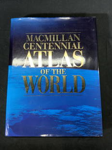
Sold2022Macmillan Centennial Atlas of the World BookMacmillan Centennial Atlas of the World. Published by Macmillan, 1997. Wear to cover and jacket consistent with exposure. Measures approx. 12 x 15.5 inches. Atlas, map, topography, photo book, referenSee Sold Price
Sold2022[CATALOGUES] A large group of early auction and dealer catalogues relating to rare books, maps &[CATALOGUES] A large group of early auction and dealer catalogues relating to rare books, maps & atlases, and related collections, 1950s-70s. A fine large collection of auction catalogues from Parke BSee Sold Price
Sold20211830 "A New Atlas World" Educational School Map Book1830 "A New Atlas World"Antique Educational School Maps. This is a wonderful antique atlas for early education, geography classes. It has a layout of the world and the breakdown of each continent. BecSee Sold Price
Sold20182 Boxes of Books on Maps & Atlases2 Boxes of Books on Maps & Atlases-- Dimensions: ---See Sold Price
Sold20211872 Morgan County, Illinois Atlas & History Book1872 Morgan County, Illinois Atlas & History Book. (1) Atlas Map of Morgan County Illinois, by Townships, 1872. Measures 17 3/4" x 14 3/4". (1) A History of Lawrence, Kansas: From the First SettlementSee Sold Price
Sold2023Charlene Mathews (20 th / 21 st Century) CaliforniaATLAS OF BOOK MAPS, 2011, artist handmade book, with 6 illustrations of enlarged black & white photos backed with Irish Linen with mylar overlay sheets: includes Key to “The Killer Inside Me”See Sold Price
Sold2024MAPS IN BOOKS, Atlases, Buy de MornasContains 135 Double-Page Maps in Contemporary Color. Atlases. Claude Buy de Mornas, [4 Volumes] Atlas Methodique et Elementaire de Geographie et d'Histoire, 1761-62 (published). Hand Color. A large anSee Sold Price
Sold2022MAPS IN BOOK, Atlases, CareyCarey's Famous 1814 General Atlas. Atlases. Mathew Carey, Carey's General Atlas, Improved and Enlarged: Being a Collection of Maps of the World and Quarters, Their Principal Empires, Kingdoms, &c., 18See Sold Price
Sold202019th Century Colored Map of NH & VT19TH CENTURY ATLAS BOOK PLATE MAP OF NEW HAMPSHIRE AND VERMONT- JOHNSON'S NH AND VT BY JOHNSON AND WARD- 26 1/2" X 17 3/4"- TONING, FOXING, CREASES, SMALL LOSSES TO EDGES AND IMPERFECTIONSSee Sold Price
Sold2021MITCHELL - New General Atlas [35 American maps] 1867MITCHELL, S. Augustus, Jr.. Mitchell's New General Atlas, containing maps of various countries of the world, plans of cities, etc., ... together with valuable statistical tables. Philadelphia: S. AuguSee Sold Price
Sold2018Pair Antique 19th Century Atlases, Bound MapsPair Antique 19th Century Atlases. ‘Mitchell’s New General Atlas Containing Maps of Various Countries of the World, Plans of Cities, Etc.’ published by S. Augustus Mitchell, Jr. c 1860. ‘AtlasSee Sold Price
Sold2018Pair Antique 19th Century Atlases, Bound MapsPair Antique 19th Century Atlases. ‘Mitchell’s New General Atlas Containing Maps of Various Countries of the World, Plans of Cities, Etc.’ published by S. Augustus Mitchell, Jr. c 1860. ‘AtlasSee Sold Price
Sold2022ANTIQUE WORLD MAPS AND AMERICAN HISTORY BOOKSA lot of eight antique and vintage historical books and maps. Arbuckles Illustrated Atlas of Fifty Principal Nations of the World, 1890. Lois Marie Hunter, The Shinnecock Indians, 1960. Replogle WorldSee Sold Price
Sold2022MITCHELL, SAMUEL AUGUSTUS. A New Universal Atlas Containing Maps of the Various Empires, Kingdoms,MITCHELL, SAMUEL AUGUSTUS. A New Universal Atlas Containing Maps of the Various Empires, Kingdoms, States and Republics of the World; With a Special Map of Each of the United States, Plans of Cities,See Sold Price
Sold20231875 Illustrated Atlas Plat Map of St. Charles Co. Missouri Book1875, Publisher - W.R. Brink and Co., Several tears in pages and along front cover, Some staining, Measures 17 3/4 x 14in.See Sold Price
BonhamsMITCHELL (SAMUEL AUGUSTUS) A New Universal Atlas Containing Maps of the Various Empires, Kingdom...£1,300
13 hrs LeftForum Auctionsd'Anville (Jean Baptiste Bourguignon) [Untitled Composite Atlas with 102 map sheets], [probably£2,000
BonhamsMITCHELL (SAMUEL AUGUSTUS) Mitchell's New General Atlas, Containing Maps of the Various Countrie...£500
3 days LeftTrillium Antique Prints & Rare BooksSanson - Map of Canada or New France with the Great Lakes$75(1 bid)
3 days LeftTrillium Antique Prints & Rare BooksSanson - Map of Florida (encompassing most of Southeast North America)$95(2 bids)
3 days LeftTrillium Antique Prints & Rare BooksKohler & Weigel - Map of the World with North and South Pole views$110(2 bids)
3 days LeftTrillium Antique Prints & Rare BooksSanson - Map of the British Isles (Ireland, Scotland, England)$75
BonhamsCHAPBOOK St. Julien, the Emigrant; or, Europe Depicted: Exhibiting the Costumes, and Describing ...£10


![Cartography: 12. Cartography.Group of 4 maps, as listed below. Various sizes; light wear. Vp, vd [75/100]Russia in Europe. Plate 21 of Johnston's National Atlas. 25-1/2 x 21 inches. 1850s * ditto. Plate 55 of Mitc](https://p1.liveauctioneers.com/1352/285291/150515655_1_x.jpg?height=310&quality=70&version=1684408824)


![[CATALOGUES] A large group of early auction and dealer catalogues relating to rare books, maps &: [CATALOGUES] A large group of early auction and dealer catalogues relating to rare books, maps & atlases, and related collections, 1950s-70s. A fine large collection of auction catalogues from Parke B](https://p1.liveauctioneers.com/292/250642/130213445_1_x.jpg?height=310&quality=70&version=1654271664)


![MAPS IN BOOKS, Atlases, Buy de Mornas: Contains 135 Double-Page Maps in Contemporary Color. Atlases. Claude Buy de Mornas, [4 Volumes] Atlas Methodique et Elementaire de Geographie et d'Histoire, 1761-62 (published). Hand Color. A large an](https://p1.liveauctioneers.com/6576/320593/172252664_1_x.jpg?height=310&quality=70&version=1708729193)


![MITCHELL - New General Atlas [35 American maps] 1867: MITCHELL, S. Augustus, Jr.. Mitchell's New General Atlas, containing maps of various countries of the world, plans of cities, etc., ... together with valuable statistical tables. Philadelphia: S. Augu](https://p1.liveauctioneers.com/7533/208644/106251073_1_x.jpg?height=310&quality=70&version=1624641782)


![d'Anville (Jean Baptiste Bourguignon) [Untitled Composite Atlas with 102 map sheets], [probably (1 of 3)](https://p1.liveauctioneers.com/5458/329231/177514974_1_x.jpg?height=282&quality=70&version=1715269091)


![[MAP]. ORTELIUS, Abraham. Turcici Imperii Descriptio.1592. (1 of 2)](https://p1.liveauctioneers.com/197/329395/177650538_1_x.jpg?height=282&quality=70&version=1715364962)