Sold2016V. Levasseur: Oceanie, 1850Map: Oceanie Cartographer: V. Levasseur Publishing: Paris, 1850 Size: 11 x 16.5 inches A highly decorative nineteenth century map of Oceania including Australia, showing the colonial possessions. TheSee Sold Price
Sold2017Levasseur: Map of Oceania, 18501850 Levasseur Map of Oceania -- Oceanie. V. Levasseur. 1850 Paris. 11 x 16.5 in. A highly decorative nineteenth century map of Oceania including Australia colored to show the colonial possessions. ThSee Sold Price
Sold2016V. Levasseur: Map of Asia, 1850Map: Asie Maker: V. Levasseur Date: 1850 Origin Paris Date: 11 x 16.5 inches A highly decorative nineteenth century map of Asia, dominated by Russian, Chinese Empires and British India and French IndoSee Sold Price
Sold2017Levasseur Map of Asia, 1850Map: 1850 Levasseur Map of Asia -- Asie Cartographer: V. Levasseur Year / Place: 1850 Paris Map Dimension: 11 x 16.5 in. A highly decorative nineteenth century map of Asia, dominated by Russian, ChineSee Sold Price
Sold20191850 Levasseur Map of Algeria -- Algerie, ColonieTitle/Content of Map: 1850 Levasseur Map of Algeria -- Algerie, Colonie Francaise Date: 1850, Paris Cartographer: V Levasseur Size: 11.4 X 16.8 in. This is a rather lovely map of the French colony ofSee Sold Price
Sold2017Levasseur: Antique Map of South America, 1850Title/Content of Map: 1850 Levasseur Map of South America -- Amerique Meridionale Date Printed: 1850, Paris Cartographer: V Levasseur Size: 11 x 16.5 in. Condition: Very Good - Excellent. Very light tSee Sold Price
Sold2017Levasseur: Antique Map of Oceania & Australia, 1850Title/Content of Map: 1850 Levasseur Map of Oceania and Australia -- Oceanie Date Printed: 1850, Paris Cartographer: V Levasseur Size: 11.3 x 16.8 in. Condition: Excellent. Very light edge toning; sliSee Sold Price
Sold2017Levasseur: Map of Asia, 1850Map: Map of Asia - Asie Cartographer: V. Levasseur Date: 1850 Origin: Paris Size: 11 x 16.5 inches A highly decorative nineteenth century map of Asia, dominated by Russian, Chinese Empires and BritishSee Sold Price
Sold20201852 Levasseur Map of Oceania -- OceanieTitle/Content of Map: 1852 Levasseur Map of Oceania -- Oceanie Cartographer: V. Levasseur Year/Place: 1852, Paris Size: 11 x 16.5 in. A highly decorative nineteenth century map of Oceania including AuSee Sold Price
Sold2016V. Levasseur: Amerique Meridionale, 1840Map: Amerique Meridionale Maker: V. Levasseur Date: 1840 Origin: Paris Size: 11 x 16.5 inches A very decorative South America continental steel engraved map. Good topographical and political boundarySee Sold Price
Sold2017(2) FRAMED HAND COLORED MAPS AFTER V. LEVASSEUR(lot of 2) Framed hand colored maps, each after Victor Levasseur (French 1800-1870), comprising: (1) "Dept. de Loir et Cher"; (1) "Dept. de la Cote D'Or"; sight: 12"h, 17"w, overall: 19.5"h, 24.5"w, 7See Sold Price
Sold2017V. Levasseur: PlanisphereMap: Planisphere Description: This world map uses the fattened view of Mercator's projection. As with other Levasseur maps, the map is surrounded by fine steel engravings of vignettes representing theSee Sold Price
Sold2016V. Levasseur: Afrique, 1856Map: Afrique Cartographer: V. Levasseur Publishing: Paris, 1856 Size: 11 x 16.5 inches A highly decorative nineteenth century map of the African continent colored to show the colonial possessions andSee Sold Price
Sold2023V. Levasseur MapVictor Levasseur, French, 1800-1870. A mid 19th century engraved map with hand-coloring, titled "Dept. de L'Aude". Very slight foxing. Image 17 1/4 x 12 1/2" high, in a contemporary composite frame wiSee Sold Price
Sold2016V. Levasseur: Map of Europe, 1861Map: Europe Maker: V. Levasseur Date: 1861 Origin: Paris Size: 11.5 x 17 inches Very decorative map of Europe. The surrounding engravings frame the map with medallion portraits and coats of arms downSee Sold Price
Sold2023V. Levasseur Hand Tinted Map Of North AmericaV. Levasseur Hand Tinted Map Of North America. Marked: "Amerique Septentrionale , Geographie et Statistique de V. Levasseur Ingenteur Geographe, Grave par Laguillermie, rue St. Jacques, No.82, IllustrSee Sold Price
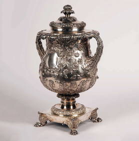
SoldOrtelius, Abraham:Ortelius, Abraham: Africae propriae tabula. [Antwerp], 1590 [but Later]. Hand-coloured, 33 x 48cm; Levasseur: Oceanie (Pacific Ocean). Paris, c.1856, mounted. 28 x 42cm; Homann: Lotharingiae Tabula GSee Sold Price
Sold2021French Map AssortmentFrench Map Assortment (4) maps from the 'Atlas National Illustre' published by V. Levasseur, Paris in 1851 including 'Dept. Du Finistere', 'Dept. De Seine Et Marne', 'Dept. Du Jura' and 'Dept. Des DeuSee Sold Price
Sold2021LEVASSEUR: HAND-COLORED ENGRAVED MAP OF ASIAHand-Colored Engraved Map of Asia, Published in the 'Atlas Universel Illustre' in Paris in 1850 by Levasseur. Printed by Lemercier. The verso of the frame mounted with a certificate of authenticity. PSee Sold Price
Sold2016V. Merritt (English, b. 1850), Landscapeoil on canvas, signed at lower right, presented in a period gilt composition frame. DOA 26.5 x 36.25 in. An old typed note accompanying the painting indicates the artist exhibited work at the Tate GalSee Sold Price
Sold2016Levasseur: Map of Amerique Septentrionale 1850Map: Amerique Septentrionale Maker: Levasseur Date ca. 1850 Size: 12.25 x 17 inches From the last great decorative atlas with the Republic of Texas outlined in blue. Original outline color No Reserve:See Sold Price
Sold2021History of the Highlands, IllustratedBrowne, James. A HISTORY OF THE HIGHLANDS, AND OF THE HIGHLAND CLANS… WITH ILLUSTRATIVE ENGRAVINGS. Edinburgh, Glasgow, London: A Fullarton and Co., n.d. (ca. 1850.) Tall 8vo, 4 v. set. IllustratedSee Sold Price
Sold20211852 Levasseur Map of Africa -- AfriqueTitle: 1852 Levasseur Map of Africa -- Afrique Cartographer: V. Levasseur Year / Place: 1852, Paris Map Dimension (in.): 11 x 16.5 in. A highly decorative nineteenth century map of the African contineSee Sold Price
Sold20206 Large CentsDESCRIPTION: 6 Large Cents. Includes 1845(2), 1850, 1852(2), & 1853 (G-V.G.)See Sold Price


![Ortelius, Abraham:: Ortelius, Abraham: Africae propriae tabula. [Antwerp], 1590 [but Later]. Hand-coloured, 33 x 48cm; Levasseur: Oceanie (Pacific Ocean). Paris, c.1856, mounted. 28 x 42cm; Homann: Lotharingiae Tabula G](https://p1.liveauctioneers.com/1782/326783/175979996_1_x.jpg?height=310&quality=70&version=1714059066)