Sold2020Nautical Map / Sea Chart, #1212 Eastern Long IslandDescription: Nautical Map / Sea Chart, United States East Coast, Connecticut - New York, Long Island Sound, Eastern Part, 12th edition feb 10 / 69 ; all measurements are approximate; Folded; ShippingSee Sold Price
Sold2021Nautical Map / Sea Chart, #362 Block Island Sound andDescription: Nautical Map / Sea Chart, United States East Coast, New York, Long Island, Block Island Sound and Gardiner's Bay, 6th edition, Feb 10/69; Shipping: $20; different rate to California, AlasSee Sold Price
Sold2020Nautical Map / Sea Chart, #224 Oyster & Huntington BaysUnited States East Coast, New York, Oyster & Huntington Bays, South Shore of Long Island Sound, 3rd edition feb 1/43; revised 7/21/58, note heavier bond paper and or better preserved than most; FoldedSee Sold Price
Sold2023NAUTICAL CHART: EASTERN PART OF LONG ISLAND SOUNDDescription: NAUTICAL CHART: EASTERN PART OF LONG ISLAND SOUNDMeasurement approximate: 30 x 37 InchesMaterial: PaperSee Sold Price
Sold2023Nautical Chart: EASTERN PART OF LONG ISLAND SOUNDDescription: EASTERN PART OF LONG ISLAND SOUND Measurement approximate: 30 x 37 Inches Material: PaperSee Sold Price
Sold2020Nautical Map / Sea Chart, #1211 MarthaDescription: Nautical Map / Sea Chart, United States East Coast, Rhode Island - Connecticut - New York, Block Island Sound and Approaces9th edition, dec 23/63 stamped CORRECTED ONLY FOR AIDS & HAZARDSSee Sold Price
Sold2023Trinidad Island. Eastern Part. West Indies. ADMIRALTY sea chart 1869 (1950) mapTrinidad Island - Eastern Portion' by Bocas Del Dragon to Icacos point from the surveys by Commr. Alun Jones, R.N., and the Officers of H.M. Surveying Ship "Challenger" 1936. Eastern portion of Gulf oSee Sold Price
Sold2023Trinidad west part Gulf of Paria West Indies ADMIRALTY sea chart 1869 (1951) mapWest Indies - Trinidad Island and Gulf of Paria' by Bocas Del Dragon to Icacos point from the surveys by Commr. Alun Jones, R.N., and the Officers of H.M. Surveying Ship "Challenger" 1936. Eastern porSee Sold Price
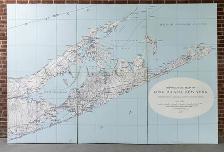
Sold2022Three Panel Water Current Map of Eastern Long Island on Canvas with FrameOver scaled Eastern Long Island water current map on three panel canvas, strengthened on frame. Please note of wear consistent with age. Each panel measures 48"W x 2"D x 96"H.See Sold Price
Sold20221970s Nautical Navigations Maps Long Island Sound, Block Island & More 47"x35"1970s Nautical Navigations Maps Long Island Sound, Block Island & More 47"x35"See Sold Price
Sold2021KERRY HALLAM PAINTED NAUTICAL CHARTLarge hand painted nautical chart (NOAA, Conn. Long Island Sound, 1983) with mixed media scene of yachts signed Kerry Hallam. Image 33 x 43 inches, framed 50 x 59 inches. VG condition. (Kerry Hallam,See Sold Price
Sold2023Nautical Chart: SOUTHERN COAST OF LONG ISLAND SOUND/ MONTAUK POINT TO EAST HAMPTONDescription: SOUTHERN COAST OF LONG ISLAND SOUND/ FROM MONTAUK POINT TO EAST HAMPTON Measurement approximate: 32 x 22 InchesMaterial: PaperSee Sold Price
Sold2023NAUTICAL CHART CONNECTICUT NORTH SHOREOF LONG ISLAND SOUND STRATFORD TO SHERWOOD POINTDescription: NAUTICAL CHART CONNECTICUT NORTH SHOREOF LONG ISLAND SOUND STRATFORD TO SHERWOOD POINT. Published at Washington, D.C. U.S. Department of Commerce Environmental Science Services AdministraSee Sold Price
Sold2019Eldridge's Long Island Sound Nautical Chartfrom New York to New London 24" x 76" published by Geo. W. Eldridge, 1911See Sold Price
Sold2023NAUTICAL CHART / CONNECTICUT/ NORTH SHORE OF LONG ISLAND GUILFORD HARBOR TO EAST HAVEN RIVERDescription: NAUTICAL CHART / CONNECTICUT/ NORTH SHORE OF LONG ISLAND GUILFORD HARBOR TO EAST HAVEN RIVER. Published at Washington D.C/ US Department of Commerce National Oceanic and Atmosphere AdminiSee Sold Price
Sold2023NAUTICAL CHART/ CONNECTICUT NORTH SHORE OF LONG ISLAND SOUND NIANTIC BAY AND VICINITYDescription: : NAUTICAL CHART/ CONNECTICUT NORTH SHORE OF LONG ISLAND SOUND NIANTIC BAY AND VICINITY. Compiled and printed at Washington D.C by US Department of commerce / Luther H. Hodges, Secretary.See Sold Price
Sold2023Nautical Chart: PLUM ISLAND TO STRATFORD SHOAL/ LONG ISLAND SOUNDDescription: PLUM ISLAND TO STRATFORD SHOAL/ LONG ISLAND SOUNDMeasurement approximate: 32 x 22 Inches Material: PaperSee Sold Price
Sold2023NAUTICAL CHART/ CONNECTICUT NEW YORK. NORTH SHORE OF LONG ISLAND SOUND GREENWICH POINT TO NEWDescription: NAUTICAL CHART EAST COAST/ CONNECTICUT – NEW YORK. NORTH SHORE OF LONG ISLAND SOUND GREENWICH POINT TO NEW ROCHELLE. Published at Washington D.C/ JUNE 1939 (6TH Edition) First editSee Sold Price
Sold2023NAUTICAL CHART/ CONNECTICUT NEW YORK. NORTH SHORE OF LONG ISLAND SOUND GREENWICH POINT TO NEWDescription: NAUTICAL CHART EAST COAST/ CONNECTICUT – NEW YORK. NORTH SHORE OF LONG ISLAND SOUND GREENWICH POINT TO NEW ROCHELLE. Published at Washington D.C/ JUNE 1939 (6TH Edition) First editSee Sold Price
Sold2022Large lot of 1960s Nautical Chart Maps Martha's Vineyard, Block Island, LI Sound Cape Cod Bay & moreLarge lot of 1960s Nautical Chart Maps Martha's Vineyard, Block Island, LI Sound Cape Cod Bay & moreSee Sold Price
Sold2023Large 1876 chart of Long Island Sound from Newport to New York. Compiled by George Eldridge, publishLarge 1876 chart of Long Island Sound from Newport to New York. Compiled by George Eldridge, published by S. Thaxter & Son, Boston. Nautical chart with notable coastal towns and landmarks. Canvas backSee Sold Price
Sold2024Antique 1883 Eldridge's Chart Long Island SoundAntique 1883 Eldridge's Chart Long Island Sound From Newport to New York by Geo. Eldridge, Hydrographer and Published by S. Thaxter & Son. The map is framed in a metal map frame with no glass. The mapSee Sold Price
Sold2021Chart of "Long Island Sound, Eastern Part"Chart of "Long Island Sound, Eastern Part", printed 1984 (ANAN3098)(WT) Dimensions: Frame 33" x 49"See Sold Price
Sold2023NAUTICAL CHART EAST COAT NY/ OYSTER AND HUNTINGTON BAYS SOUTH SHORE OF LONG ISLAND SOUND. PublishedDescription: NAUTICAL CHART EAST COAT NY/ OYSTER AND HUNTINGTON BAYS SOUTH SHORE OF LONG ISLAND SOUND. Published at Washington, D.C. U.S. Department of Commerce Environmental Science Services AdministSee Sold Price
2 days LeftZikorn Arts & History ObjectsWest Indies, Eastern Cuba 1881 British Admiralty Nautical Map$100
2 days LeftZikorn Arts & History ObjectsWest Indies, Western Cuba 1879 British Admiralty Nautical Map$100
Featured1 day LeftJasper52Chart of the Sea Coasts of England, Flanders & Holland. MOUNT & PAGE 1758 map$420
May 21Hess Fine AuctionsLux Waterbury Steamship Desk Clock Nautical Mechanical MHP Collection$20(2 bids)
1 day LeftWorld Auction Gallery LLCFramed Reproduction of an Antique Map of Iceland by Georgio Carolo$30
5 days LeftWorld Auction Gallery LLCMiddle Eastern Marquetry Inlaid Chess & Backgammon Board Box$60(2 bids)
Featured1 day LeftJasper52Baltic Sea sea chart. Ports lighthouses mail routes dockyards. LARGE 1952 map$40
Jun 02Nazmiyal AuctionsAntique Persian Serapi Rug 11 ft 8 in x 10 ft 3 in (3.56 m x 3.12 m)$12,000(1 bid)
2 days LeftZikorn Arts & History ObjectsWest Indies, Providence, Windward, Cuba 1834 British Admiralty Map$100(1 bid)
2 days LeftZikorn Arts & History ObjectsEntrance to Baltic Great & Little Belt 1852 British Admiralty Map$100
2 days LeftZikorn Arts & History ObjectsCentral America West Coast 1855 British Admiralty Nautical Chart$100(1 bid)
2 days LeftZikorn Arts & History ObjectsWest Indies Pt. Manzanilla to San Juan 1844 British Admiralty Map$100
2 days LeftZikorn Arts & History ObjectsWest Indies, Cape Gracias to Belize 1843 British Admiralty Map$100
May 23Eldred'sINTERNATIONAL MUTOSCOPE REEL CO. "WORLD'S FAIR POSTCARD VENDER" Long Island City, New York, Mid-20th$200