Sold2024Marmocchi, F. C. 1845 Hand Col Map. Holy Land. Israel, Jerusalem insetFolio Hand Colored Etching/Engraving Published 1845, Florence for "Atlante di Geografia-Storica Universale" by Francesco C. Marmocchi. Paper Size: 17 x 11 inch (43 x 28cm) Good ConditionSee Sold Price
Sold2024Marmocchi, F. C. 1845 Hand Col Map. Holy Land. Canaan. Israel PalestineFolio Hand Colored Etching/Engraving Published 1845, Florence for "Atlante di Geografia-Storica Universale" by Francesco C. Marmocchi. Paper Size: 17 x 11 inch (43 x 28cm) Good ConditionSee Sold Price
Sold2024Marmocchi, F. C. 1845 Hand Col Map. Holy Land. Persia Empire, Alexander the GreatFolio Hand Colored Etching/Engraving Published 1845, Florence for "Atlante di Geografia-Storica Universale" by Francesco C. Marmocchi. Paper Size: 17 x 11 inch (43 x 28cm) Good ConditionSee Sold Price
Sold2024Marmocchi, F. C. 1845 Hand Col Map. Mediterranean"Carta dell' Italia dell' Africa della Numidia?." Folio Hand Colored Etching/Engraving Published 1845, Florence for "Atlante di Geografia-Storica Universale" by Francesco C. Marmocchi. Centre fold asSee Sold Price
Sold2024Marmocchi, F. C. 1845 Hand Col Map. Ancient Italy"L'Italia Antica" Folio Hand Colored Etching/Engraving Published 1845, Florence for "Atlante di Geografia-Storica Universale" by Francesco C. Marmocchi. Folds as issued. Paper Size: 27.5 x 21 inch (71See Sold Price
Sold2024Marmocchi, F. C. 1845 Hand Col Map. Arabia, Syria, Cyprus, Crete, Egypt"Siria Cipro, Creta Egitto Cirenaica Marmarica ed Arabia Carta di Geografica Antica" Folio Hand Colored Etching/Engraving Published 1845, Florence for "Atlante di Geografia-Storica Universale" by FranSee Sold Price
Sold2024Marmocchi, F. C. 1845 Hand Col Map. Egypt Pharaoh Empire, David SalomonFolio Hand Colored Etching/Engraving Published 1845, Florence for "Atlante di Geografia-Storica Universale" by Francesco C. Marmocchi. Paper Size: 17 x 11 inch (43 x 28cm) ome toning, otherwise Good CSee Sold Price
Sold2024Marmocchi, F. C. 1845 Hand Col Map. Greek Colonies. Ancient Greece"Carta delle Colonie Greche" Folio Hand Colored Etching/Engraving Published 1845, Florence for "Atlante di Geografia-Storica Universale" by Francesco C. Marmocchi. Paper Size: 17 x 11 inch (43 x 28cm)See Sold Price
Sold2024Marmocchi, F. C. 1845 Hand Col Map. Greece - Ancient Attica & LaconiaFolio Hand Colored Etching/Engraving Published 1845, Florence for "Atlante di Geografia-Storica Universale" by Francesco C. Marmocchi. Paper Size: 17 x 11 inch (43 x 28cm) Good ConditionSee Sold Price
Sold2024Marmocchi, F. C. 1845 Hand Col Map. Europe Political Map"Prospetto Geografico Politico della Gallia della Germania della Bretagna della Ibernia" Folio Hand Colored Etching/Engraving Published 1845, Florence for "Atlante di Geografia-Storica Universale" bySee Sold Price
Sold2024Marmocchi, F. C. 1845 Hand Col Map. Asia Minor. Macedonia Greece CyprusFolio Hand Colored Etching/Engraving Published 1845, Florence for "Atlante di Geografia-Storica Universale" by Francesco C. Marmocchi. Paper Size: 17 x 11 inch (43 x 28cm) Good ConditionSee Sold Price
Sold2024Marmocchi, F. C. 1845 Hand Col Map. Ancient Greece"La Grecia Antica" Folio Hand Colored Etching/Engraving Published 1845, Florence for "Atlante di Geografia-Storica Universale" by Francesco C. Marmocchi. Paper Size: 17 x 11 inch (43 x 28cm) Very minoSee Sold Price
Sold2024Marmocchi, F. C. 1845 Hand Col Map. Ancient World"Mondo Conosciuto dagli Antichi" Folio Hand Colored Etching/Engraving Published 1845, Florence for "Atlante di Geografia-Storica Universale" by Francesco C. Marmocchi. Folds as issued. Paper Size: 22See Sold Price
Sold2024Marmocchi, F. C. 1845 Hand Col Map. Black Sea. Greece Armenia Turkey Russia"Carta del Reame di Mitridate il Grande della Grecia dell' Aermenia..." Folio Hand Colored Etching/Engraving Published 1845, Florence for "Atlante di Geografia-Storica Universale" by Francesco C. MarmSee Sold Price
Sold2024Original Vintage TWA Holy Land Israel Noah’s Ark Travel Poster David Klein. Vintage TWA Holy Land Israel Noah’s Ark Travel Poster David Klein (25" x 40")See Sold Price
Sold2021Manuscript Map of the Holy Land, early 18th Century[Manuscript map of the Holy Land] Pencil, ink, and watercolor on faux vellum with horizontal and vertical folding creases (8 segments) and no mounting guard; pencil grid visible in upper left and righSee Sold Price
Sold2023AN ILLUMINATED HAMELECH MEGILLAT ESTHERIsrael, c.2009. Hand written by expert Sofer Stam in Sephardic Ksav. Hand illuminated with a magnificent painting from the Story of Esther and decorative borders.9.5” tall.See Sold Price
Sold2022BRITISH ISLES LILY (GEORGE) Britanniae insulae quae nunc Angliae et Scotiae regna continet cum H...BRITISH ISLES LILY (GEORGE) Britanniae insulae quae nunc Angliae et Scotiae regna continet cum Hibernia adiacente nova descriptio, double-page engraved map, land masses hand-coloured, title cartoucheSee Sold Price
Sold2021c 1730 Seutter Map: Novi Belgii, in America ...Historic Maps c. 1730 Historic Rare Earlier State of Seutter's Important American Northeast Map & New York City Restitutio View c. 1730 Hand-Colored Copper-Engraved Map titled, "Recens Edita totius NoSee Sold Price
Sold2023AN ILLUMINATED SHIR HASHIRIMIsrael, c. Modern. Hand written by expert Sofer Stam in Sephardic Ksav. Hand illuminated decorative borders.12.5” tall.See Sold Price
Sold2022(REPUBLIC OF TEXAS.) James Hamilton Young. A New Map of Texas, with the Contiguous American &(REPUBLIC OF TEXAS.) James Hamilton Young. A New Map of Texas, with the Contiguous American & Mexican States. Hand-colored engraved map of Texas with inset text panels relating information on its riveSee Sold Price
Sold2022Ortelius, Abraham Islandia [Iceland]Ortelius, Abraham Islandia [Iceland] [Antwerp, c.1590 or later]. Hand-coloured engraved map (platemark 33.5 x 48.5cm, sheet size 43.5 x 55.5cm), incorporating sea-monsters, polar bears and Hekla volcaSee Sold Price
Sold2020Original Map, Nantucket Drawn by Rev F.C. Ewer, 1869Original Historical Map of Nantucket Surveyed and Drawn by Reverend F.C. Ewer D.D., 1869, (Ferdinand Cartwright 1826-1883) mounted on canvas, unframed. 12 ¾ in. x 20 in.See Sold Price
Sold2022(BERMUDA.) Major General John Henry Lefroy. Map of the Bermudas.(BERMUDA.) Major General John Henry Lefroy. Map of the Bermudas. Hand-colored lithographed wall map of Bermuda with inset diagrams and statistical tables on 4 sheets joined. 51½x60 inches overallSee Sold Price
Featured16 hrs LeftGold Coast AuctioneersJudaica Hungarian Sterling Silver Repousse Challah Brad Tray$425(6 bids)
7 days LeftSimpson Galleries, LLC.MATTHAUS SEUTTER (1678-1757) A MAP OF THE HOLY LAND AND TWELVE TRIBES, "Terra Sancta Vocatta Que$150
Featured3 days LeftJasper521875, Brooklyn Bridge under Construction, Prospect Part, sites in the Holy Land. By Hardesty$20
BonhamsSPILSBURY (FRANCIS B.) Picturesque Scenery in the Holy Land and Syria, FIRST EDITION, Edward Orm...£600
16 hrs LeftGold Coast AuctioneersArtur Szyk ( Polish America Israel 1894-1951) Thorens Music Box Wall Art Judaic$100(2 bids)
Jun 23Schilb Antiquarian Rare Books1790 Life of Jesus Christ Fleetwood Bible ART Miracles Jerusalem MAP Holy Land$64(3 bids)
Jun 11Bill Hood & Sons Art & Antique AuctionsAncient Holy Land Terracotta Cooking Pot, Israel - A terracotta pottery cooking pot with a rounded$100
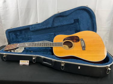
Crawford Family Auctions LLCMartin & Co. D-93 1993 Acoustic Guitar, needs work w/ Martin branded Hard Case$1,100(8 bids)
1006 Lots AwayMynt AuctionsJIMMY CARTER Signed "We Can Have Peace In The Holy Land" hardcover book-JSA$10(1 bid)


![Manuscript Map of the Holy Land, early 18th Century: [Manuscript map of the Holy Land] Pencil, ink, and watercolor on faux vellum with horizontal and vertical folding creases (8 segments) and no mounting guard; pencil grid visible in upper left and righ](https://p1.liveauctioneers.com/1968/225974/116712048_1_x.jpg?height=310&quality=70&version=1636655147)


![Ortelius, Abraham Islandia [Iceland]: Ortelius, Abraham Islandia [Iceland] [Antwerp, c.1590 or later]. Hand-coloured engraved map (platemark 33.5 x 48.5cm, sheet size 43.5 x 55.5cm), incorporating sea-monsters, polar bears and Hekla volca](https://p1.liveauctioneers.com/94/251108/130828919_1_x.jpg?height=310&quality=70&version=1655281539)