Sold2017Map of Alabama by HardestyItem: Map of Alabama by Hardesty Date: 1883 Dimensions: 10.75 x 14.5 in No Reserve: This lot starts at $1 and has no reserve as a courtesy so that collectors can determine the true market value on thiSee Sold Price
Sold2022Pub. 1885, First Edition, Illustrated Clour Plates, Maps, "Hardesty's Military Historical and"Hardesty's Military Historical and Geographical Illustrated: Special Military History of Ohio, Giving Its Part in the Indian Wars, Border Annals, War 1812, Mexican War and the War of the Rebellion",See Sold Price
Sold20223-1937 Cities Service Road Maps Alabama, Mississippi & Chicagorated 7, 9.5"x4.5", all have light wear and soiling.See Sold Price
Sold2020Alabama & GeorgiaTitle/Content of Map: Alabama & Georgia Date: 1861 Cartographer: Johnson Material/Medium: steel engraved Size: 28x14”Provenance: New York Hand colored Reserve: $40.00 Shipping: Domestic: FreeSee Sold Price
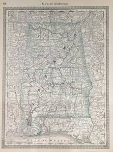
Sold2022Alabama 1896Title/Content of Map: Alabama 1896 Date Printed: 1896 Material/Medium: Paper Size: approx. 10.75x13.75 inches Additional Info: Rand McNally & Co. Universal Atlas of the World Reserve: $35.00 Shipping:See Sold Price
Sold2019Alabama, GeorgiaTitle/Content of Map: Alabama, Georgia Date: 1863 Cartographer: By Johnson & Ward. From, Johnson’s New Illustrated Family Atlas Size: 18x26” Provenance: New York Additional Info: Hand colored. TexSee Sold Price
Sold2017Bradford: Antique Map of Alabama, 1838Title/Content of Map: Alabama by Bradford Date Printed: 1838/1841 Cartographer: Thomas G. Bradford Material/Medium: Paper Size: 13" x 16 1/2" Hand colored. A General Atlas of the World with a SeparateSee Sold Price
Sold2018Alabama by TannerTitle/Content of Map: Alabama by Tanner Date Printed: 1843 Cartographer: based on the work of H.C. Tanner Material/Medium: Paper Size: 17" x 14" Provenance: New York From the first edition published bSee Sold Price
Sold2020Alabama 1897Title/Content of Map: Alabama 1897 Date Printed: 1897 Material/Medium: Paper Size: approx. 14.5x22 inches Additional Info: Cram's Universal Atlas Reserve: $25.00 Shipping: Domestic: Flat-rate of $15.0See Sold Price
Sold2018Colton: Antique Map of Alabama, 1859Title/Content of Map: Alabama by Colton Date Printed: 1859 Cartographer: H.J. Colton Material/Medium: Paper Size: 17 1/1" x 15" Hand colored,engraved. Published in New York in 'Colton's General Atlas.See Sold Price
Sold20202 Hand Colored Maps - Florida & AlabamaTwo Gray's Atlas Maps on one sheet - Florida & Alabama Depicts railroad lines, common roads, canals, topography, etc. Maps are on each side of one sheet. A beautiful & rarSee Sold Price
Sold20231835 Mitchell Map of Louisiana, Mississippi and Alabama -- Map of the States of Louisiana,Title: 1835 Mitchell Map of Louisiana, Mississippi and Alabama -- Map of the States of Louisiana, Mississippi & Alabama Cartographer: S Mitchell Year / Place: 1835, Philadelphia Map Dimension (in.): 1See Sold Price
Sold2022Scarce 1833 Finley map of Alabama – near fineExcellent example of Anthony Finley's very scarce 1833 map of Alabama from a rare late edition of his New General Atlas, one of the earliest obtainable separate maps of Alabama. Map is hand-colored bySee Sold Price
Sold2023Carey & Lea - Map of AlabamaThis hand-colored map was part of the atlas titled A Complete Historical, Chronological, and Geographical American Atlas, being A Guide to the History of North and South America, and the West Indies:See Sold Price
Sold2017Carey & Lea: Antique Geographical Map of Alabama, 1827Title/Content of Map: 1827 Carey & Lea Map of Alabama -- Geographical, Statistical, and Historical Map of Alabama Date Printed: 1827, Philadelphia Cartographer: Carey & Lea Size: 20.4x 16.5 in. This eSee Sold Price
Sold20191825 Buchon Map of Alabama -- Carte Geographique,Title/Content of Map: 1825 Buchon Map of Alabama -- Carte Geographique, Statistique et Historique d' Alabama Cartographer: J Buchon / Carey & Lea Size: 18.1 x 24 in. This early map of Alabama is fromSee Sold Price
Sold2022Scarce Hardesty map of Southwest US, 1875Great map of the West, noting copper, silver and gold regions throughout southern Arizona and New Mexico. “Map of Colorado, Utah, New Mexico and Arizona,” by J. David Williams. Published 1875 by HSee Sold Price
Sold20171882 Historical Hand Atlas, H. H. Hardesty Map1882 Historical Hand Atlas Illustrated, H. H. Hardesty 11.5 X 15. This Hard-to-find Atlas Has Been Rebound—it Will Look Great on Your Shelf. Several State Maps (texas/indian Territory, California/laSee Sold Price
Sold2022Uncommon Hardesty map of upper Northwest US, 1875Nice, elusive early map of northwest territories with vintage original full hand coloring. Idaho and Washington still seen as Territories. ?Map of Washington Oregon and Idaho? published 1875 by HigginSee Sold Price
Sold2023Scarce 1850 RR and steamboat route map of Alabama“A New Map of Alabama with its Roads & Distances from Place to Place along the Stage and Steamboat Routes.” Fascinating map of this southern state from an exceedingly scarce atlas (dated 1850See Sold Price
Sold2021RR map of Alabama from scarce Colton atlasStunning example of 1855 map of Alabama from a very scarce edition of Colton’s New General Atlas. Great original hand coloring and an excellent impression. Nicely centered. Clean on sound paper.See Sold Price
Sold2022Great 1850 map of Alabama in excellent conditionScarce map of Alabama from a company whose maps were among the finest issued in the period. Shows Alabama at an important and interesting period in its history. It is filled with topographical detailsSee Sold Price
Sold20211851 Map of AlabamaTitle: 1851 Map of Alabama Author: Meyer Medium: Ink on Paper Dimensions: 14"X17" Description: Map of Alabama dated 1851. Printed by Meyer. Part of Hand Atlas. Published in Amsterdam, Paris and PhiladSee Sold Price
Sold2017Mitchell: Antique Map of Alabama, 1848Clean 1848 Mitchell hand-colored map of Alabama. Highly detailed and collectible map of Alabama with original, rich hand-coloring. A lovely snapshot of mid-19th century history. Nicely centered with gSee Sold Price
1 day LeftJasper52Map of the Campaign in East Tennessee, Mississippi, Georgia, Alabama, and Florida.$65
May 29Cedarburg Auction & Appraisals LLCSet of Four Maps Showing All of Spain and Portugal$375(2 bids)
Jun 07Freeman's | Hindman[MAP]. TODESCHI, Pietro. [Nova et Acurata Totius Americae Tabula auct. G.I. Blaeu] America quarta$5,000
May 29Cedarburg Auction & Appraisals LLCRare 1877 Double sided map of Milwaukee and Wisconsin$40(4 bids)
2 days LeftFreeman's | Hindman[MAPS]. A group of 3 engraved maps, most with hand-coloring.$300(1 bid)
Jun 07Freeman's | Hindman[MAP]. ORTELIUS, Abraham. Americae Sive Novi Orbis, Nova Descriptio. 1573.$1,000(1 bid)
6 days LeftArarity AuctionsThomson's 1817 Hand Colored Map Comparative Heights of the World's Great Mountains$50
2 days LeftThomaston Place Auction GalleriesCOLLECTION OF TRAVEL EPHEMERA, BROCHURES, BOOKLETS, MAPS 1900-1950$100


![[MAP]. TODESCHI, Pietro. [Nova et Acurata Totius Americae Tabula auct. G.I. Blaeu] America quarta (1 of 1)](https://p1.liveauctioneers.com/197/329395/177650542_1_x.jpg?height=282&quality=70&version=1715364962)


![[MAPS]. A group of 3 engraved maps, most with hand-coloring. (1 of 4)](https://p1.liveauctioneers.com/197/328642/177014805_1_x.jpg?height=282&quality=70&version=1714760103)
![[MAP]. ORTELIUS, Abraham. Americae Sive Novi Orbis, Nova Descriptio. 1573. (1 of 2)](https://p1.liveauctioneers.com/197/329395/177650534_1_x.jpg?height=282&quality=70&version=1715364962)


