Sold2017HAND COLORED ENGRAVED MAP IN 2 SECTIONSHAND COLORED ENGRAVED MAP IN 2 SECTIONS, IMAGE SIZE OF EACH SECTION: H 21", W 48", "A NEW MAP OF THE WHOLE CONTINENT OF AMERICA":"---- Divided into North and South and West Indies"; compiled from "Me.See Sold Price
Sold2018AFTER MATTHIAS SEUTTERI, HAND COLORED ENGRAVED MAP,AFTER MATTHIAS SEUTTERI, HAND COLORED ENGRAVED MAP, "GLOBI TERRAQUEL", COMPRISED OF (12) SECTIONS, MOUNTED ON LINEN, 20TH CENTURY. 27 X 31 1/2"See Sold Price
Sold2015HAND COLORED ENGRAVED MAPS ANTIQUE 2HAND COLORED ENGRAVED MAPS, ANTIQUE, 2:Framed. Date of printings unknown.See Sold Price
Sold2020Guillaume de L'Isle and Peter Schenk MapGuillaume de L'Isle and Peter Schenk "L'Amerique Septentrionale Dressee sur les Observations...", Amsterdam, Pierre Schenk, 1708, hand-colored engraved map, 17 1/2 in. x 23 in., matted and framed ProvSee Sold Price
Sold2020Johannes Blaeu (1596-1673) MapJohannes Blaeu (1596-1673), "Yucatan Conventus luridici Hispaniae Novae Pars Occidentalus, et Guatimala Conventus luridicus", Amsterdam, c. 1662, hand-colored engraved map, 16 1/2 in. x 20 3/4 in., frSee Sold Price
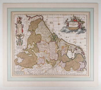
Sold2020Visscher, Claes .Germaniæ Inferioris XVIIVisscher, Claes .Germanie Inferioris XVII Provinciarum. Fine hand colored engraved double-page map. 18-1/2 x 22-1/2 inches plus margins, blank on verso, neatly matted; some browning, generally sound.See Sold Price
Sold2018Colton: Antique Map of West Indies, 1859Title/Content of Map: West Indes by Colton Date Printed: 1859 Cartographer: H.J. Colton Material/Medium: Paper Size: 17 1/2" x 14 1/2" Hand colored engraved Map. Publsihed in New York in 'Colton's GenSee Sold Price
Sold2018ATTRIBUTED TO WILLEN BLAEU 2 ENGRAVED MAPSATTRIBUTED TO WILLEN BLAEU, 2 HAND COLORED ENGRAVED MAPS, "NAVA BELGICA" & "MAPPA AESTIVARUM", 15 1/4" X 19 3/4" & 16" X 21" DATES OF PRINTING ARE UNKNOWN; FRAMED. ARNOLD KLEIN FRAMING LABEL.See Sold Price
Sold2021Map of City and Harbour of MacauA Plan of the City and Harbour of Macao" engraved by B. Baker, Islington 27" x 20 1/2" (sight) hand-colored engraved map 18th century framed- 32 1/2" x 40See Sold Price
Sold2023Antique Map of HispaniolaAntique Map of Hispaniola, "Hispaniolae, Cubae...", Ortelius, late 17th/early 18th c., hand-colored engraved map, sight 15 in. x 21 1/2 in., framedSee Sold Price
Sold2018Colton: Antique Map of North America, 1859Title/Content of Map: North America by Colton Date Printed: 1859 Cartographer: H.J. Colton Material/Medium: Paper Size: 17 1/2" x 15" Hand colored, engraved Map. Published in New York in Colton's 'GenSee Sold Price
Sold2018Colton: Antique Map of Upper Canada, 1859Title/Content of Map: Upper Canada by Colton Date Printed: 1859 Cartographer: H.J. Colton Material/Medium: Paper Size: 17 1/2" x 15" Hand colored, engraved Map. Published in New York in Colton's 'GeneSee Sold Price
Sold2018Colton: Antique Map Canada, Russian Alaska & GreenlandTitle/Content of Map: Canada, Russian Alaska & Greenland Date Printed: 1859 Cartographer: H.J. Colton Material/Medium: Paper Size: 17 1/2" x 15" Hand colored, engraved Map. Published in New York in CoSee Sold Price
Sold2018Colton: Antique Map of Hawaii, New Zealand, 1859Title/Content of Map: Hawaii, New Zealand & other islands Date Printed: 1859 Cartographer: H.J. Colton Material/Medium: Paper Size: 17 1/2" x 15" Hand colored engraved Map. Publsihed in New York in 'CSee Sold Price
Sold2018Johnson: Antique Map of the World, 1868Title/Content of Map: World by Johnson Date Printed: 1868 Cartographer: A.J. Johnson Material/Medium: Paper Size: 23 1/2" x 18" Hand colored engraved Map. From Johnson's 'New Illustrated Family AtlasSee Sold Price
Sold2018Colton: Antique Map of Mexico, 1859Title/Content of Map: Mexico by Colton Date Printed: 1859 Cartographer: H.J. Colton Material/Medium: Paper Size: 17 1/2" x 15" Hand colored, engraved Map. Published in New York in Colton's 'General AtSee Sold Price
Sold2018Colton: Antique Map of Lower Canada, 1859Title/Content of Map: Lower Canada by Colton Date Printed: 1859 Cartographer: H.J. Colton Material/Medium: Paper Size: 17 1/2" x 15" Hand colored, engraved Map. Published in New York in Colton's 'GeneSee Sold Price
Sold2017Mitchell: Antique Map of Mississippi Louisiana, 1869Title/Content of Map: Arkansas, Mississippi & Louisiana by Mitchell Date Printed: 1869 Cartographer: Augustus S. Mitchell Material/Medium: Paper Size: 23 1/2" x 15" Hand colored engraved Map. From 'MiSee Sold Price
Sold2018Colton: Antique Map of New Brunswick & Nova ScotiaTitle/Content of Map: New Brunswick & Nova Scotia by Colton Date Printed: 1859 Cartographer: H.J. Colton Material/Medium: Paper Size: 17 1/2" x 15" Hand colored, engraved Map. Published in New York inSee Sold Price
Sold2017Colton: Antique Map of South America, 1861Title/Content of Map: South America Date Printed: 1861 Cartographer: J.H. Colton Material/Medium: Paper Size: 14" x 17 1/2" Hand colored steel engraved Map from 'Colton's General Atlas'. Published inSee Sold Price
Sold20222 E. Bowen Maps of Italy & GreeceEmanuel Bowen, Welsh, 1694-1767. Two 18th century hand-colored engraved maps. Includes one titled "Middle or Proper Italy" and another titled "A Map of Great Greece and the Islands of Sardinia and CorSee Sold Price
Sold2016Two Framed Hand-colored Engraved Maps, 19th/20thTwo Framed Hand-colored Engraved Maps, 19th/20th Century, Including a map of Morea olim Peloponnesus by Gerardus Mercator and of Deventer by Johannes Blaeu. Largest framed dimensions: h: 21 1/2 x w: 2See Sold Price
Sold20222 Antique Maps of Saltzberg & Swiss AlpsTwo 18th century hand-colored engraved maps. Includes one titled "Saltzberg" by Gabriel Bodenehr and another titled "La Descente du Cote du Midi des Alpes" (The Descent on the South Side of the Alps)See Sold Price
Sold2017John Rapkin, (2) maps North and South AmericaJohn Rapkin, (2) maps North and South America, John Rapkin (British, 1815-1876), "North America" and "South America", c. 1851, hand-colored engraved maps with decorative border and vignettes, 14.5"h xSee Sold Price
Jun 07Freeman's | HindmanMURCHISON, Roderick Impey, Sir. The Silurian System. 1839. COMPLETE WITH VERY RARE HAND-COLORED$1,500
Jun 07Freeman's | Hindman[MAPS]. HOMANN, Johann Baptist, HOMANN HEIRS, and Georg Matthäus SEUTTER. [Composite Atlas].$15,000
Jun 08Early American History Auctionsc 1730 Hand-Colored Colonial Era Map of the Americas, California shown as an Island, Matted + Framed$500(1 bid)
Jun 08Early American History Auctions1753 Map of the County of Lancaster Divided into its Hundreds, by Royal Mapmaker Emanuel Bowen$280
Jun 07Freeman's | Hindman[MAP]. TODESCHI, Pietro. [Nova et Acurata Totius Americae Tabula auct. G.I. Blaeu] America quarta$5,000
Jun 09Worthington Galleries18th c. Map OBSERVATIONS SUR LES POINTS CARDINAUX. LIGNES, ET CIRCLES DE LA SPHÈ$10
3 days LeftArarity AuctionsThomson's 1817 Hand Colored Map Comparative Heights of the World's Great Mountains$50
Jun 09Worthington GalleriesAntique Hand-colored Hemisphere Map Mappemonde Revue par E. Cortambert 1864$25
Jun 08Auction WallstreetEngraving on glass Johannes Kip La Ville de Londres Prospectus Londinensis City of London$750
5 days LeftThe Bidder AuctionsJohann Baptista Homann. Terra Sancta Holy Land Map with the Borders of the 12 Tribes of Israel, Hand$100


![[MAPS]. HOMANN, Johann Baptist, HOMANN HEIRS, and Georg Matthäus SEUTTER. [Composite Atlas]. (1 of 5)](https://p1.liveauctioneers.com/197/329395/177650530_1_x.jpg?height=282&quality=70&version=1715364962)


![[MAP]. TODESCHI, Pietro. [Nova et Acurata Totius Americae Tabula auct. G.I. Blaeu] America quarta (1 of 1)](https://p1.liveauctioneers.com/197/329395/177650542_1_x.jpg?height=282&quality=70&version=1715364962)


