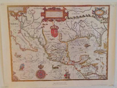
Sold2017Gabriel Tatton: Map of The New World, 1600The New World Map. 1600. Drawn by Gabriel Tatton. Engraved by Benjamin Wright. 24 x 18 inches. Please note that this lot has a confidential reserve. When you leave a bid in advance of the auction, subSee Sold Price
Sold2017Gabriel Tatton: The New World Map, 1600The New World Map 1600” drawn by Gabriel Tatton - reproduction by American Heritage, the magazine of history. Measurement approximate: 24” x 18”. Condition: Very Good Please note that this lSee Sold Price
Sold2023The New World 1600 Tatton MapSite: 16" x 20.5" H 24.25 W 28.75 D 0.75 Weight 8 lbsSee Sold Price
Sold20231600s Map of the New World drawn by Gabriel Tatton & engraved by Benjamin WrightMeasurements:With frame- 20" x 25.75"Without frame- 17.75" x 22.75"Weight- 5 lb. A portion of the proceeds from Lots 1-40 are going to the Gibbes Museum of Art in memory of Katherine M. Huger**ShippinSee Sold Price
Sold2015American Heritage Early Maps of America Reproductions(6) maps include the New World 1500 & 1600, New France 1745, the Known Globe 1667, and more, also includes a collection of noteble early maps of America Booklet See Sold Price
Sold2020Sanson Orbis Vetus World Map Paris 1657Nicolas Sanson (1600-1677), "Orbis Vetus, et Orbis Veteris Utraque Continens, Terrarumque Tractus Arcticus, et Antarcticus ex Platone, Thopompo, sive Aeliano, Manilio & c." Paris: P. Mariette, 1657. HSee Sold Price
Sold2022DOPPELMAYR, JOHANN GABRIEL; and JOHANN BAPTIST HOMANN. Basis Geographiae Recentioris Astronomica.DOPPELMAYR, JOHANN GABRIEL; and JOHANN BAPTIST HOMANN. Basis Geographiae Recentioris Astronomica. Double-page engraved double-hemispheric map of the world with astronomy-related spandrel decoration anSee Sold Price
Sold2022MAP, World, BellinWorld. Jacques Nicolas Bellin, Carte Reduite des Parties Connues du Globe Terrestre Dressee au Depost des Cartes Plans et Journaux de la Marine..., 1755 (dated). Hand Color. This is the rare first ediSee Sold Price
Sold20231939 Chase World Pictorial Map - World Wonders A Pictorial Map Designed and drawn by Ernest DudleyTitle: 1939 Chase World Pictorial Map - World Wonders A Pictorial Map Designed and drawn by Ernest Dudley Chase Cartographer: E D Chase Year / Place: 1939 Map Dimension (in.): 27.5 X 17.5 in. This supSee Sold Price
Sold2017Tallis World Map World on Mercator's Projection 1851Tallis World Map The World on Mercator's Projection 1851 . J. Tallis, 1851 London, 10.5 X 14 In.. This Is a Decorative and Striking Steel Engraved World Map That Was Produced from the Same Plate UsedSee Sold Price
Sold2021MAP, World, SchreiberWorld. Johann Georg Schreiber, Globus Terrestris ex Probatissimis Recentiorum Geographorum Observationibus Confectus cum Systemate Copernicano..., 1750 (circa). Hand Color. This charming double hemispSee Sold Price
Sold2022MAP, World, JannotWorld. J.B. Jannot, Le Tour du Monde en 120 Images Grand Concours du Chocolat Menier, 1956 (circa). Printed Color. This attractive and novel pictorial map of the world was created by J.B. Jannot and pSee Sold Price
Sold2023Lizars, Daniel 1831 LG Rare HC Map. World on Mercator's ProjectionLarge Folio Copper Engraved Map Published 1831-2 by John Hamilton, Successor to Daniel Lizars, Edinburgh for "The Edinburgh Geographical and Historical Atlas..." First Edition by Daniel Lizars. Very fSee Sold Price
Sold20231810 Modern Geography America MAP + World Map Massachusetts Elijah Parish1810 Modern Geography America MAP + World Map Massachusetts Elijah Parish Elijah Parishs “New System of Modern Geography” is an early 19th-century American geography textbook. Published inSee Sold Price
Sold2021Guthrie, William 1806 Map. World HemispheresCopper Engraved Map Published 1806, London for "A New Geographical, Historical and Commercial Grammar..." by William Guthrie. The maps are by John Senex, Thomas Kitchin and others. Folds as issued. PaSee Sold Price
Sold2021Barlow 1807 Antique Map. World HemispheresCopper Engraved Map Published 1807 by Brightly & Kinnersley, Bungay, England for "A General View of the World, Geographical, Historical and Philosophical" by The Rev. E. Blomfield. Engraved by Barlow.See Sold Price
Sold2017Strategic Russian Map, World War I, 1917Strategic Russian Map, World War 1. 54x62 cm. Date: 1917 Shipping: Domestic: Flat-rate of $10.00 to anywhere within the contiguous U.S. International: Foreign shipping rates are determined by destinatSee Sold Price
Sold2021Guthrie, William 1798 Map. World HemispheresCopper Engraved Map Published 1798, London for "A New Geographical, Historical and Commercial Grammar..." by William Guthrie. The maps are by John Senex, Thomas Kitchin and others. Folds as issued. PaSee Sold Price
Sold2024Russell & Allen (Pub) 1812 Map. World HemispheresFolio Copper Engraved Map Published 1812 by Russell and Allen, Manchester for "A New And Commercial System Of Geography" Paper Size: 15.5 x 9 inch (39 x 23cm) Very minor toning. Good ConditionSee Sold Price
Sold2024Blackie (Pub) 1882 Large Map. World on Mercators ProjectionLithograph Maps Published 1882 by Blackie & Son, London for "The Comprehensive Atlas & Geography of the World" by W. G. Blackie. Paper Size: 22.5 x 15.5 inch (57 x 39cm) Good conditionSee Sold Price
Sold2024Aitchison, Alexander 1799 Hand Col Map. World HemispheresOutline Hand Colored Copper Engraved Map Published 1798-99, London for "The Modern Gazetteer; Being a compendious Geographical Dictionary?" by Alexander Aitchison. Folds as issued. Paper Size: 10 x 8See Sold Price
Sold2023Brookes & Baker 1797 Antique Map. World HemispheresCopper Engraved Map Published 1797, London for "The General Gazetteer; Or, Compendious Geographical Dictionary" by Richard Brookes. Engraved by B. Baker. Original outline hand colour. Folds as issued.See Sold Price
Sold2024Cooke, George 1801 Antique Map. World Hemispheres by ArrowsmithEngraved J. Lodge after Aaron Arrowsmith. Copper Engraved Map Published 1801-07 by Macdonald & Son, London for "Modern and Authentic System of Universal Geography" By George A. Cooke. Folds as issued.See Sold Price
Sold2022Barclay & Becker C1845 Map. World of MercatorsSteel Engraved Map Published C1845, London for "A Complete and Universal English Dictionary" by the Rev. James Barclay and B. B. Woodward. Maps by F. P. Becker. Outline hand colour. Paper Size: 10.5 xSee Sold Price
5 days LeftTrillium Antique Prints & Rare BooksSanson - Map of California as an Island, Mexico (Audience de Guadalajara)$160(4 bids)
5 days LeftTrillium Antique Prints & Rare BooksSanson - Map of North America with California as an Island$120(3 bids)
5 days LeftTrillium Antique Prints & Rare BooksSanson - Map of Moluccas, Celebes, & Gilolo (Halmahera)$75
1 day LeftJasper521881 Vuillemin World Map with French Colonies Shown -- Planisphere: Indiquant les Colonies Francises$30
6 days LeftWorthington Galleries19th c. Hemisphere World Map, Hohen und Tiefen der Erde in Lambert’s Zenithal-Projection von$10
3 days LeftActivity AuctionsRare 1976**Franklin Mint*Sterling Silver**925/Gold World Map Old Art Piece$1,100
Jun 15Fine Arts OutletYoung Couple Reviewing a World Map Bronze Statue - Size: 32"L x 47"W x 42"H.$3,150