Sold2019French "Plan de la Ville de Cochin," 1761, engraving,French "Plan de la Ville de Cochin," 1761, engraving, H.- 10 1/4 in., W.- 15 5/8 in.See Sold Price
Sold20241812 large French map of Paris plan routier de la Ville et faubourgLarge engraving of Paris and its surrounding area dated 1812 , cooper engraving in the manner of the Turgot map ,Jean Pierre printer , a Paris, chez Jean, Rue St Jean de Beauvais, N° 10, It is thSee Sold Price
Sold2019French, "Plan de la Ville de Londres," c. 1768, H.- 12French, "Plan de la Ville de Londres," c. 1768, H.- 12 5/8 in., W.- 9 1/8 in.See Sold Price
Sold2022Nicolas de La Mare (French, 1639–1723), Antoine Coquart (French, 1668–1707), and Nicolas de FerNicolas de La Mare (French, 1639–1723), Antoine Coquart (French, 1668–1707), and Nicolas de Fer (French, 1646-1720), "Cinquieme Plan de la Ville de Paris," c. 1705, hand-colored map, preSee Sold Price
Sold2022Engraving of Guillaume DHEULLAND Plan de la Ville de Paris 1756This is Dheulland's historical view of Paris, a fascinating mid-18th century piece showing the city as it stood during the reign of Charles IX, that is, sometime between 1560 and 1574. Published in PaSee Sold Price
2017Bellin: Plan De La Ville De Port Royal, 1763Map Title: Plan De La Ville De Port Royal Maker: Jacques Bellin Printed in Paris Publishing Date: Circa 1763 Dimensions: 9 x 11.5 inches Jacques-Nicolas Bellin(1703-1772) was a French cartographer, hySee Sold Price
Sold202118TH C. PLAN OF THE SIAMESE ROYAL COMPOUND BY JACQUES"Plan de la ville de Louvo, demeure ordinaire des Rois de Siam", (Lavo, Thailand", copperplate engraving on laid paper, 1746-1759, published by Antoine Francois Prevost, Paris, from "Historie GeneraleSee Sold Price
Sold2022New road map of the city of Paris 1839 Rosselin editeur engravingNouveau plan routier de la ville de Paris, Guide exacte de cette capitale : en 12 arrondissemens avec leurs mairies et en 48 quartiers, 1839V. ROSSELIN (19th century), print editor, Paris, EstablishedSee Sold Price
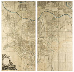
Sold2020Le Plan en Perspective de la Ville de Paris"Le Plan en Perspective de la Ville de Paris" after the 1734-1739 map by Louis Bretes and Claude Lucas, large facsimile engraving mounted on board and framed. sight 60-1/2" x 78", framed 67-3/4" x 85"See Sold Price
Sold2021[MAPS] SÉBASTIEN DE PONTAULT, CHEVALIER DE[MAPS] SÉBASTIEN DE PONTAULT, CHEVALIER DE BEAULIEU. Plan de la Ville, et Chateau de Valence... Paris: circa 1690. 17 1/2 x 21 inches, hand-colored engraving. Usual folds, generally a clean exampSee Sold Price
Sold2019Noel le Mire, hand-colored engravingNoel le Mire, hand-colored engraving, Noel le Mire (French, 1724-1801), "Vue du Basin et de la Ville de Bruges", hand-colored engraving on paper, from a 1665 painting by Hendrik von Minderhout, 17.25"See Sold Price
Sold2016French Framed Colored Engraving VersaillesFrench Framed Colored Engraving.Jardins Et de la Ville de VersaillesOpening Measurements: 20î1/4 x 15"1/2 - Frame Measurements:28" 1/2 x 23".Weight Approx:7.14 lbsThis piece is in very goodSee Sold Price
Sold2022ANTIQUE HAND COLORED FRENCH ENGRAVINGANTIQUE HAND COLORED VUE DE LA VILLE SALINS ENGRAVING Height: 26 in. by Width: 34 in.See Sold Price
Sold2021Group of Two French 18th C. EngravingsGroup of two 18th century engravings, one "Char de la Ville" by Pierre Francois Tardieu (French, 1711-1771), the other "Representation de Feu d'Artifice dans la place de l'Hotel de Ville de Paris", bySee Sold Price
Sold2016"Plan de la Nouvelle Orleans," by Jacques Nicolas"Plan de la Nouvelle Orleans," by Jacques Nicolas Bellin, Paris, 1764, hand colored copper engraving, depicting the French Quarter, with a list of keys across the top and turbulent waves of the MissisSee Sold Price
Sold2015A FRAMED FRENCH COPPER PLATE CARTOGRAPHIC ENGRAVINGA FRAMED FRENCH COPPER PLATE CARTOGRAPHIC ENGRAVING AFTER JACQUES-NICOLAS BELLIN (1703-1772), "PLAN DE LA FORTERESSE DE COYLAN," PARIS, 1757, prepared for and issued by Abbé Prévost (French 1697-176See Sold Price
Sold2021TWO FRENCH LOUIS XV AND LOUIS XVI PLANS OF NEW ORLEANS,TWO FRENCH LOUIS XV AND LOUIS XVI PLANS OF NEW ORLEANS, "Nouvelle Orléans Capitale de la Louisiane.," AND, "Plan de La Nouvelle Orléans," 1758-1780, comprising two engravings on paper, "NOUVELLE ORLSee Sold Price
Sold201718thC. French Hand Colored Architectural EngravingHand colored engraving. Portal de la Maison de Ville de Lyon; 11in. X 20.5in.(image size)See Sold Price
Sold2020Johann Martin Weiss (French, 1711-1751)Johann Martin Weiss (French, 1711-1751), 5 double-page engravings, from Représentation des fêtes données par la ville de Strasbourg Pour la Convalescence du Roi; à l'arrivée et pendant le séjourSee Sold Price
Sold2024Antique Hand-colored Harbour Plan - Map Milazzo - Sicily, Italy, MediterraneanOriginal hand-colored copper engraving print originates from "Recueil des Principaux Plans des Ports et Rades de la Mer Méditerranée …", translated from French as "CollectionSee Sold Price
Sold2019Plan de la Ville de Meaco'. Kyoto town city plan,TITLE/CONTENT OF MAP: 'Plan de la Ville de Meaco A.Quartier de Dayri ou Empereur hereditaire B. Palais du Cubosama [Plan of the city of Kyoto]' DATE PRINTED: 1752 IMAGE SIZE: Approx 20.5 x 29.0cm, 8 xSee Sold Price
Sold2021Town city 'Plan de la Ville de Louvo'. Lopburi,TITLE/CONTENT OF MAP: 'Plan de la Ville de Louvo [Plan of the city of Lopburi]' The top image on the right hand side shows the entire map. To view a close up of the map showing the level of printed deSee Sold Price
Sold2022AN ANTIQUE PRINTED MAP BY J. N. BELLIN, Paris 1752. PLAN DE LA VILLE DE MEACO. CopperplateAN ANTIQUE PRINTED MAP BY J. N. BELLIN, Paris 1752. PLAN DE LA VILLE DE MEACO. Copperplate Uncoloured. A well engraved and detailed plan of the port and city of Meaco, present-day Kyoto. Jacques NicolSee Sold Price
Sold2018Austria.- Grimm (Maximilian von) Grundriss der Kl: Kl:Austria.- Grimm (Maximilian von) Grundriss der Kl: Kl: Haupt und Residenzstadt Wien mit ihren Vorstadten nach den Neuen Hausnumern 1797 / Plan de la Ville de Vienne et de ses Fouxbourgs avec le DenombSee Sold Price
Jun 05Jasper52FRENCH SUDAN (Now Mali). Soudan Français. Bamako city plan de la ville 1938 map$25
Jun 05Jasper52FRENCH SUDAN (Now Mali). Soudan Français. Bamako city plan de la ville 1929 map$25
Jun 05Jasper52FRENCH SUDAN (Now Mali). Soudan Français. Bamako city plan de la ville 1931 map$25
Jun 07Freeman's | Hindman[MAP]. SARTINE, Antoine Plan de la Barre et du Havre de Charles-Town...1778. RARE REVOLUTIONARY WAR$1,000(1 bid)
Jun 08Auction WallstreetEngraving on glass Johannes Kip La Ville de Londres Prospectus Londinensis City of London$50(1 bid)
7 hrs LeftJasper52Carthagene des Indes'. Cartagena de Indias city plan, Colombia. BELLIN 1756 map$130
2 days LeftRapid Estate Liquidators and Auction Gallery1908 Souvenirs Et Campagnes Par R. De La Ville$55
Jun 05Jasper52Guinea-Bissau. View of Cacheu town & Fortaleza de São José da Amura 1746 print$15
Jun 30Global Auctions CompanyBernard de Montfaucon c1730 Engraving Les monuments de la monarchie francaise$100
Jun 14DuMouchellesRigobert Bonne (French, 1727-1794) Hand Colored Engraving Ca. 18th Century, Les Etats Unis De$50(1 bid)
4 days LeftGold Coast Auctioneers17th-19th c. French Wall Art Collection Map City Sea Scapes Scenes etc.$50


![[MAPS] SÉBASTIEN DE PONTAULT, CHEVALIER DE: [MAPS] SÉBASTIEN DE PONTAULT, CHEVALIER DE BEAULIEU. Plan de la Ville, et Chateau de Valence... Paris: circa 1690. 17 1/2 x 21 inches, hand-colored engraving. Usual folds, generally a clean examp](https://p1.liveauctioneers.com/292/204169/103522320_1_x.jpg?height=310&quality=70&version=1621026354)


![Plan de la Ville de Meaco'. Kyoto town city plan,: TITLE/CONTENT OF MAP: 'Plan de la Ville de Meaco A.Quartier de Dayri ou Empereur hereditaire B. Palais du Cubosama [Plan of the city of Kyoto]' DATE PRINTED: 1752 IMAGE SIZE: Approx 20.5 x 29.0cm, 8 x](https://p1.liveauctioneers.com/5584/156033/78750029_1_x.jpg?height=310&quality=70&version=1575421548)
![Town city 'Plan de la Ville de Louvo'. Lopburi,: TITLE/CONTENT OF MAP: 'Plan de la Ville de Louvo [Plan of the city of Lopburi]' The top image on the right hand side shows the entire map. To view a close up of the map showing the level of printed de](https://p1.liveauctioneers.com/5584/200280/101303623_1_x.jpg?height=310&quality=70&version=1618350002)


![[MAP]. SARTINE, Antoine Plan de la Barre et du Havre de Charles-Town...1778. RARE REVOLUTIONARY WAR (1 of 1)](https://p1.liveauctioneers.com/197/329395/177650540_1_x.jpg?height=282&quality=70&version=1715364962)


