Sold2022French Battle Map 1710A French battle map of the ‘Plan du champ de Bataille pour L'Armée des Hauts Alliés entre Vitry et Montigny le 28 May 1710.’ The map is saran wrapped to a board. Dimensions are: sigSee Sold Price
Sold2024Military Costume Print LotVarious antique and vintage prints, including French military dress. Also battle scene views, Nieuwe Kaart map by Isaac Tirion, etc. Condition varies.See Sold Price
Sold2018BATTLE OF FLEURUS: 26th June 1794. Belgium. FrenchTITLE/CONTENT OF MAP: 'Battle of Fleurus, (26th June 1794) ' DATE PRINTED: 1848 IMAGE SIZE: Approx 16.0 x 20.5cm, 6.25 x 8 inches (Medium) TYPE: Antique hand-coloured engraved map. This map was publisSee Sold Price
Sold2023Baines, Edward 1817 Antique Naval Map. Battle of TrafalgarWood Engraved Map (Reverse side blank) Published 1817, London for "History of the Wars of the French Revolution..." by Edward Baines. Paper Size: 10 x 8 inch (25 x 20cm) Very minor toning. Good ConditSee Sold Price
Sold2023Baines, Edward 1817 Antique Map. Battle of the Nile, EgyptWood Engraved Map (Reverse side blank) Published 1817, London for "History of the Wars of the French Revolution..." by Edward Baines. Paper Size: 10 x 8 inch (25 x 20cm) Very minor toning. Good ConditSee Sold Price
Sold2018BATTLE OF JEMAPPES: 6 November 1792. Belgium. FrenchTITLE/CONTENT OF MAP: 'Battle of Jemappes, 6th November. 1792' DATE PRINTED: 1848 IMAGE SIZE: Approx 16.0 x 20.5cm, 6.25 x 8 inches (Medium) TYPE: Antique hand-coloured engraved map. This map was publSee Sold Price
Sold20221800 Map of the Battle of the Nile -- Disposition of the English & French Fleets at the CommencementTitle: 1800 Map of the Battle of the Nile -- Disposition of the English & French Fleets at the Commencement of the Action August 1st 1798 Cartographer: E Duyckinck, pub. Year / Place: 1800 c.., New YoSee Sold Price
Sold2020London Mag 1758 Map. Map of the Rhine, Germany"A Map of the Rhine between Wesel & Duseldorp Shewing the Country round Crevelt Where the Battle Was Fought between the Allied & French Armies June 23, 1758" Copper Engraved Map Published 1732-85, LonSee Sold Price
Sold2023Carte Du Royaume De Danemarc by Guillaume De l’Isle. 1710.“Carte Du Royaume De Danemarc” Ca. 1710. Created by French cartographer Guillaume De l’Isle (1675 - 1726), a prominent early 18th century map maker. The map covers all of Denmark, aSee Sold Price
Sold2018Early Rhode Island Map:A French military map prepared for the Marquis de Lafayette showing American troop positions on August 30, 1778, after the Battle of Rhode Island. M'r Michel Capitaine du Chesnoy, A.d.C. du GénéralSee Sold Price
Sold2022SEVEN ENGRAVED MAPS.European, 18th-19th century. Printed with some hand coloring. Four on laid paper including three German and French military maps, "Plan des Camps de Pisek, 1741", 15.25"h. 20.25"w., battles of PeterwaSee Sold Price
Sold2022Rare First American Revolutionary War Battle MapAmerican Revolution First American Printing Of A Revolutionary War Battle Map "A View of the Present Seat of War, at and near New-York." 1777-Dated (Printed 1776) Revolutionary War Period, Printed MapSee Sold Price
Sold2023First American Revolutionary War Battle Map, from Nathan Daboll, Freebetter's New-England Almanacks,American Revolution First American Printing of a Revolutionary War Battle Map Titled: "A VIEW of the Present Seat of War, at and near New-York." by Nathaniel Low, Printed by John Gill, Boston 1777-DatSee Sold Price
Sold201718th C. French Map w/ Oiled Paper, ex-Sotheby'sEurope, France, map from 1709 CE, oiled paper overlays from 1756 to 1763 CE, owned by Louis-Alexandre Berthier (1753 to 1815 CE), Marshal, Vice-Constable of France, and Chief of Staff (Major general)See Sold Price
Sold20211777 1st American Rev War Battle Map: SEAT of WARAmerican Revolution First American Printing Of A Revolutionary War Battle Map "A View of the Present Seat of War, at and near New-York." [1776] Revolutionary War Printed, First American printed RevoluSee Sold Price
Sold2021Antique French Map of MississippiAntique French Map of Mississippi , "Carte Geographique, Statistique et Historique du Mississipi", Paris, Buchon, 1825, sight 21 in. x 27 1/2 in., framed Provenance: Estate of Julia Evans ReedSee Sold Price
Sold2016After Christophe Gabriel Allegrain (French, 1710After Christophe Gabriel Allegrain (French, 1710-1795)Venus in the BathBronSee Sold Price
Sold2021Antique French Map of United States- Etats-Unis De L'Amerique Septentrionale Avec Les Isles Royale, De Terre Neuve, De St. Jean, L'Acadie &c.; Hand-colored; Ches Boudet Imprimeur du Roi; Paris; undated (circa 1785). One of the early maSee Sold Price
Sold2022Mannevillette French Map of the Indian Ocean, 1753D'APRES DE MANNEVILLETTE, Jean-Baptiste-Nicolas-Denis (1707-1780). [Indian Ocean] Carte Reduite de l'Ocean Oriental depuis le Cap de Bonne Esperance... Engraved map with original hand color in part. PSee Sold Price
Sold20241812 large French map of Paris plan routier de la Ville et faubourgLarge engraving of Paris and its surrounding area dated 1812 , cooper engraving in the manner of the Turgot map ,Jean Pierre printer , a Paris, chez Jean, Rue St Jean de Beauvais, N° 10, It is thSee Sold Price
Sold20221738 Antique French Map of North America1738 Antique French Map of North America, 1783 - Antique Map of North America, with documentation, This map is 221 years old - it is not a modern reproduction or copy, This map comes from: ATLAS DE TOSee Sold Price
Sold201718th Century French Map of North AmericaL’Amerique Septentrionale. Daniel de la Feuille (1640-1709). Engraved map with hand color in full. Amsterdam, 1702 or 1706. 6 x 8 inches visible, 13 x 14 1/2 inches framed. Nicely colored early 18thSee Sold Price
Sold2022c. 1788 French Map of the Eastern United StatesHistoric Maps c. 1788 Map, "Les Etats Unis de L'Amerique Septentrionale, Partie Orientale" (Eastern Part of the Northern United States of America) by M. (Rigobert) Bonne c. 1788 Map titled, "Les EtatsSee Sold Price
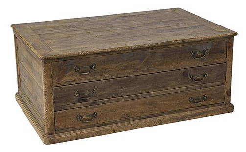
Sold2020Country French Map CabinetThree drawer case in pine with original brass hardware. Drawers pull out from both sides. 49w x 31 1/2d x 20 1/2hSee Sold Price
Jun 23Schilb Antiquarian Rare Books1816 Napoleonic War ENGLISH 1ed Campaigns Russia Invasion Labaume MAPS Napoleon$1
11 hrs LeftOriental Art AuctionsA RARE NON COLORED PRINTED FRENCH MAP OF THE ARABIC WORLD DURING THE OTTOMAN EMPIRE (ARABIA€1,000
7 days LeftThomaston Place Auction GalleriesHAND COLORED MAP OF PERU & COUNTRY OF THE AMAZONS, 1747, BY EMANUEL BOWEN, FRAMED$250
Jun 02Schilb Antiquarian Rare Books1871 Alfred the Great King of England MAP Battle of Ashdown Vikings Thom Hughes$110(3 bids)
18 hrs LeftPotter & Potter AuctionsAUDIBERTI, J. Choain. Afrique Equatoriale Francaise. Paris:...$100(1 bid)
6 days LeftJasper52Map No. 1. the Chickamauga Campaign... / Topographic Map of the Approaches and Defenses of$25
Jun 02Carlsen Gallery, Inc.DIORAMA OF A BATTLE IN FRENCH & INDIAN WAR ROGERS RANGERS (12 3/8" X 20 1/4" )$100(1 bid)
6 days LeftJasper521866 Johnson's Map of France, Spain, Portugal -- Johnson's France, Spain and Portugal$45
6 days LeftJasper521892 Cowles Civil War Map of Battles in Gettysburg, Virginia, W Virginia and Maryland -- Sketch of$55
3 days LeftActivity AuctionsAntique 1787 French Maritime Hydrography Map Eastern Coast United States M Bonne$150


![1777 1st American Rev War Battle Map: SEAT of WAR: American Revolution First American Printing Of A Revolutionary War Battle Map "A View of the Present Seat of War, at and near New-York." [1776] Revolutionary War Printed, First American printed Revolu](https://p1.liveauctioneers.com/218/230033/119008047_1_x.jpg?height=310&quality=70&version=1639440290)


![Mannevillette French Map of the Indian Ocean, 1753: D'APRES DE MANNEVILLETTE, Jean-Baptiste-Nicolas-Denis (1707-1780). [Indian Ocean] Carte Reduite de l'Ocean Oriental depuis le Cap de Bonne Esperance... Engraved map with original hand color in part. P](https://p1.liveauctioneers.com/1968/250616/130196497_1_x.jpg?height=310&quality=70&version=1654190895)