Sold2023Antique Map County of Cumberland EnglandAntique Framed and Hand Colored Map of the County of Cumberland, England by Richard Blome (London Engraver 1600-1705) . 16 inches x 13 inchesSee Sold Price
Sold2024John Speed 1610 Map County of CumberlandFramed, hand-colored copperplate engraved map on laid paper by John Speed (1551 or 1552 – 28 July 1629) entitled: "Cumberland and the Ancient Citie Carlile Described with Many Memorable AntiquitiesSee Sold Price
Sold2023HAND-COLORED TOPOGRAPHICAL MAP "THE NORTH EAST PROSPECT OF PLYMOUTH, IN THE COUNTY OF DEVON.", DatedHAND-COLORED TOPOGRAPHICAL MAP "THE NORTH EAST PROSPECT OF PLYMOUTH, IN THE COUNTY OF DEVON."Dated 1736Crest and text in lower margin.12.5" x 32" sight. Framed 19.5" x 39".See Sold Price
Sold2023ANTIQUE MAP FRAMEDANTIQUE MAP FRAMED, TOPOGRAPHICAL & GEOLOGICAL MAP OF THE VALLEY OF THE OHIO, APPROXIMATELY 21 IN X 20 IN OVERALLSee Sold Price
Sold2021Antique Framed Map of Columbia County, NY 1829Antique Framed Map of Columbia County, NY, dated 1829. Engraved by Rawdon Clark & Co, Albany, NY. Also marked Rawdon Wright, New York. Map includes locations of mills, churches and stage roads. NicelySee Sold Price
Sold2017Framed map of Chester County, Pennsylvania, copyright 1Framed map of Chester County, Pennsylvania, copyright 1938, compiled and drawn by Charles B MuthSee Sold Price
Sold20231876 Atlas of Illinois- Cook County Map Framed PagTravel back in time to the late 19th century with this enchanting Framed Map Page from the 1876 Atlas of Illinois by Warner & Beers. This exquisite piece showcases the detailed cartography of Cook, DuSee Sold Price
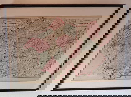
Sold20222 Topographical Maps of Warren County, New Jersey2 topographical maps of Warren County, New Jersey. Largest map: Sight: 23" x 15 1/4". Frame: 26 3/4" x 18 1/4" . Toning to both maps.See Sold Price
Sold2018FRAMED MAP OF CHESTER COUNTY 1847Framed Map Of Chester County 1847: Dated 1847. This map is adhered to a backing board. Projection and drawing by J.S Bowen, engraved by Edward Yeager of Philadelphia. 50"See Sold Price
Sold20211845 Moule Map of Cumberland -- CumberlandTitle: 1845 Moule Map of Cumberland -- Cumberland Cartographer: T Moule Year / Place: 1845 c., London Map Dimension (in.): 10.4 X 9 in. This is a lovely map of Cumberland, a county in north-west EnglaSee Sold Price
Sold2022Map of Albany CountyFramed map of Albany County. Dated 1947. Overall 22" x 30 1/2".See Sold Price
Sold2024FRAMED WARREN COUNTY MAPWARREN CO., NEW JERSEY. MATTED AND FRAMED UNDER GLASS. 29 1/4" X 21 3/4". PLEASE READ CAREFULLY - Terms for Purchasing and Shipping of Auction Items. Please read carefully before bidding. All paymentsSee Sold Price
Sold2017Three framed local maps including Dutchess County NY,Three framed local maps including Dutchess County NY, Putnam County NY, and a hand colored City of Poughkeepsie. All in good condition, late 19th to early 20th century.See Sold Price
Sold20221898 Topographical Colored Maps of Worcester County,LJ Richards & Co. Pub. Plate #2 Worcester is missing Cover is detached 22" x 17" Please see photos and come to the 2 day preview for condition.See Sold Price
Sold20223 FRAMED CHARLESTON COUNTY MAPSThree (3) Framed Charleston County Maps showing Neighborhoods. Includes 1- The Peninsula of Charleston.2- East Cooper; Mt. Pleasant, Isle of Palms, Sullivans Island. 3- Sea Islands; Kiawah, Seabrook,See Sold Price
Sold20241859 Clark & Hopkins Wall Map Litchfield County CTAntique 1859 Clark & Hopkins Topographical Wall Map of Litchfield County Connecticut, Coated Fabric Backed Paper with Original Rollers. Measures 55 inches x 51 inches. Please note condition issues notSee Sold Price
Sold2020FRAMED 19th c. MAP-DUTCHESS COUNTY, 20" X 13"FRAMED 19th c. MAP-DUTCHESS COUNTY, 20" X 13"See Sold Price
Sold2022Framed 1873 Columbia County MapFramed page from Columbia County Atlas, 1873, showing Malden Bridge, East Chatham, Chatham, Chatham Center, New Concord, and Claverack, 13 3/4" x 16 1/2" framed.See Sold Price
Sold2021FRAMED 1891 MAP OF ULSTER + DUTCHESS COUNTIES, 20" XFRAMED 1891 MAP OF ULSTER + DUTCHESS COUNTIES, 20" X 30.25"See Sold Price
Sold2020Nantucket Map, c. 1890Two U.S. geological survey topographical chart maps framed and matted together, showing Nantucket Tuckernuck and Muskeget,c.1890, Overall, 35” x 45”See Sold Price
Sold2020NJ TOPOGRAPHICAL MAP CENTRAL HIGHLANDS MORRIS & SUSSEXNJ TOPOGRAPHICAL MAP CENTRAL HIGHLANDS MORRIS & SUSSEX COUNTIES 1888 JOHN C. SMOCK STATE GEOLOGIST, OVERALL DIMENSIONS INCLUDING FRAME 31 3/4 IN X 42 3/4 INSee Sold Price
Sold2023Antique Map County of Northumberland EnglandAntique Framed and Hand Colored Map of the County of Northumberland, England by Richard Blome (London Engraver 1600-1705) . 16 inches x 13 inchesSee Sold Price
Sold2021Antique Framed Map Livingston,Germantown,Claremont NYAntique Framed Map of Livingston, Germantown and Claremont, Columbia County, NY. Dated 1850. Engraved by R.H.Pease, Albany, NY. Lovely early map is nicely framed in dark brown wood, and wired on the bSee Sold Price
17 hrs LeftRapid Estate Liquidators and Auction GalleryFramed Collection Engravings & A Map From The Excursions In The County Of Sussex Published In 1822$50
Jun 08Early American History Auctions1836 Hand-Colored Map, Country Twenty Five Miles Round The City Of New-York Published by D.S. Stone$260
Jun 08Early American History Auctions1753 Map of the County of Lancaster Divided into its Hundreds, by Royal Mapmaker Emanuel Bowen$280
Brooks Auction LLCAntique 1888 Topographical Map of Bergen, Hudson, and Essex Counties, New Jersey$5(1 bid)
Jun 08Tony Putty Artifacts3" Cumberland. Boyles Chert. Cumberland County, KY. Fluted on both sides, one side fluted to top of$265(6 bids)
237 Lots AwayArarity AuctionsC. G. Reichard "Charte des Osmanische Reichs in Asien" 1804 Antique Hand Colored Framed Map$50