Sold20223 FRAMED CHARLESTON COUNTY MAPSThree (3) Framed Charleston County Maps showing Neighborhoods. Includes 1- The Peninsula of Charleston.2- East Cooper; Mt. Pleasant, Isle of Palms, Sullivans Island. 3- Sea Islands; Kiawah, Seabrook,See Sold Price
Sold2024FRAMED WARREN COUNTY MAPWARREN CO., NEW JERSEY. MATTED AND FRAMED UNDER GLASS. 29 1/4" X 21 3/4". PLEASE READ CAREFULLY - Terms for Purchasing and Shipping of Auction Items. Please read carefully before bidding. All paymentsSee Sold Price
Sold2022Framed 1873 Columbia County MapFramed page from Columbia County Atlas, 1873, showing Malden Bridge, East Chatham, Chatham, Chatham Center, New Concord, and Claverack, 13 3/4" x 16 1/2" framed.See Sold Price
Sold20223 David Burr Maps Erie & Niagara County3 David Burr Maps Erie & Niagara County Framed - approx 25" x 21.5"See Sold Price
Sold2020Map ColllectionCollection of (3) framed maps and (6) unframed maps. Includes Amenia, Dover, Dutchess County, Pleasant Valley, Dover Plains, Washington etc.. Largest frame 24 1/2" x 34 1/2".See Sold Price
Sold2018Cram Map of TexasCRAM, George F (1842-1928). Railroad and county map of Texas. Lithograph with handcolor, with original black slipcase on the verso. Chicago, 1876. 17 3/4 x 24 inches sheet, 28 x 33 inches framedSee Sold Price
Sold20211610 Map of County of Radnor (Wales)Unknown cartographer. Hondius is featured, described by Christopher Saxon, and published by John Speed. Conservation framed. MEASUREMENTS: Map 15" high x 20" wide; overall with frame 22-3/4" high x 27See Sold Price
Sold2016DAVID FAIRBANKS (1914-2002)DAVID FAIRBANKS (1914-2002), LITHOGRAPH, A PICTORIAL MAP OF WOODSTOCK IN ULSTER COUNTY, NY: A CARTOGRAPHICAL WHERE'S WHO", C.1930s, UNSIGNED. 19 3/4" X 26 1/4"; FRAMED AND GLAZED 21 1/2" X 28"See Sold Price
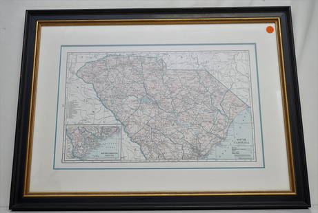
Sold2021HAMMONDS COMPLETE MAP OF SOUTH CAROLINAVintage Hammonds Complete Map of South Carolina. Showing all the railroad routes. c. 1930s. Professionally framed and matted. In frame measures 26 3/4"x20"x 1 1/4". Weight 7 pds. PROVENANCE: A PrivateSee Sold Price
Sold2020Set 3 Framed Maps. The World, Canada, and MediterraneanSet 3 Framed Maps. The World, Canada, and Mediterranean. -- Dimensions: H: 13.5 inches: W: 18 inches ---See Sold Price
Sold2023ESTATE OF SEYMOUR STEIN: 3 FRAMED MAPS OF BORDEAUX FRENCH WINES, LARGEST 27 1/2" X 19 1/2"ESTATE OF SEYMOUR STEIN: 3 FRAMED MAPS OF BORDEAUX FRENCH WINES, LARGEST 27 1/2" X 19 1/2"See Sold Price
Sold20223 framed Mortier 18th cent maps of Coastal SpainCovens & Mortier, circa 1737, Amsterdam, 3 framed maps of Coastal Spain, Coste D'Espagne, Plan du Port de Cartagene, and Coste de Catalogne, hand colored engravings, 18.5 x 26.5 inches image size, fraSee Sold Price
Sold2016Map LotLot (3) framed maps including "Carte De La Baye De Hudson" (sight 9 1/4" x 12 1/4"), "The River St. Laurence" (sight 10" x 14 1/2"), "A Plan of the City and Harbour of Louisburg" (sight 11" x 14 1/2")See Sold Price
Sold2021(3) MAPS: UNITED STATES, MARTHA'S VINEYARD, EUROPE(lot of 3) Framed maps, including: (1) Martha's Vineyard, U.S. Geological Survey, sight: 10.25"h, 14.25"w, overall: 12"h, 16"w, (1) Hungarian map of Europe, sight: 8.25"h, 10"w, overall: 13.25"h, 15"wSee Sold Price
Sold2023Map LotLot (3) framed maps including "PLAN DU CENTRE DE PARIS VOLD' OISEU" (overall in frame 28" x 38 1/2"), Spain (overall 25" x 34 1/2"), "GALLACIA REGNUM" (overall 21" x 23").See Sold Price
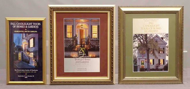
Sold2020Framed Charleston Historical Society PrintsLot (3) framed Charleston Historical Society prints. Largest frame 24 1/2" x 20".See Sold Price
Sold20223 Framed Vermont MapsA group of 3 framed Vermont maps including a reproduction 1796 Sotzmann 24" x 32" frame, Stowe Vermont from Beers Atlas 1878 19" x 23", and reproduction of Stowe Vermont map blown up, 25" x 32"See Sold Price
Sold2021(3) ENGRAVED & FRAMED MAPSIncluding Persian Dominions, France, and Turkey & Asia. Dimensions: (Persian Dominions) H 28" x W 33", (Sight) H 25" x W 20" Condition: Engravings have previous fold creases, but good color. Frames wiSee Sold Price
Sold20173 Framed Vintage Maps Navigational & Geological3 Framed Vintage Maps, both Navigational & Geological in nature. Representing the Atlantic Ocean, Barre, VT, and Biddeford, ME, containing Kennebunkport. All measure 21 x 17 inches.See Sold Price
Sold2021Moule, Thomas C1840 Lot of 3 British County MapsHuntingdonshire, Westmoreland, Monmouthshire. Steel Engraved Map Published C1840, London for "A Complete and Universal English Dictionary" by the Rev. James Barclay et al. Maps by Thomas Moule. PaperSee Sold Price
Sold2022Leigh, Samuel 1826 Lot of 3+ British County MapsEngraved Title Page plus 3 Copper Engraved Maps Published 1826, London for "Leigh's New Pocket Road-Book of England, Wales and Part of Scotland..." by Samuel Leigh. Maps Engraved by Sidney Hall. PaperSee Sold Price
Sold2023ESTATE OF SEYMOUR STEIN: 3 LARGE FRAMED MAPS/PRINTS - NY, PEEKSILL, PHILADELPIA EXHIBITION, LARGESTESTATE OF SEYMOUR STEIN: 3 LARGE FRAMED MAPS/PRINTS - NY, PEEKSILL, PHILADELPIA EXHIBITION, LARGEST IS 40" X 41"See Sold Price
Sold20163 Southwestern Maps3 Framed Southwestern Maps. 1st item: Map showing the Southern boundary of New Mexico, agreed upon by Commissioners Bartlett & Conde, February 7, 1853. 11 1/4" x 7 1/2" sight, 19 1/2" x 15 3/4" mattedSee Sold Price
Jun 12Dan Morphy AuctionsLOT OF 2 MAPS: LANDS IN THE COUNTIES OF RUNNELS & TOM GREEN RUNNELS COUNTY TEXAS MAPS.$200
Jun 08Early American History Auctions1753 Map of the County of Lancaster Divided into its Hundreds, by Royal Mapmaker Emanuel Bowen$280
Jun 08Early American History Auctions1836 Hand-Colored Map, Country Twenty Five Miles Round The City Of New-York Published by D.S. Stone$260
3 days LeftWhites Auctions CharlestonConstantine Makowsky /Konstantin Makovsky Three Cherubs Oil On Board$50
Jun 07Freeman's | Hindman[MAPS]. ORTELIUS, Abraham. A group of 3 engraved maps with hand-coloring.$175(2 bids)
8 hrs LeftPotter & Potter Auctions[SLAVERY DOCUMENT]. Manuscript Appraisal Bill of Slaves. [S...$325(3 bids)


![[MAPS]. ORTELIUS, Abraham. A group of 3 engraved maps with hand-coloring. (1 of 4)](https://p1.liveauctioneers.com/197/329395/177650539_1_x.jpg?height=282&quality=70&version=1715364962)


![[SLAVERY DOCUMENT]. Manuscript Appraisal Bill of Slaves. [S... (1 of 2)](https://p1.liveauctioneers.com/928/328184/176813741_1_x.jpg?height=282&quality=70&version=1714496988)


