Sold2020FRAMED MAP OF ROXBURY NJFRAMED MAP OF ROXBURY NJ IT HAS A BUSINESS DIRECTORY & AN INSET OF DRAKESVILLE, OVERALL DIMENSIONS INCLUDING FRAME, 28 1/2 IN 21 1/2 INSee Sold Price
Sold2017Vintage Artwork Framed Map of Short Hills, NJVintage 1936 illustrated map of the town of Short Hills, New Jersey. Framed and matted, possibly hand-drawn, possibly hand-painted. Measures 17 inches H x 20 inches H.See Sold Price
Sold2022Framed Copy of Map of Roxbury Ma 1888Framed Copy of Map of Roxbury Ma 1888 featuring Boston Ball Grounds and Neighborhood of the Original McGreevy's. Measures 31" tall x 37.5" wide. All lots in this auction came from the Historic McGreevSee Sold Price
Sold2023Vintage framed Borough of Rumson N.J. map 21.25''x25''Vintage framed Borough of Rumson N.J. map 21.25''x25''See Sold Price
Sold20164 Anyique Framed MapsLot includes 4 gold framed antique maps, in order 1 map is marked on bottom Series M2 Hoffmann-Laroche Inc. Nutley 10, NJ and Totled at the top in the map Geographia Sacra emphasis on land continents,See Sold Price
Sold20164 Anyique Framed MapsLot includes 4 gold framed antique maps, in order 1 map is marked on bottom Series M2 Hoffmann-Laroche Inc. Nutley 10, NJ and Totled at the top in the map Geographia Sacra emphasis on land continents,See Sold Price
Sold2017Easton, Pa & Phillipsburg, NJ Map.Framed behind glass. The map is dated 1900 and was done by Landis & Alsop. There is some soiling and fold lines present. Condition: (Very Good).Dimensions: Framed: 47" x 38".See Sold Price
Sold20231732 H. Moll New England New York, NJ. & PA Map1732 H. Moll New England New York, New Jersey, and Pennsylvania with hand coloring. Framed, 8 by 11 1/2 in acid free matt. Beautiful Map.See Sold Price
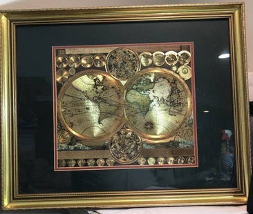
Sold2023Vintage GOLD FOIL WORLD MAP DOUBLE HEMISPHERE 25x31 FRAMED Wall HangingVintage Huge GOLD FOIL WORLD MAP DOUBLE HEMISPHERE 25x31 FRAMED Wall Hanging in a Gorgeous Gold Leaf Frame in VG Condition. Local Pickup Only in Berlin NJ 08009 or UPS Store Shipping Paid for by the WSee Sold Price
Sold2020Framed Map of ManhattanMap of Manhattan. [Map: 20" H x 50" W; Frame: 23 1/2" H x 53 1/2" W].See Sold Price
Sold2022FRAMED MAP OF HOUSTON TEXAS, RESTRIKE 1891FRAMED MAP OF HOUSTON TEXAS, RESTRIKE 1891. Height: 36 in. by Width: 56 in.See Sold Price
Sold2021Large Matted and Framed Map of Norfolk Virginia:Large Matted and Framed Map of Norfolk Virginia: Stylized Blazon Coat of Arms of Howard Duke of Norfolk (Premier Duke of England) Motto is "Virtuecont Alone is Invincible". Labeled JH DINGEE, Banker,See Sold Price
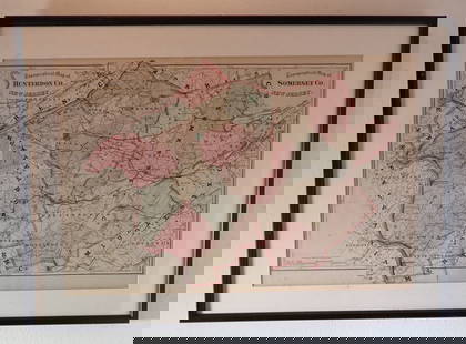
Sold2023FRAMED MAP OF SUSSEX CO. NEW JERSEYPUBLISHED PHILADELPHIA 1860. FRAMED UNDER GLASS. 55" X 52". Terms: PLEASE READ CAREFULLY - Terms for Purchasing and Shipping of Auction Items. Please read carefully before bidding. All payments for puSee Sold Price
SoldEASTERN EUROPEAN MAPS. Four framed maps.EASTERN EUROPEAN MAPS. Four framed maps. Comprising: Magni Ducatus Lithuaniae (18 1/4 x 22 1/2 in.); Emanuel Bowen's A New and Accurate Map of the Whole Russian Empire (15 x 20 in.); Polonia et SilesiSee Sold Price
Sold2021Antique Framed Map. Virginia Marylandia et Carolina. JoAntique Framed Map. Virginia Marylandia et Carolina. Johannes Baptisa Homann-- Dimensions: Image Size: H: 21 inches: W: 24.5 inches -- FRAME SIZE: Frame Height 25 inches - Frame Width 28.5 inches ---See Sold Price
Sold2023Framed Map of Fort Worth StockyardsVintage map of the U.S. Department of Agriculture's 1937 master plan for the Fort Worth Stockyards, framed sight: 22 x 30 in., frame: 33 x 45 in. Provenance: The Dallas, Texas collection of a lSee Sold Price
Sold2022Framed Map of Nantucket Printed in Colors on CanvasFramed Map of Nantucket, 20th Century, printed in colors on canvas in floater frame 33 in. x 50 in.See Sold Price
Sold2023Framed Map of Spanish & Mexican Land Grants for King RanchFramed and glazed colored map depicting the coastal area between the Rio Grande and The Nueces, showing early Spanish and Mexican land grants for King Ranch as of 1852 We happily provide seamless shiSee Sold Price
Sold20221818 PARIS FRAMED MAPESNAULT PARIS STREET MAP. RICHELIEU #7. FRAMED UNDER GLASS. GOOD CONDITION. 43" x 34" THIS ITEM EXCEEDS SIZE LIMITATIONS FOR IN HOUSE SHIPPING.See Sold Price
Sold2022Framed Map of Africa by Margaret WhitingFramed Map of Africa by Margaret Whiting 31" tall x 22 1/2" wideSee Sold Price
6 days LeftThe North Georgia Auction Company LLCClint Alderman Edgefield Area Potteries Map$200(1 bid)
Crawford Family Auctions LLCFramed print of Map of Part of the Island of Hawaii & Sandwich Islands, w/COA$20
Jul 11Dan Morphy AuctionsRARE INDEPENDENT GASOLINE & MOTOR OIL FRAMED GRAPHIC HIGHWAY MAP OF ILLINOIS.$125
4 days LeftHolabird Western Americana CollectionsSanitary & Topographical "Viele Map" of Manhattan 1865 [182838]$750
3 days LeftRapid Estate Liquidators and Auction GalleryFramed Collection Engravings & A Map From The Excursions In The County Of Sussex Published In 1822$50
2 days LeftRapid Estate Liquidators and Auction GalleryVintage 1950s Still Life Print By Reliable Marcel DYF$50
7 days LeftWinter Associates Three historical engraved maps of the Caribbean, ranging from 1616-1814, each hand colored, framed$100(1 bid)
5 days LeftEarly American History Auctions1836 Hand-Colored Map, Country Twenty Five Miles Round The City Of New-York Published by D.S. Stone$260


![Framed Map of Manhattan: Map of Manhattan. [Map: 20" H x 50" W; Frame: 23 1/2" H x 53 1/2" W].](https://p1.liveauctioneers.com/1221/185484/93762114_1_x.jpg?height=310&quality=70&version=1606596560)


![Sanitary & Topographical "Viele Map" of Manhattan 1865 [182838] (1 of 3)](https://p1.liveauctioneers.com/2699/331495/178785766_1_x.jpg?height=282&quality=70&version=1717094933)


