Sold2019Civil War Atlas, Boundaries Union and ConfederateCivil War Atlas, Boundaries Union and Confederate Divisons and Departments,"1863, Plate 167, H. - 18 1/2 in., W. - 29 1/2 in.See Sold Price
Sold2019Civil War Atlas, Boundaries Union and ConfederateCivil War Atlas, Boundaries Union and Confederate Divisions and Departments," 1862, Plate 166, H. - 16 in., W. - 27 in.See Sold Price
Sold2019Civil War Atlas, Boundaries Union andCivil War Atlas, Boundaries Union and ConfederateDivisions and Departments," 1865, Plate 171, H. - 16 in., W. - 27 in.See Sold Price
Sold2019Civil War Atlas, United States Boundaries Showing UnionCivil War Atlas, United States Boundaries Showing Union and Confederate Divisiomns and Departtments," 1861, Plate 164, , H. - 18 1/4 in., W. - 29 1/2 in.See Sold Price
Sold2018Julius Bien Litho Map Civil War Battle of ChickamaugaPrinted 1895. From the Atlas to Union and Confederate Armies published under direction of the honorable Daniel S Lamont. The map having good color and well-detailed features throughout. Some tears toSee Sold Price
Sold2017Old Map of 1864 United States with Civil War BoundariesOld Map entitled "Map of the United States of America Showing Boundries of the Union & Confederate Geographic Divisions and Departments Dec. 31, 1864." Printed by Julius Bien & Co. Lith, NY. Top markeSee Sold Price
Sold202221 Campaigns/Battles map - 1891 Civil War atlasLarge format layout of 21 Civil War maps on one sheet. (1-19) Campaign maps showing position of the 20th Army Corps on the march from Chattanooga, Tenn. to Atlanta, Ga. with dates and Union and RebelSee Sold Price
Sold2015Battle Maps from Atlas of the Union & ConfederateLithographed by Julius Bien & Co., N.Y., under the direction of Daniel S. Lamont, Government printing office, Washington, D.C., 1893, including Plates LXXXI, LXXXII, LXXXIII, LXXXIV & LXXXV. All are 1See Sold Price
Sold2015Battle Maps from Atlas of the Union & ConfederateLithographed by Julius Bien & Co., N.Y., under the direction of Daniel S. Lamont, Government printing office, Washington, D.C., 1893, including Plates, CXVI, CXVII, CXVIII, CXIX, CXX. All are 18.5 x 2See Sold Price
Sold2015Battle Maps from Atlas of the Union & ConfederateLithographed by Julius Bien & Co., N.Y., under the direction of Daniel S. Lamont, Government printing office, Washington, D.C., 1893, including Plates, CXXVI, CXXVII, CXXVIII, CXXIX, CXXX. All are 18.See Sold Price
Sold2015Battle Maps from Atlas of the Union & ConfederateLithographed by Julius Bien & Co., N.Y., under the direction of Daniel S. Lamont, Government printing office, Washington, D.C., 1893, including Plates, CXXI, CXXII, CXXIII, CXXIV, CXXV. All are 18.5 xSee Sold Price
Sold2021Civil War Geographical Boundary mapDefinitive map of the geographical boundaries between the Union and Confederate armies. Opens a window into the state of the U. S. during the height of the Civil War. “Map of the United States oSee Sold Price
Sold2024Official Civil War Geographical Boundary map, Julius Bien 1891Scarce definitive map of the geographical boundaries between the Union and Confederate armies. Opens a window into the state of the U. S. during the height of the Civil War. “Map of the United SSee Sold Price
Sold20221893 Government Map of Civil War Era United States -- Map of the United States of America ShowingTitle: 1893 Government Map of Civil War Era United States -- Map of the United States of America Showing the Boundaries of the Union and Confederate Geographical Divisions and Departments CartographerSee Sold Price
Sold20221893 Government Map of Civil War Era United States -- Map of the United States of America ShowingTitle: 1893 Government Map of Civil War Era United States -- Map of the United States of America Showing the Boundaries of the Union and Confederate Geographical Divisions and Departments; Plate CLXIVSee Sold Price
Sold20221893 Government Map of Civil War Era United States -- Map of the United States of America ShowingTitle: 1893 Government Map of Civil War Era United States -- Map of the United States of America Showing the Boundaries of the Union and Confederate Geographical Divisions and Departments; Plate CLXIISee Sold Price
Sold2017Civil War Map of America June 30, 1861Framed Civil War Map of America from June 30, 1861 showing the boundaries of the Union and Confederate Geographical Divisions and Departments. It also features a gold plaque with the description. ThisSee Sold Price
Sold2022MapMap "MAPE / OF THE / UNITED STATES / OF AMERICA / SHOWING THE / BOUNDARIES / OF THE / UNION AND CONFEDERATE / GEOGRAPHICAL DIVISIONS / AND / DEPARTMENTS / JUNE 30 1861". Sight 17" x 28 1/2", overall 2See Sold Price
Sold2017Bien: Antique Map of the US, Union & Confederate, 1895Item: Map of the United States of America showing the boundaries of the Union and Confederate geographical divisions and departments, Dec. 31, 1860 Maker: Julius Bien & Co Size: 28 x 17 inches Date: 1See Sold Price
Sold2024ARMS, EQUIPMENT AND ATLAS of the CIVIL WAR 3 Book Set in New ConditionILLUSTRATED HISTORY OF THE CIVIL WAR - ECHOES OF GLORY. ARMS, EQUIPMENT AND ATLAS OF THE CIVIL WAR - ARMS AND EQUIPMENT OF THE UNION - ARMS AND EQUIPMENT OF THE CONFEDERACY - ILLUSTRATED ATLAS OF THESee Sold Price
Sold2019A COLLECTION OF FOUR CIVIL WAR THEME BOOKS,A COLLECTION OF FOUR CIVIL WAR THEME BOOKS, "Echoes of Glory," a three volume set includes: "Illustrated Atlas of the Civil War," "Arms and Equipment of the Union," and "Arms and the Equipment of theSee Sold Price
Sold2021Two 19th Century American MapsA map that describes the Atlanta Campaign from the Atlas of the official records of the Union and the Confederate Armies, published by Julius Bein and Co. And an Dutch map that depicts Dakota, Iowa, NSee Sold Price
Sold2017Civil War PrintPair of early post Civil War Military prints, commissioned by Congress C. 1896. Artist Julius Ien & Co., N.Y.. Comes with "Atlas To Accompany The Official Records Of The Union And Confederate Armies".See Sold Price
2022MAP antique SAVANNAH GA GENERAL SHERMAN ARMY CIVIL WAR 1864 OPERATIONS CAMPAIGNOriginal Lithograph Plate LXX (70) of the 175 Plates of The Official Folio Historical Record of The Official Atlas to Accompany the Official Records of the Union and Confederate Armies, Ordered by ActSee Sold Price
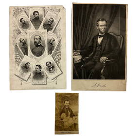
Jun 22Lakeshore Event CenterEphemera, Civil War Generals, Abraham Lincoln, Ulysses Grant, Lot of 3$30(1 bid)
4 days LeftEarly American History Auctions1905 Civil War General OLIVER OTIS HOWARD Typed Letter Signed as President of the Lincoln Memorial$300
4 days LeftEarly American History AuctionsAbraham Lincoln Gettysburg Address on Muslin Cotton Fabric measuring 21.5 x 15.5$100
Jun 23Schilb Antiquarian Rare Books1890 1ed Confederate Memoirs of Joseph Johnston & Jefferson Davis Civil War CSA$66(3 bids)
5 days LeftHolabird Western Americana CollectionsJefferson Davis Confederate Stamp Sheet, Scott 11 [179366]$750
Jun 23Schilb Antiquarian Rare Books1918 Robert E Lee Civil WAR Confederate General CSA Battles MAPS Illustrated$9(3 bids)
4 days LeftEarly American History Auctions1863 JOHN ARCHIBALD CAMPBELL ALS Re: a Friends Prisoner Exchange Confederate Asst. Secretary of War$450
2 days LeftWeatherham Estate TreasuresAbraham Lincoln Bronze Bust Sculpture On Marble Base - Signed Original - 10lbs$400
4 days LeftEarly American History Auctions1862 Civil War Dated, Union General David Hunter Autograph Letter Signed Involving 3 Union Generals$600
4 days LeftEarly American History AuctionsALS, Civil War Veteran, Member of Honor Guard for Assassinated President Lincoln as he Laid in State$1,000
4 days LeftEarly American History Auctions1864 Abraham Lincoln Presidential Campaign Rally Round The Boys theme San Francisco, CA National$150(1 bid)
Jun 15Bazaar of PersiaUS Half dollar 1922 100th anniversary Birth of Ulysses S. Grant Silver coin$400
4 days LeftSimpson Galleries, LLC.JULIUS BIEN (1826-1909) AN AMERICAN CIVIL WAR RECONNAISSANCE MAP, "Map of Texas and Part of New$100
2 hrs LeftJasper521893 Civil War Map of Knoxville Area -- Topographical Map of the Approaches and Defences of$70
2 hrs LeftJasper521893 Civil War Map of Yorktown -- Secession Works at Yorktown [with] The Position of Yorktown with$55
41 mins LeftJasper521898 US CIVIL WAR GAR PERSONAL WAR SKETCHES HANNIBAL HAMLIN antique FOLIO$220(1 bid)
4 days LeftConnoisseur AuctionsCivil War Battle of Antietam, Abraham Lincoln, General McClellan$20(1 bid)
Jun 23Schilb Antiquarian Rare Books1860 Political Textbook 1ed SLAVERY Abe Lincoln Douglass Civil War Government$7(3 bids)
4 days LeftEarly American History AuctionsRinggold Light Artillery FIRST DEFENDERS, Rare Civil War Reunion Printed Silk Ribbon, Reading, PA.$150


![Jefferson Davis Confederate Stamp Sheet, Scott 11 [179366] (1 of 1)](https://p1.liveauctioneers.com/2699/331499/178846702_1_x.jpg?height=282&quality=70&version=1717095214)


![1893 Civil War Map of Yorktown -- Secession Works at Yorktown [with] The Position of Yorktown with (1 of 1)](https://p1.liveauctioneers.com/5584/331064/178466378_1_x.jpg?height=282&quality=70&version=1716924723)


