Sold2018BOOKS: Morse 1802 Gazetteer COMPLETE 18 MapsBOOKS: Morse 1802 Gazetteer COMPLETE 18 Maps, Jedidiah Morse and Rev. Elijah Parish. A New Gazetteer of the Eastern Continent; or, A Geographical Dictionary: containing, in alphabetical order, a descrSee Sold Price
Sold20211854 HUGE MAP 1ed California Gold Rush Baldwin Complete1854 HUGE MAP 1ed California Gold Rush Baldwin Complete Gazetteer Americana Thomas Baldwin’s ‘Complete Gazetteer’ is a mid-19th-century book describing a comprehensive history of the United StatSee Sold Price
Sold20231810 American Gazetteer ATLAS Map Georgia Native Americans RARE Jedidiah Morse1810 American Gazetteer ATLAS Map Georgia Native Americans RARE Jedidiah Morse Jedidiah Morse was an important and prominent geographer known for his American textbooks, books that earned him the nameSee Sold Price
Sold20201798 American Gazetteer ATLAS Map Georgia Indians1798 American Gazetteer ATLAS Map Georgia Native Americans RARE Jedidiah Morse Jedidiah Morse was an important and prominent geographer known for his American textbooks, books that earned him the nameSee Sold Price
Sold20161950's Space Kit.Includes the original box, marked "Copyright 1954 McMahon & Morse, N. Y." Marked "Charter Member of the Interplanetary Space Squadron". Inside, which looks complete, are maps of the stars, a book abouSee Sold Price
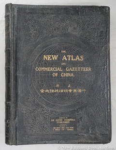
Sold2023Dingle, Edwin John51. Dingle, Edwin John. The New Atlas and Commercial Gazetteer of China. 28 color-printed maps and 18 color-printed statistical tables. Large folio, publisher's black cloth decorated in gilt and blindSee Sold Price
Sold2017REMNANTS OF JOHNSON'S ATLAS BOOKMissing complete cover and numerous pages still having several maps in good condition size 46 by 36 cm. (18 by 14 in)See Sold Price
Sold2021Atlas - Hughes, William C1900 Clasical Atlas, 18 Maps"Philips' Handy Classical Atlas" by William Hughes. London: George Philip & Son, nd C1900. 8vo (220 x 155m) Burgundy cloth, very slight wear. Complete with 18 Maps. A few with light pencil notes, oneSee Sold Price
Sold20221880 Antique Chinese Japanese 7 woodblock printed Books Complete Set with map: Chinese History1880 Antique Chinese Japanese 7 woodblock printed Books Complete Set with map: Chinese History Introduction. A little about how these were printed. The printing method in Japan up to the late 1800's wSee Sold Price
Sold2019Atlas C1875 Philips' & Hughes Classical Atlas, 18 Maps"Philips' Hand Classical Atlas" by William Hughes. London: George Philip, nd C1875. 8vo (215 x 155mm) Complete with 18 Lithograph Maps. Red cloth with slight wear. Previous owners inscription on frontSee Sold Price
Sold2024Chicago Danville and Vincennes RR Gold Bond Prospectus Book-1872This is a Chicago Danville and Vincennes gold bond prospectus book dated 1872. This book has a complete route map with connecting lines on two pages inside the front cover. Has 16 total pages, with teSee Sold Price
Sold2021Atlas entitled "NEW ILLUSTRATED ATLAS OF DUTCHESSAtlas entitled "NEW ILLUSTRATED ATLAS OF DUTCHESS COUNTY NEW YORK" by O.W. Gray & Son - Reading Publishing House, Reading Pa. 1876. Book is complete with supplements and some maps with hand tinting. MSee Sold Price
Sold2023"Atlas of Columbia Co. New York" by F.W. Beers, published in 1873. The book is complete with all"Atlas of Columbia Co. New York" by F.W. Beers, published in 1873. The book is complete with all hand colored maps - wear to binding and covers but overall it is in very good condition. The book measuSee Sold Price
Sold2020West Indies,Title: West Indies, Cartographer: GRIDLEY, ENOCH Publication Date: 1797 Publisher: THOMAS & ANDREWS Size: Height: 7.1 Width: 12.1 Detailed small map. From Morse's American Gazetteer. Modern coloring.See Sold Price
Sold20201940 Rock County Wisconsin Farm Plat Book w/ Maps1940 Rock County Wisconsin Farm Plat Book w/ Maps 4lbs 18 x 16 x 1/2 Shipping in continental US $25.00 If shipping is $0 then buyer arranges pick up or shipping. Please ask any questions before biddinSee Sold Price
Sold2023Captain Hartwell Osborn "The Trials and Triumphs The Record of the 55th Ohio Volunteer Infantry"Captain Hartwell Osborn "The Trials and Triumphs The Record of the 55th Ohio Volunteer Infantry" 1904: Published by A.C. McClurg and Co. book complete with 80 portraits and 10 maps. Blue cloth coveredSee Sold Price
Sold2018COMPLETE 18 VOLUME SET LEATHER BOUND BOOKSCOMPLETE 18 CONSECUTIVE VOLUME SET OF FULL LEATHER BOUND BOOKS WITH MARBELIZED BOARDS TITLED "BRYDEN'S WORKS", LONDON, 1808; 8.5" X 5.5"See Sold Price
Sold20171906 Atlas Book of Canada1906 Department of the Interior of Canada, Honorable Frank Oliver, Minister, Atlas Book of Canada. CONDITION: Complete with all the maps intact. Wear and loss on covers and binding.See Sold Price
Sold20201759 Geography 18 Maps ATLAS Africa Italy Asia America1759 Geography 18 Maps ATLAS Africa Italy Asia America California Island Buffier Known primarily for his contributions to philosophy, Claude Buffier, a 17th-century French Jesuit historian, publishedSee Sold Price
Sold20211819 RARE Jedidiah Morse MAPS American Geography US1819 RARE Jedidiah Morse MAPS American Geography US Constitution Indians Europe Jedidiah Morse was an important and prominent geographer known for his American textbooks, books that earned him the namSee Sold Price
Sold20231894 ALASKA California 18 MAPS United States Geodetic Surveys State Boundaries1894 ALASKA California 18 MAPS United States Geodetic Surveys State Boundaries Throughout the 19th-century, the United States government published countless reports and surveys on natural history of ASee Sold Price
Sold2022Lot of 18 Vintage X-Men Comic Books 15- 25 CentLot of 18 Vintage X-Men Comic Books 15 cent, 20 cent & 25 cent. The X-Men comic books complete No.71 through No.88. In good condition. We have more comics from the same collection. Please be sure to vSee Sold Price
Sold20201820 Three Geography Books Morse MitchellGroup of three geography books including "Geography Made Easy..", by Morse printed at Boston, 1829 (no maps); Mitchell's "A System of Modern Geography.." with nice illustrations,1854, and "Key to PeltSee Sold Price
Sold2022Soft Cover Railroad & Train Books (18)A group of about 18 softcover books and periodicals. Most are New England with a couple of good titles: "When the Maine Central went to Sea" and a nice 1920's book with many folding maps of New EnglanSee Sold Price
Jun 13TheRedFinch AuctionsVan Dongen. Les plus beaux contes de KIPLING, 1920. 23 pochoirs in color.$2,000
BonhamsJUVENILIA - MOVEABLE PARTS Lucinda, the Orphan; or the Costumes. A Tale Exhibited in a Series of...£600
Jun 23Schilb Antiquarian Rare Books1831 Northern Traveller Voyages to NIAGARA Falls Quebec Canada Illustrated MAPS$1(1 bid)
Jun 29Thomaston Place Auction GalleriesRARE PORTFOLIO OF 18 NAVAJO POCHOIR PRINTS, COMPLETE, WWII CONTEXT, 1943$400
BonhamsMORSE (SIDNEY E.) Morse's North American Atlas, New York, Harper & Brothers, 1842 [but 1845]£650
Jun 13TheRedFinch AuctionsThe complete collection of La Revue Blanche with 18 original lithographs.$12,000
BonhamsSOCIETY FOR THE DIFFUSION OF USEFUL KNOWLEDGE The Complete Atlas of Modern, Classical and Celest...£1,800
11 hrs LeftTrillium Antique Prints & Rare BooksJohn James Audubon's Birds of America - 7 Volume set with 500 Originally Hand-colored Lithographs,$30,000
2 days LeftSchilb Antiquarian Rare Books1871 Holy BIBLE & MAPS Holy Land Hitchcock Analysis Gruden Concordance Theology$120(3 bids)
11 hrs LeftTrillium Antique Prints & Rare BooksCatesby, Folio - Goat Sucker of Carolina with Mole Cricket. 1-8$200(1 bid)


![MORSE (SIDNEY E.) Morse's North American Atlas, New York, Harper & Brothers, 1842 [but 1845] (1 of 2)](https://p1.liveauctioneers.com/1043/319451/178359102_1_x.jpg?height=282&quality=70&version=1716978858)


