Sold2022Antique Map Print of Oceania - Map of Madeira & The Azores - 1870 - James CookOriginal Antique Decorative Map of Madeira & The Azores, Fullarton, C.1870 This fascinating folio engraving is from Captain James Cook & James King's "A Voyage to the Pacific Ocean, for making DiscoveSee Sold Price
Sold2022Antique Map Print of Oceania - Map of Old Rus' - Avachy Bay - James CookMap of Old Rus'. Avachy Bay, marine. Nicol 1785 engraved marine map with inset of the harbor of St. Peter and Paul. The relief is shown by dashes with sounding depths. This fascinating folio engravingSee Sold Price
Sold2023La Mappe Monde- Map of 3 Voyages of Captain CookAntique Map Print- La Mappe Monde, Depicting the Three Voyages of Captain Cook. Original was Drawn by Herisson, Hand Watercolored, Number 64 and Dated 1816. Measures 33 1/2" x 47" framed. Good ConditiSee Sold Price
Sold2021Antique Map of Captain James Cook's Voyages to theAntique map of Captain James Cook's voyages to the Pacific region. Captain Cook made numerous discoveries in the Pacific region during the late 1700's . Artists and mapmakers aboard the ship, includinSee Sold Price
Sold2024James Cook - Antique map Australia titled 'Gezigt van het Eil. Suffren'. Antique map of SuffrenAntique map Australia titled 'Gezigt van het Eil. Suffren'. Antique map of Suffren Island. Originates from 'Reizen Rondom de Waereld door James Cook (..)'. Artists and Engravers: Translated by J.D. PaSee Sold Price
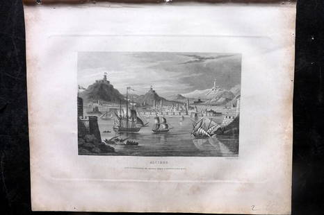
Sold2018Antique View of Singapore 1870Map: Beautiful print of 1870 circa showing the view of Singapore. Date: 1870 circa Technique: Steel etching Leaf Dimension: 15x22,5 cm (5.9x8.9 inches) Engraving Dimension: 10x16 cm (3.9x6.3 inches) CSee Sold Price
Sold2024Original Jean Baptiste D'Anville Occidental ou du Nouveau Monde Hemisphere Framed Map1786. Antique map showing most of the western hemisphere known to the world on the eve of the first voyage of James Cook by Jean Baptiste Bourguignon D'Anville. minus the North-West coast of North AmeSee Sold Price
Sold2024Map of New Zealand Print from 1772 RecordThorndon Fine Prints (Wellington, New Zealand) reprodcued this chart of the 1772 record of New Zealand, which was compiled by Lieutenant James Cook Commander of the Endeavor, using the running surveySee Sold Price
Sold2024Antique Map - Views on the coast of Asia. J. Webber del. Engraved after J. Webber and W. Bligh.Views on the coast of Asia. J. Webber del. (Engraved after J. Webber and W. Bligh. London, G. Nicol and T. Cadell, 1785). Author: Webber, John, 1751-1793; Bligh, William, 1754-1817; Cook, James, 1728-See Sold Price
Sold2018Antique Chart of the Island of Tahiti, 1775Title/Content of Map: Chart of the Island of Otaheite Date Printed: 1775 ca. Cartographer: Capt. James Cook R.N. Size (inches): 12.3x16.1 Large scale map of the Island of Tahiti, with detailed typograSee Sold Price
Sold2023Wright, Thomas 1852 Portrait Print. Captain James Cook, AustraliaSteel Engraved Map Published 1852-56, London for "The Universal Pronouncing Dictionary" by Thomas Wright. Paper Size: 10.5 x 7 inch (27 x 18cm) Margin toning and staining present. Image fineSee Sold Price
Sold20241842 VOYAGES OF CAPTAIN JAMES COOK 2 VOLUMES antique ILLUSTRATEDThe Voyages of Captain James Cook London: William Smith, 1842 2 volumes Size 7 by 9 3/4" Additional engraved title in volume I, engraved frontispieces, double-page maps, in-text vignettes, etc. MinorSee Sold Price
Sold2023Barclay, James 1834 Antique Print. Naples, Italy. ShipsSteel Engraving Published 1834 by Thomas Kelly, London for "A New and Universal English Dictionary" by the Rev. James Barclay. Maps Drawn & Engraved by Alexander Findlay. Paper Size: 10.5 x 8 inch (27See Sold Price
Sold2023Barclay, James 1834 Antique Print. Algiers, Ships, AlgeriaSteel Engraving Published 1834 by Thomas Kelly, London for "A New and Universal English Dictionary" by the Rev. James Barclay. Maps Drawn & Engraved by Alexander Findlay. Paper Size: 10.5 x 8 inch (27See Sold Price
Sold2023Barclay, James 1834 Antique Print. Madrid, SpainSteel Engraving Published 1834 by Thomas Kelly, London for "A New and Universal English Dictionary" by the Rev. James Barclay. Maps Drawn & Engraved by Alexander Findlay. Paper Size: 10.5 x 7 inch (27See Sold Price
Sold2023Barclay, James 1834 Antique Print. Paris, FranceSteel Engraving Published 1834 by Thomas Kelly, London for "A New and Universal English Dictionary" by the Rev. James Barclay. Maps Drawn & Engraved by Alexander Findlay. Paper Size: 10.5 x 8 inch (27See Sold Price
Sold2023Antique Map Print - Map of World - Scheme of Oceanic and Continental BasinsDescription: This vibrant hand-colored map of the world was published in Chicago by Rand McNally in the last quarter of the 19th century for inclusion in the company’s geography textbook, McNallSee Sold Price
Sold2023World: Captain Cook, Large Folio - A General Chart Exhibiting the Discoveries made by Captain JamesThis fascinating folio engraving is from Captain James Cook & James King's A Voyage to the Pacific Ocean, for making Discoveries in the Northern Hemisphere. To determine the Position and Extent of theSee Sold Price
Sold2023Captain Cook; Hawaii, Sandwich Islands - A Man of the Sandwich Islands, In a Mask. 66This fascinating folio engraving is from Captain James Cook & James King's A Voyage to the Pacific Ocean, for making Discoveries in the Northern Hemisphere. To determine the Position and Extent of theSee Sold Price
Sold2023Captain Cook; Hawaii, Sandwich Islands - Tereoboo, King of Owyhee, bringing Presents to CaptainThis fascinating folio engraving is from Captain James Cook & James King's A Voyage to the Pacific Ocean, for making Discoveries in the Northern Hemisphere. To determine the Position and Extent of theSee Sold Price
Sold2023Captain Cook; Hawaii, Sandwich Islands - A Canoe of the Sandwich Islands, the Rowers Masked. 65This fascinating folio engraving is from Captain James Cook & James King's A Voyage to the Pacific Ocean, for making Discoveries in the Northern Hemisphere. To determine the Position and Extent of theSee Sold Price
Sold2024Matthaus Merian 1627 Antique Map Engraving "Virginia" from Theodore de Bry's "Grand Voyages" #1Antique 1627 map of Virginia by Matthaus Merian after John Smith's 1612 map, from Theodore de Bry's "Grand Voyages". Please see "The Philidelphia Print Shop" sheet shown in final photo. Good conditionSee Sold Price
Sold2023Collection of Antique Prints "Cities of the World"Antique prints and etchings depicting "Cities of the World" - including Harper's Weekly illustrations, landscapes, antique maps, depictions of notable landmarks and famous cities such as Paris, New YoSee Sold Price
Sold202119th Century Map of MemphisPLAN DE LA VILLE DE MEMPHIS (ETATS-UNIS) 40,000 HABITANTS pen and ink with watercolor hand drawn drainage system map, circa 1870. Depicts a grid street plan of the city of Memphis with labeled streetSee Sold Price
21 hrs LeftTrillium Antique Prints & Rare BooksAudubon, Imperial Folio - Bachman's Hare. 108$375(1 bid)
21 hrs LeftTrillium Antique Prints & Rare BooksAudubon, Imperial Folio - Canada Porcupine. 36$375(1 bid)
Jun 01Trillium Antique Prints & Rare BooksAudubon, Imperial Folio - PAIR of Lithographs: Spermophile & Marmot Squirrel$375
21 hrs LeftTrillium Antique Prints & Rare BooksDe Jode, Rare, pub. 1593 - Map of Europe (Nova Totius Europae Tabula)$210(4 bids)