Sold2024George F. Cram - Historical Map of Pittsburgh Allegheny PennsylvaniaHistorical Map of Pittsburgh Allegheny Pennsylvania - Cram 1892.Size: 54 cm x 33 cmSee Sold Price
Sold2022Hand colored Map of Pittsburgh & CincinnatiGray's Atlas Map of Pittsburgh & Allegheny County and Cincinnati, Ohio Depicts railroad lines, common roads, canals, topography, etc. A beautiful & rare map. Cartographer: <See Sold Price
Sold2017Cram's Map of Pittsburgh (and Allegheny City), 1887Map: Pittsburgh (and Allegheny City) Maker: George F. Cram Date: 1887 Size: 21.5 x 14.5 in Please note that this lot has a confidential reserve. When you leave a bid in advance of the auction, submitSee Sold Price
Sold2020Map of Pittsburgh and Environs, 1830, printed laterCopy of an Early Map of Pittsburgh, originally 1830, issued by Fidelity Title as a reproduction. Fidelity was founded in the 1880s and this map was probably printed in 1920s-1940s. 24.5 x 32 inches, rSee Sold Price
Sold2019Pittsburgh/Allegheny, Pennsylvania. Cincinnati, OhioTITLE OF MAP (NOT PRINTED ON THE PAGE):'The Cities of Pittsburgh and Allegheny with parts of adjacent boroughs, Pennsylvania, and the City of Cincinnati, Ohio' DATE PRINTED: 1863 IMAGE SIZE: Approx 41See Sold Price
Sold2022Scarce map of Pittsburg and Allegheny by Geo. F. CramScarce and huge doubler-page map showing “Pittsburg” and the now bygone municipality of Allegheny, annexed by Pittsburgh in 1907. This map comes the extremely scarce 1910 edition of CramâSee Sold Price
Sold2017Early 1900's Pittsburgh North Shore Plot Map AlleghenyPittsburgh North Shore Plot Map Allegheny City, Volume 1, Plate 1, circa early 1900's, print on paper with colored additions, 18.5 x 26.25, black matte frame: 26 x 34.25 x 0.75 inchesSee Sold Price
Sold20181874 Colton Map of Pittsburgh and Cincinnati -- TheTitle/Content of Map: 1874 Colton Map of Pittsburgh and Cincinnati -- The Cities of Pittsburgh with Allegheny [on a sheet with] The City of Cincinnati Date: 1874 Philadelphia Cartographer: J Colton SiSee Sold Price
Sold2017Colton: Antique Map of Cincinnati and Pittsburgh, 1856Title/Content of Map: 1856 Colton Map of Cincinnati and Pittsburgh -- The Cities of Pittsburgh and Allegheny... on sheet with The City of Cincinnati Ohio Date Printed: 1856, New York Cartographer: J CSee Sold Price
Sold20201855 Colton Map of Cincinnati and Pittsburgh -- TheTitle/Content of Map: 1855 Colton Map of Cincinnati and Pittsburgh -- The Cities of Pittsburgh and Allegheny… [with] The City of Cincinnati Ohio Date: 1855, New York Cartographer: J ColtonSize: 13.8See Sold Price
Sold20221898 Map of WorcesterMatte 24" x 36". Map 21" x 31" Please see photos and come to the 2 day preview for condition.See Sold Price
Sold20211898 Map of IcelandAuthor: Cram Title: 1898 Map of Iceland Medium: Ink on Paper Dimensions: 14.5"X11" Map of Iceland dated 1898. Printed and published by George Cram in Chicago. Part of his World Atlas. Key lower right.See Sold Price
Sold20201898 Map of CaliforniaAuthor: Cram Title: 1898 Map of California Medium: Ink on PaperDimensions: 14.5"X22" Map of California dated 1898. Engraved and published by George Cram in Chicago. Double folio map. Key lower right.See Sold Price
Sold2024West India Islands. West Indies Caribbean Jamaica Antilles. BARTHOLOMEW 1898 mapTITLE OF MAP (NOT PRINTED ON THE PAGE):'West India Islands' DATE PRINTED: 1898 IMAGE SIZE: Approx 29.5 x 40.5cm, 11.5 x 16 inches (Large) TYPE: Antique atlas map CONDITION: Good; suitable for framing.See Sold Price
Sold2024Asia. Arabia. Siam includes Laos. Abou Thubbi (Abu Dhabi) BARTHOLOMEW 1898 mapTITLE OF MAP (NOT PRINTED ON THE PAGE):'Asia' DATE PRINTED: 1898 IMAGE SIZE: Approx 44.5 x 57.0cm, 17.5 x 22.25 inches (Large); Please note that this is a folding map. TYPE: Antique atlas map CONDITIOSee Sold Price
Sold20201898 Map of the Philippine IslandsAuthor: Cram Title: 1898 Map of the Philippine Islands Medium: Ink on PaperDimensions: 14.5"X22" Map of the Philippine Islands dated 1898. Engraved and published by George Cram in Chicago. Double foliSee Sold Price
Sold2022Moule, Thomas C1845 British Map. Environs of LondonSteel Engraved Map Published C1845, London for "A Complete and Universal English Dictionary" by the Rev. James Barclay et al. Maps by Thomas Moule. Paper Size: 10.5 x 8 inch (27 x 21cm) Good ConditionSee Sold Price
Sold2023SOUTH AMERICA NW. Shows Colombian & Peruvian claims on Ecuador. Lima 1898 mapTitle: SOUTH AMERICA NW. Shows Colombian & Peruvian claims on Ecuador. Lima 1898 map Description: South America (Section 1); Inset maps of Lima' by John Bartholomew (1898). Antique colour map, 43.0 xSee Sold Price
Sold2023SOUTH AMERICA NE. Brazil. Guyana. inset Rio de Janeiro. BARTHOLOMEW 1898 mapTitle: SOUTH AMERICA NE. Brazil. Guyana. inset Rio de Janeiro. BARTHOLOMEW 1898 map Description: South America (Section 2); Inset map of Rio de Janeiro' by John Bartholomew (1898). Antique colour map,See Sold Price
Sold2023Moule, Thomas C1840 British Map. Environs of LondonSteel Engraved Map Published C1840, London for "A Complete and Universal English Dictionary" by the Rev. James Barclay et al. Maps by Thomas Moule. Paper Size: 10.5 x 8 inch (27 x 21cm) Small top margSee Sold Price
Sold201747 Pcs. Limoges Porcelain Tea Set47 Pcs. Limoges Porcelain Tea Set. Cobalt with gilt and enamel filigree trim, borders and handles; signed "C. Ahrenfeldt, Limoges, pour C. Reizenstein, Pittsburgh-Allegheny - Patented". All pieces areSee Sold Price
Sold2024EUROPEAN CITIES. London Edinburgh Madrid Lisbon Dublin. JOHNSTON 1900 old mapTITLE/CONTENT OF MAP: 'Environs of London; environs of Dublin; Edinburgh and environs; Madrid; Lisbon and environs' DATE PRINTED: 1900 IMAGE SIZE: Approx 20.0 x 26.5cm, 8 x 10.5 inches (Medium) TYPE:See Sold Price
Sold2017Map of Hawaii and the Philippines, 1898Map: 1898 Map of Hawaii and the Philippines -- The Philippine Islands and Hawaii Cartographer: Century Co. Year / Place: 1898, New York Map Dimensions: 10.4 x 14.7 in. An unsual, rare and interestingSee Sold Price
Sold2022Pittsburgh 1889Title/Content of Map: Pittsburgh 1889 Date Printed: 1889 Material/Medium: paper Size: approx 21.5x14 inches Additional Info: W.H. Stewart Publishing, Rochester NY Reserve: $35.00 Shipping: Domestic: FSee Sold Price
7 hrs LeftJasper52Rand, McNally & Co.'S Map of the Western Hemisphere. Globe Series Compiled from the Latest And Most$340
May 14Fleischer's Auctions1755 Map Partie de l'Amerique Septentrionale, qui comprend Le Cours de L'Ohio...$200(3 bids)
May 12Schilb Antiquarian Rare Books1883 FLORIDA for Tourists & Settlers Illustrated Fort Barrancas MAP Fine BINDING$78(5 bids)
4 days LeftJay Anderson AuctionDated 1898 & signed Aan, Rosemaled Norwegian Trunk found near Rochester MN. Good original paint &$225(3 bids)
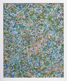
5 days LeftCurated Gallery AuctionsFredric Karoly (1898 - 1987) Important Mid Century Abstract Action Painting Signed Titled Catalogued$450(7 bids)
5 days LeftTremont AuctionsJohn Speed and Francis Lamb "Map of New England and New York", ca. 1676. Hand colored engraved map$900(3 bids)
5 days LeftTremont Auctions17th century original map 1676 "Virginia and Maryland" by John Speed. 2 sided framing. Overall:$325(2 bids)


![1874 Colton Map of Pittsburgh and Cincinnati -- The: Title/Content of Map: 1874 Colton Map of Pittsburgh and Cincinnati -- The Cities of Pittsburgh with Allegheny [on a sheet with] The City of Cincinnati Date: 1874 Philadelphia Cartographer: J Colton Si](https://p1.liveauctioneers.com/5584/124256/63192775_1_x.jpg?height=310&quality=70&version=1530636078)

![1855 Colton Map of Cincinnati and Pittsburgh -- The: Title/Content of Map: 1855 Colton Map of Cincinnati and Pittsburgh -- The Cities of Pittsburgh and Allegheny… [with] The City of Cincinnati Ohio Date: 1855, New York Cartographer: J ColtonSize: 13.8](https://p1.liveauctioneers.com/5584/160636/81086770_1_x.jpg?height=310&quality=70&version=1580865551)