Sold2020NJ TOPOGRAPHICAL MAP CENTRAL HIGHLANDS MORRIS & SUSSEXNJ TOPOGRAPHICAL MAP CENTRAL HIGHLANDS MORRIS & SUSSEX COUNTIES 1888 JOHN C. SMOCK STATE GEOLOGIST, OVERALL DIMENSIONS INCLUDING FRAME 31 3/4 IN X 42 3/4 INSee Sold Price
Sold2022Topographical Atlas of Bergen County NJ (US) 1876Topographical Illustrated, Historical Descriptive, A.H. Walker, Published by C.C. Pease, Successor to A.H. Walker. Color maps, home sites, business locations in fold-out pages. Cover in green with blaSee Sold Price
Sold20231862 Civil War, Coltons New Topographical Map of The States of Virginia, Maryland and DelawareHistoric Maps 1862 Civil War "Colton's New Topographical Map of The States of Virginia, Maryland and Delaware" Hardcover Folio 1862-Dated Civil War Period, Hand-colored 45.25" x 31.5" Folding Map titlSee Sold Price
Sold2022[MAPS & ATLASES]. COLTON, J.H. (1800-1893). Colton's New Topographical Map of The States Of[MAPS & ATLASES]. COLTON, J.H. (1800-1893). Colton's New Topographical Map of The States Of Virginia, Maryland and Delaware, Showing Also Eastern Tennessee & Parts Of Other Adjoining States. New York:See Sold Price
Sold2022Topographical Maps of Vineyard Nantucket Sound, StTopographical Maps of Vineyard Nantucket Sound, St Joseph Sound, Cape Cod Bay, Medield, and Massachusetts Harbor Islands. Group of 6 Mid Century Geological Survey maps. Largest 23 x 27 inches. Small eSee Sold Price
Sold2016Stargate SG1 Topographical Map PropsCollection of topographical maps used as set dressing in the SGC in the series Stargate SG1. These pieces were used on monitor screens around the SGC command center and feature illustrated topographicSee Sold Price
Sold2023DENNIS HOPPER | NEW MEXICO TOPOGRAPHICAL MAPSA group of five topographical maps of New Mexico from the personal collection of Dennis Hopper. PROVENANCE Property from the Life and Career of Dennis Hopper;See Sold Price
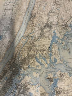
Sold20222 Topographical Maps of Warren County, New Jersey2 topographical maps of Warren County, New Jersey. Largest map: Sight: 23" x 15 1/4". Frame: 26 3/4" x 18 1/4" . Toning to both maps.See Sold Price
Sold2023Group lot of NEW YORK State Topographical MapsGroup lot of NEW YORK State Topographical Maps, maps measure 17 x 21 inches, wear consistent with age and use. not framed. Art, wall art, artwork, home decor, maps, topographic, topography, New York SSee Sold Price
Sold2022Group lot of NEW YORK State Topographical MapsGroup lot of NEW YORK State Topographical Maps, maps measure 17 x 21 inches, wear consistent with age and use. not framed. Art, wall art, artwork, home decor, maps, topographic, topography, New York SSee Sold Price
Sold2017The History of Topographical Maps, 1st EdTitle: The History of Topographical Maps. Symbols, Pictures and Surveys. London. Thames and Hudson. 1980 Author(s): Harvey, P.D.A First edition Condition: Fine copy in fine dust jacket (in mylar). 199See Sold Price
Sold2015Pr French Topographical Maps20th Century. Mounted in a molded frame, each measures 12.5 inches height, 33.5 inches width. 12.5"H x 33.5"WSee Sold Price
Sold2022Lambertville and Two Clinton NJ MapsClinton Maps are approx 19"x25", Lambertville is approx 26" x 40". All are reprints.See Sold Price
Sold20232 Topographical Maps of MASSACHUSETTS2 topographical maps of Massachusetts. 1 marked untied states, East coast, Rhode Island, Massachusetts. Narragansett Bay. Other marked Marthas Vineyard- Eastern Part. Largest map is approximately 47 xSee Sold Price
Sold2022Three Topographical Maps of East Coast CitiesThree Topographical Maps, Newark, Hartford, Scranton Wear, stains Largest: 20-1/2"h x 31"wSee Sold Price
Sold2022J. H. Colton’s Topographical Map of Louisiana, Mississippi and Alabama. & partsTitle: J. H. Coltonâ€â„¢s Topographical Map of Louisiana, Mississippi and Alabama. & parts of Adjoining States. Publisher: Joseph Hutchins Colton Height: 19 Width: 31 Rare Colton large forSee Sold Price
Sold2022Rare 18th C Copper engraved Topographical Map of Taiwan, "L'Ile de Formosa, ou sont Exactement MarquGeographic location: Asia Title: "L'Ile de Formosa, ou sont Exactement Marquez les Bancs de Sables (..)" Cartographer / Publisher: Pieter van der Aa Date: 1719 Technique: Copper engraving Dimensions:See Sold Price
Sold2017Color topographical map of Lake TahoeHeading: (California - Lake Tahoe) Author: Eddy, Gerald A. Title: Lake Tahoe Place Published: Tahoe City Publisher: Date Published: [c.1940's] Description: Color topographiSee Sold Price
Sold2023[ROMA]. Topographical map of Rome from the Direzionedel Censo. Rome: [Calcografia], 1866. Large map made on a scale of 1:4000 by the Congregazione del Censo of the Papal States, the last version printed before the taking of Rome in 1871 and preceded bySee Sold Price
Sold2017Nell's Topographical Map of Colorado 1896Heading: (Colorado) Author: Nell, Louis Title: Nell's Topographical Map of the State of Colorado Place Published: Denver Publisher:Hamilton & Kendrick Date Published: 1896 Description:See Sold Price
Sold2017Easton, Pa & Phillipsburg, NJ Map.Framed behind glass. The map is dated 1900 and was done by Landis & Alsop. There is some soiling and fold lines present. Condition: (Very Good).Dimensions: Framed: 47" x 38".See Sold Price
Sold2023HAND-COLORED TOPOGRAPHICAL MAP "THE NORTH EAST PROSPECT OF PLYMOUTH, IN THE COUNTY OF DEVON.", DatedHAND-COLORED TOPOGRAPHICAL MAP "THE NORTH EAST PROSPECT OF PLYMOUTH, IN THE COUNTY OF DEVON."Dated 1736Crest and text in lower margin.12.5" x 32" sight. Framed 19.5" x 39".See Sold Price
6 hrs LeftJasper521893 Civil War Map of Knoxville Area -- Topographical Map of the Approaches and Defences of$70
Jun 13Swann Auction Galleries(NEW JERSEY.) William Kitchell; and Robert Pearsall Smith. Topographical Map of the State of New$600
6 hrs LeftJasper521852 Evans Map of the Badlands -- Map Showing the Position of the Bad Lands or Mauvaises Terres of$60
6 hrs LeftJasper521853 Williamson Map of Tejon Pass, California -- Map and Profile of the Tejon Pass from explorations$55
6 hrs LeftJasper521853 Williamson Map of California's Tejon Pass Region -- Map and Profile of the Cañada de las$55
Jun 13Swann Auction Galleries(COLORADO.) Louis Nell; and Chain, Hardy & Co. Nell's Topographical & Township Map of the State of$600
Jun 23Schilb Antiquarian Rare Books1855 San Francisco 1st ed California Gold Rush Illustrated MAPS Soule Indians$11(3 bids)
6 hrs LeftJasper521893 Civil War Map of Siege of Yorktown, Battle of Siloh and Army of Ohio Operations -- Plan of$55


![[MAPS & ATLASES]. COLTON, J.H. (1800-1893). Colton's New Topographical Map of The States Of: [MAPS & ATLASES]. COLTON, J.H. (1800-1893). Colton's New Topographical Map of The States Of Virginia, Maryland and Delaware, Showing Also Eastern Tennessee & Parts Of Other Adjoining States. New York:](https://p1.liveauctioneers.com/197/265299/138516337_1_x.jpg?height=310&quality=70&version=1666051328)


![Color topographical map of Lake Tahoe: Heading: (California - Lake Tahoe) Author: Eddy, Gerald A. Title: Lake Tahoe Place Published: Tahoe City Publisher: Date Published: [c.1940's] Description: Color topographi](https://p1.liveauctioneers.com/642/108631/55725357_1_x.jpg?height=310&quality=70&version=1504140470)
![[ROMA]. Topographical map of Rome from the Direzione: del Censo. Rome: [Calcografia], 1866. Large map made on a scale of 1:4000 by the Congregazione del Censo of the Papal States, the last version printed before the taking of Rome in 1871 and preceded by](https://p1.liveauctioneers.com/4096/306130/163511022_1_x.jpg?height=310&quality=70&version=1697623610)


