Sold20211859 Map of ScotlandAuthor: Chambers Title: 1859 Map of Scotland Materials: Ink on Paper Dimensions: 9.5"X11.5" Description: Map of Scotland dated 1859. Part of the Modern & Ancient Geography Atlas. Engraved by J.GellatlSee Sold Price
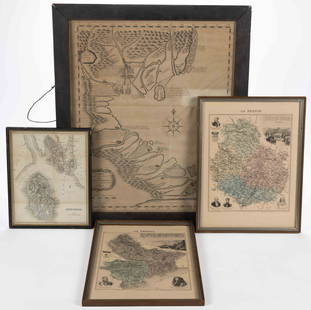
Sold2023ASSORTED EUROPEAN AND ASIAN MAPS, LOT OF FOURASSORTED EUROPEAN AND ASIAN MAPS, LOT OF FOUR, engraving on paper, three with hand-coloring, comprising a map of Buteshire in Scotland by William Home Lizars (Scottish, 1788-1859), two "LA FRANCESee Sold Price
Sold2021EXCEPTIONAL 1859 MAP OF ORANGE/ROCKLAND COUNTIESEXCEPTIONAL 1859 MAP OF ORANGE/ROCKLAND COUNTIES, FF FRENCH, WE WOOD & S.N. BEERS PUB. CORY & BACHMAN, 65" X 62"See Sold Price
Sold2023United States of North America, Pacific States by Joseph Wilson Lowry 1859 mapDescriptionCAPTION PRINTED BELOW PICTURE: The United States of North America, Pacific States [including California, Oregon, Washington, Utah, and part of New Mexico, ]The map shows Washington, Oregon,See Sold Price
20231859 Map of Texas. By ColtonTitle: 1859 Map of Texas. By Colton Date/Period: 1859 Materials: Hand colored steering engraved Size: 17 1/2 x 14 1/2” br>Texas right before the civil war, inserts the northern part of the stateSee Sold Price
Sold20231859 Map of Texas. By ColtonDescriptionTitle: 1859 Map of Texas. By ColtonDate/Period: 1859Materials: Hand colored steering engravedSize: 17 1/2 x 14 1/2”br>Texas right before the civil war, inserts the northern part of thSee Sold Price
Sold2024MAP, Scotland, BlaeuNorthern Scotland. Johannes Blaeu, Cathenesia. Caithness, from Geographiae Blavianae Volumen Sextum, 1662 (published). Hand Color. This beautifully engraved map covers the northern tip of Scotland. ThSee Sold Price
Sold20221859 MAP OF MANHATTAN (FASCIMILE OF 1664) 21 X 271859 MAP OF MANHATTAN (FASCIMILE OF 1664) 21 X 27See Sold Price
20231859 Map of Florida by ColtonTitle: 1859 Map of Florida by Colton Date/Period: 1859 Materials: Steel engraved Size: 17 1/2 x 14 1/2” Florida with Florida keys in the insert. From before the civil war. By J. H. Colton & G. WSee Sold Price
Sold2023Burmah, Siam & Anam. Indochina Shan States Thailand Vietnam. WELLER 1859 mapCAPTION PRINTED BELOW PICTURE: 'Burmah, Siam, and Anam' DATE PRINTED: 1859 IMAGE SIZE: Approx 37.0 x 27.0cm, 14.5 x 10.75 inches (Large) TYPE: Antique engraved atlas map with original hand colour/coloSee Sold Price
Sold2023New Zealand Sandwich Galapagos Islands. Papuan Archipelago. Melanesia 1859 mapNew Zealand. // Sandwich Islands, or Hawaiian Group, // Galapagos Islands // Papuan Archipelago' by John Bartholomew (1859). Antique engraved atlas map with original hand colour/color, 37.0 x 53.5cm,See Sold Price
Sold20231859 Map of Florida by ColtonTitle: 1859 Map of Florida by Colton1859 Materials: Steel engraved Size: 17 1/2 x 14 1/2” Florida with Florida keys in the insert. From before the civil war. By J. H. Colton & G. W. Colton. From "GeSee Sold Price
Sold20211859 Map of New Amsterdam, (Manhattan) AS IS. 30" X 24"1859 MAP OF New Amsterdam (Manhattan)AS IS. 30" X 24". This map is actually a rendering after a 1664 map made in 1859.See Sold Price
Sold20231859 Map of Washington and Oregon territory includes modern Idaho by ColtonTitle: 1859 Map of Washington and Oregon territory includes modern Idaho by Colton Date/Period: 1859 Materials: Steel engraved Size: 17 1/2 x 14 1/2” Washington and Oregon territories with whatSee Sold Price
Sold20231859 Map of Boston and surrounding communities by ColtonTitle: 1859 Map of Boston and surrounding communities by Colton Date/Period: 1859 Materials: Steel engraved Size: 17 1/2 x 14 1/2” br>Boston and surrounding communities. Shows, rivers, lakes, coSee Sold Price
Sold20231859 Map of Massachusetts and Rhode Island. Insert of Boston by ColtonTitle: 1859 Map of Massachusetts and Rhode Island. Insert of Boston by Colton1859 Materials: Steel engraved Size: 17 1/2 x 14 1/2” Massachusetts and Rhode Island. With insert of Boston and surroundiSee Sold Price
Sold2021Tallis, John (Pub) 1852 Map. ScotlandSteel Engraved Map with Original Outline Hand Color Published 1852-56 by John Tallis, London for "The Universal Pronouncing Dictionary" by Thomas Wright. Drawn & Engraved by John Rapkin. Centre fold aSee Sold Price
Sold2020Antique 1859 Map of Kendall County IllinoisBy L. J. Bennett, 45 x 51 inches some damageSee Sold Price
Sold20231859 Map of Connecticut by ColtonTitle: 1859 Map of Connecticut by Colton Date/Period: 1859 Materials: Steel engraved Size: 17 1/2 x 14 1/2” Connecticut. Shows, rivers, lakes, counties cities, towns, villages, roads, and rail lSee Sold Price
Sold20211859 Map of the USTitle: 1859 Map of the US Author: Chambers Medium: Ink on Paper Dimensions: 11.5"X9.5" Description: Map of the United States dated 1859. Part of the Modern & Ancient Geography Atlas. Engraved by J.GelSee Sold Price
Sold2023Lizars, Daniel 1831 LG Rare HC Map. Scotland on 2 SheetsLarge Folio Copper Engraved Map Published 1831-2 by John Hamilton, Successor to Daniel Lizars, Edinburgh for "The Edinburgh Geographical and Historical Atlas..." First Edition by Daniel Lizars. Very fSee Sold Price
Sold20211859 Map of PalestineTitle: 1859 Map of Palestine Author: Chambers Medium: Ink on Paper Dimensions: 9.5"X11.5" Description: Map of Palestine dated 1859. Part of the Modern & Ancient Geography Atlas. Engraved by J.GellatlySee Sold Price
Sold20231859 Map of Illinois, with Chicago, insert by ColtonTitle: 1859 Map of Illinois, with Chicago, insert by Colton Date/Period: 1859 Materials: Steel engraved Size: 17 1/2 x 14 1/2” Illinois with an insert of Chicago. By J. H. Colton & G. W. Colton.See Sold Price
Sold20211859 Map of CanadaTitle: 1859 Map of Canada Author: Chambers Medium: Ink on paper Dimensions: 11.5"X9.5" Description: Map of Canada dated 1859. Part of the Modern & Ancient Geography Atlas. Engraved by J.Gellatly. PublSee Sold Price
5 days LeftBrzostek’s Auction Service, Inc.Antique Seneca-Cayuga Wall map 1859 by Arz Dawson, Philadelphia$10
5 days LeftBrzostek’s Auction Service, Inc.Antique Seneca-Cayuga Wall map 1859 by Arz Dawson, Philadelphia$10(1 bid)
Jun 18DOYLE Auctioneers & AppraisersA block puzzle with maps of Europe, England, Ireland, Scotland, America and the World$100
4 days LeftHolabird Western Americana CollectionsMaps of San Francisco Bay 1851, 1859 (3) [180180]$150
BonhamsANDERSON (JOHN CORBET) To India and Back by the Cape. By a Traveller... Subscriber's Copy, FIRST...£150
BonhamsEDWARDS OF HALIFAX - FORE-EDGE PAINTING CARDONNEL (ADAM DE) Picturesque Antiquities of Scotland,...£400


![United States of North America, Pacific States by Joseph Wilson Lowry 1859 map: DescriptionCAPTION PRINTED BELOW PICTURE: The United States of North America, Pacific States [including California, Oregon, Washington, Utah, and part of New Mexico, ]The map shows Washington, Oregon,](https://p1.liveauctioneers.com/5584/311630/167410815_1_x.jpg?height=310&quality=70&version=1701439692)


![Maps of San Francisco Bay 1851, 1859 (3) [180180] (1 of 3)](https://p1.liveauctioneers.com/2699/331495/178785789_1_x.jpg?height=282&quality=70&version=1717094933)


