Sold20211760 Map Theatre Guerre Coromandel IndiaFolding map "Theatre De La Guerre Sur la Coste de Coromandel", by Jacques Nicolas Bellin, cirac 1760, printed at Paris. Fine condition, measures 10 x 15.75". Reserve: $20.00 Shipping: Domestic: Flat-rSee Sold Price
Sold20191760 Bellin Map of SouthEast India -- Theatre de LaTitle/Content of Map: 1760 Bellin Map of SouthEast India -- Theatre de La Guerre Sur la Coste De Coromandel Date: 1760, Paris Cartographer: J Bellin Size: 12.5 X 9.6 in. This is a very interesting andSee Sold Price
Sold2017Bellin: Antique Map of Seven Year’s War India, 1760Map: Theatre de la Guerre Sur la Coste de Coromandel Cartographer: Bellin Place & Date: Paris / 1760 Size: 9 5/8" x 12 1/2" Condition: outline color; old folds; margins extended with contemporary papeSee Sold Price
Sold2020Le Rouge Map of Theatre de la Guerre en AmeriqueGeorge Louis Le Rouge (fl.1740–80), "Theatre de la Guerre en Amerique," Paris: Le Rouge, 1777. A nice Revolutionary War period map of the east coast of North America from northern Florida to NeSee Sold Price
Sold2017Harrison: Antique Map of Southeast India, 1788Title/Content of Map: Coromandel Coast of SE India Showing British, French, Dutch and Danish Territories Date Printed: 1788 Cartographer: Harrison Material/Medium: Paper Size: 15" x 20" Condition: ExcSee Sold Price
Sold2018India.- De L'Isle (Guillaume) Carte des Cotes deIndia.- De L'Isle (Guillaume) Carte des Cotes de Malabar et de Coromandel, detailed map of India with part of Sri Lanka in the lower right corner and decorative title cartouche, engraving with outlineSee Sold Price
Sold2017GEORGE-LOUIS LE ROUGE (FRENCH, 18TH CENTURY)GEORGE-LOUIS LE ROUGE (FRENCH, 18TH CENTURY) REVOLUTIONARY WAR MAP hand-colored engraving on laid paper, "Theatre du Guerre en Amerique", published in Paris 1777, includes a small vignette of NiagaraSee Sold Price
Sold2018Prévost: Plan of Tranquebar, Coromandel Coast, IndiaMap Title: Carte du District de Tranquebar Cartographer: van der Schley/Prévost d'Exile Place/Date: Paris/The Hague / 1755 Size: 12 1/8" x 11 7/8" Condition: b&w; overall age toning; minor spotting aSee Sold Price
Sold2019Rare map of the Bosphorus, 1788Heading: Author: Maire, François Joseph Title: Plan de Constantinople et du Bosphore pour Servir de Renseignement a la Carte des Limites des Trois Empires, ou Theatre de la Guerre Presente Place PubSee Sold Price
Sold2019Rare map of the Dardanells, 1788Heading: Author: Maire, François Joseph Title: Hellespont ou detroit des Dardanelles pour servir de renseignement a la carte des limites des trois empires ou théatre de la guerre presente... PlaceSee Sold Price
Sold2022(MEDITERRANEAN.) Tobias Conrad Lotter. Carte Geographique Representant la Mer Mediterranee(MEDITERRANEAN.) Tobias Conrad Lotter. Carte Geographique Representant la Mer Mediterranee ou la Seconde Partie du Theatre de la Guerre Entre les Russes et les Turcs. Large engraved map of the MediterSee Sold Price
Sold2022MAP: "An Accurate Map of Hindostan and India", from the best Authorities, 1795, published by MatthewMAP: "An Accurate Map of Hindostan and India", from the best Authorities, 1795, published by Matthew Carey (1760- 1839), Philadelphia, J.T. Scott sculp., engraved for Carey's American Edition of GuthrSee Sold Price
Sold2022(INDIA.) Homann Heirs. Peninsula Indiae Citra Gangem hoc est Orae Celeberrimae Malabar & Coromandel.(INDIA.) Homann Heirs. Peninsula Indiae Citra Gangem hoc est Orae Celeberrimae Malabar & Coromandel. Double-page engraved map of lower India and Sri Lanka with colonial flags lining the coast and a deSee Sold Price
Sold2017Bonne: Map of South India Ceylon Maldives, 1780Title/Content of Map: 'Carte de la Partie Inferieure de l' Inde en deça du Gange' The map covers south India including the Malabar and Coromandel coasts, Sri Lanka/Ceylon, The Laccadives, the MaldiveSee Sold Price
Sold20191792 Elwe Map of India and Southeast India -- Partie DeTitle/Content of Map: 1792 Elwe Map of India and Southeast India -- Partie De La Nouvelle Grande Carte Des Indes Orientales, Contenant Les Terres Du Mogol, Surate,Malabar, Coromandel, Bengale, Aracan,See Sold Price
Sold20221745 Delisle Map of India -- Carte des Cotes de Malabar et de CoromandelTitle: 1745 Delisle Map of India -- Carte des Cotes de Malabar et de Coromandel Cartographer: G Delisle Year / Place: 1745, Paris Map Dimension (in.): 17.5x23 in. This is a superb large map of southerSee Sold Price
Sold2017Antique Map of India into Southeast Asia, 1541Map: India into Southeast Asia Date Printed: 1541 Cartographer: Waldseemuller & Friers Material/Medium: Paper Size: 21" X 14 1/4" Condition: Excellent Second oldest Map of India into Malay peninsula.See Sold Price
Sold2017Hondius Map of IndiaIndia quae Orientalis dicitur et Insulae Adiacentes. Henricus Hondius (1597-1651). Copperplate engraving. Amsterdam, c. 1636. 17 x 21 3/4 inches sheet. An important Dutch map of South East Asia, notewSee Sold Price
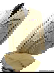
Sold2024Churchill & Nieuhof 1744 Folio Map. Malabar India"A Map of the Coast of Malabar, Madura and Cormendel" Folio Copper Engraved Map Published 1704-47 [1744] London for "A Collection of Voyages and Travels..." By Awnsham & John Churchill. The work basedSee Sold Price
Sold2020Grp: 7 Maps of IndiaGroup of seven maps of India. Includes two hand colored maps by Pierre Duval (1618-1683), "Presquisle de L'Inde de ca le Gange" and "Empire Du Mogol"; three maps by Girolamo Ruscelli (1500-1566), "TabSee Sold Price
Sold2024Abraham Ortelius Indiae Orientalis 1580 MapAbraham Ortelius (Belgian, 1527-1598). Indiae Orientalis, Insularumque Adiacientium Typus, circa 1580. Hand colored engraved map of India, China, southeast Asia. Text page, India, in Latin on verso. 1See Sold Price
Sold20191849 India Shewing The Post Roads And Dawk StationsThis remarkably detailed large format map of India and parts of bordering countries highlights the means of transportation in mid-19th century India of both people and goods in the vast region depicteSee Sold Price
Sold2016c. 1760s, Hand-Colored World Map, “Mappa Mondo”Historic Maps 1760 Hand-Colored World Map, Siena Presso Pazzini Carli c. 1760s, Hand-Colored World Map, “Mappa Mondo,” Printed & Colored by Siena Presso Pazzini Carli, Choice Very Fine. A fine GobSee Sold Price
Sold2023WW2 WWII Major General Thomas Alexander Terry Dress Whites UniformGeneral Terry Commanded the 2nd Service command as well as China Burma India Theatre. This Beautiful set is Palm Beach Tailored. Features a 1/2" Ribbon Bar set. General Terry would earn the Army DistiSee Sold Price
2 days LeftForum AuctionsIndia.- Laurie & Whittle (publishers) A New Map of the Jaghir Lands, on the Coast of Coromandel, The£75
20 hrs LeftJasper521760 MAP CARTE PARTICULIERE DE L'ISLE DE JUAN FERNANDES antique Robinson Crusoe$55
Jun 12Dan Morphy AuctionsPLATE CXIII. MAP OF INDIAN TERRITORY SHOWING DISTRIBUTION OF WOODLAND” FROM THE TWENTY-FIRST$100
Jun 07Freeman's | HindmanBELLIN, Jacques-Nicolas. Carte Reduite de L'Ocean Oriental ou Mer Des Indies. Paris, 1757. Second$150
21 hrs LeftJasper521898 Rand McNally Map of Texas [verso] Indian Territory and Oklahoma -- Texas [verso] Oklahoma and$70(1 bid)
Jun 12Dan Morphy AuctionsMAP OF THE CHOCTAW NATION, INDIAN TERRITORY - COAL AND ASPHALT SEGREGATION 1903$150
21 hrs LeftJasper521788 Bowen Map of Ottoman Empire and Mediterranean Region -- A Correct Map of the Ottoman Empire,$140
5 days LeftTrillium Antique Prints & Rare BooksSanson - Map of the Philippines and Ladrones Islands$75
Featured21 hrs LeftJasper52Johnson's New Military Map of the United States Showing the Forts, Military Posts &C. With Enlarged$65


![Churchill & Nieuhof 1744 Folio Map. Malabar India: "A Map of the Coast of Malabar, Madura and Cormendel" Folio Copper Engraved Map Published 1704-47 [1744] London for "A Collection of Voyages and Travels..." By Awnsham & John Churchill. The work based](https://p1.liveauctioneers.com/3952/320085/171971823_1_x.jpg?height=310&quality=70&version=1708266709)


![1898 Rand McNally Map of Texas [verso] Indian Territory and Oklahoma -- Texas [verso] Oklahoma and (1 of 2)](https://p1.liveauctioneers.com/5584/329422/177662173_1_x.jpg?height=282&quality=70&version=1715717898)


