Sold20211752 Map of the Marianes Islands GuamEngraved map of the Mariana Islands by jacques Bellin circa 1752, Paris. Entitled "Carte De L'Archipel De St. Lazare ou Les Isles Marianes…" from his work L'Histoire Generale des Voyages". Fine condSee Sold Price
Sold20171715 MAPS William Dampier Voyages Pacific Islands1715 William Dampier Voyages Illustrated MAPS Pacific Islands Wars Guam Panama An incredible rare and desirable voyages book by William Dampier. This book covers some of the most important and famousSee Sold Price
Sold20231752 Sulawesi. Map of the Indonesian Island by BellinTitle: 1752 Sulawesi. Map of the Indonesian Island by Bellin Date/Period: 1752 Materials: Copperplate engraved Size: 7" x 9” This 1752 copperplate engraving by Jacques Nicolas Bellin depicts SulSee Sold Price
Sold2017Bowen: Atlantic / Mediterranean IslandsCartographer: Bowen Place & Date: London / 1752 Size: 16 3/4" x 13 3/4" Bowen's fascinating composite map of the islands surrounding Africa in the Atlantic, the Mediterranean, and the Indian Ocean. EaSee Sold Price
Sold2023Perry, Commodore 1856 Large Map. China, Japan & Philippines"Chart of the coast of China and of the Japan Islands including the Marianes and a part of the Philippines" Large Folio Lithograph Map Published 1856, Washington for "Narrative of the Expedition of anSee Sold Price
Sold2019With two maps featuring California as an island, 1752Heading: (California as an Island) Author: de Chevigni; de Limiers; Massuet, Pierre Title: La Science Des Personnes De Cour, D'Epe?e Et De Robe. Place Published: Amsterdam Publisher:Z. Chatelain & FilSee Sold Price
Sold2017PhilippinesTitle/Content of Map: Philippines Date Printed: 1752 Cartographer: Bellin, Jacques Nicolas Size (in): 6 x 8 Early map of the Philippines Islands by Bellin after Velarde . Dated 1752 in cartouche PleasSee Sold Price
Sold2017Bellin: Antique Map of the Mariana Islands, 1758Carte de l'Archipel de St. Lazare ou Les Marianes Sur les cartes du P. Alonso Lopez et le memoire du P Morales Jesuites Espagnols Missionaires dans ces Isles Pour servir à l'Histoire Générale des VSee Sold Price
Sold2022[MAP]. BOWEN, Emanuel (1694–1767). Particular Draughts of S...[MAP]. BOWEN, Emanuel (1694–1767). Particular Draughts of Some of the Chief African Islands in the Mediterranean. London: William Innys and Joseph Richardson, 1752. Original hand–colored eSee Sold Price
Sold2019Bellin: Spice Islands (Moluccas), IndonesiaMap Title: Carte Particuliere des Isles Moluques Cartographer: Bellin Place / Date: Paris / 1752/1760 Size: 6" x 8 1/2" Condition: b&w; light overall age toning; map mounted on contemporary paper to fSee Sold Price
Sold20231752 Map East Indies, Thomas JefferysHand-colored map published in London by cartographer and engraver Thomas Jefferys (ca. 1719-1771.) Jefferys was geographer to Frederick Prince of Wales and to King George III. Map, approx. 11" x 7". FSee Sold Price
Sold2017Neele: Antique Map Islands of the Pacific Ocean, 1817Map: Map of the Islands in the Pacific Ocean Publication Date: 1817 Cartographer: NEELE, sc. Publisher: THOMSON'S NEW GENERAL ATLAS Size: Folio – 19.50 H x 23.75 W Inches From a famous Scottish atlaSee Sold Price
Sold20211752 Map of Indoustan India Bengal KashmirA map of Jacques Bellin showing a portion of India, "Carte de L'Indoustan", printed at Paris circa 1752, shows portion including Kashmir and Bengal. Fine folding, measures 15 x 10". Reserve: $100.00 SSee Sold Price
Sold20201752 Map East Indies, Thomas JefferysHand-colored map published in London by cartographer and engraver Thomas Jefferys (ca. 1719-1771.) Jefferys was geographer to Frederick Prince of Wales and to King George III. Map, approx. 11" x 7". FSee Sold Price
Sold2023Frame Map "Islands of Minorca" 28" x 36"Frame Map "Islands of Minorca" 28" x 36"See Sold Price
Sold20231752 MAP OF MOSCOVIA RUSSIA & UKRAINE by CHATELAIN copper engraving ANTIQUEMAP OF MOSCOVIA (RUSSIA) by HENRI CHATELAIN 1752 size 6 by 7" Very good condition Reserve: $35.00 Shipping: Domestic: Flat-rate of $25.00 to anywhere within the contiguous U.S. International: ForeignSee Sold Price
Sold2021Tallis, John (Pub) 1852 Map Islands in the Indian OceanSteel Engraved Map with Original Outline Hand Color Published 1852-56 by John Tallis, London for "The Universal Pronouncing Dictionary" by Thomas Wright. Drawn & Engraved by John Rapkin. Centre fold aSee Sold Price
Sold2021Tallis, John (Pub) 1852 Map. Islands in the AtlanticShowing Canary Islands, Madeira and Bermuda. Steel Engraved Map with Original Outline Hand Color Published 1852-56 by John Tallis, London for "The Universal Pronouncing Dictionary" by Thomas Wright. DSee Sold Price
Sold2022Dictionary And Grammar Of The Chamorro Language Island Guam 1918 Navy Department Of U.S.A.Publish by The Government Printing Office, WashingtonSee Sold Price
Sold2019Anon 1816 Hand Col Map. Island of St. Helena, Africa"The Island & Forts of St. Helena" Copper Engraved Map Published 1816 by Nuthall, Fisher & Co., Liverpool. Unknown Cartographer/Engraver. Paper Size: 10.5 x 8.5 inch (27 x 22cm) Chip to bottom marginSee Sold Price
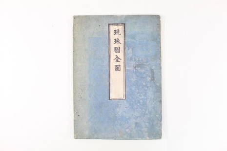
Sold2021Japanese Fold Out Handmade Ink Drawn Map,Islands,RoutesJapanese Fold Out Handmade Ink Drawn Map,Islands,Routes. This is a beautiful, handmade map of what appear to be islands and possibly routes. It is written in Japanese. The two hard covers are attachedSee Sold Price
Sold2019INDIAN OCEAN Madagascar Seychelles Maldives MauritiusReserve Reduced! TITLE/CONTENT OF MAP: 'ISLANDS IN THE INDIAN OCEAN. Madagascar, Amirantes, Seychelle Archipelago, Socotra, Lakadive Islands, Maldive Islands, Andaman Isles, Nicobar Isles, Chagos GrouSee Sold Price
Sold2022Three Antique Hawaiian Maps, US Government3 1920s Hawaiian Maps. Island Of Oahu Map Approximately 47.1875 x 36.5 in. Hawaiian Islands Approximately 45.875 x 35.125 in. Hawaii To Oahu Approximately 46.4375 x 35.5625 in.See Sold Price
Sold2019ATLANTIC ISLANDS. Bermuda Madeira Canaries.TenerifeTITLE/CONTENT OF MAP: 'Islands in the Atlantic' The map shows the islands of Madeira, the Azores, the "Bermudas or Summers Islands", the Canary Islands and teh Cape de Verde Islands. Vignettes: Fayal,See Sold Price
450 Lots AwayKey Date Coins2009 United States Quarters District of Columbia and U.S. Territories Silver Proof Set - 6 pc set No$30
5 days LeftJasper521822 MAP of LEEWARD ISLANDS GEOGRAPHICAL STATISTICAL HISTORICAL antique 17.5x22"$120
5 days LeftJasper521760 MAP CARTE PARTICULIERE DE L'ISLE DE JUAN FERNANDES antique Robinson Crusoe$55
22 hrs LeftAlbion AuctionsStieler, Adolf 1909 Antique Map. New Zealand - South Sea Islands, Pacific Australia Hawaii$5
Featured5 days LeftJasper521764 Bellin Map of Lesser Antilles Northern Portion -- Petites Antilles ou Isles du Vent 3e. Partie.$130
6 days LeftJasper52Les Indes Orientales… South Asia India Indochina. SANTINI / VAUGONDY 1784 map$85
2 days LeftTrillium Antique Prints & Rare BooksPrevost - Map of China, Korea, Japan, Phlippines and Surrounding Islands$50
Featured6 days LeftJasper52Suite de l’Ocean Oriental…' East Asia/Indies. Western Pacific. BELLIN 1746 map$200
Featured5 days LeftJasper521740. Map of Isle de Juan Fernandes ''Robinson Crusoe Island'', Chile. George Anson$130
Crawford Family Auctions LLCVintage 1940s US DOC Survey Map, Alaska South Coast, Cape St. Elias to Shumagin Islands$10
Crawford Family Auctions LLCVintage 1945 SE Alaska Midway Islands to Cape Spencer incl. Lynn Canal USC&GS Map$10


![[MAP]. BOWEN, Emanuel (1694–1767). Particular Draughts of S...: [MAP]. BOWEN, Emanuel (1694–1767). Particular Draughts of Some of the Chief African Islands in the Mediterranean. London: William Innys and Joseph Richardson, 1752. Original hand–colored e](https://p1.liveauctioneers.com/928/252933/131521910_1_x.jpg?height=310&quality=70&version=1656110480)