1664 / 1859 "The Duke's Plan" A Description of
Similar Sale History
View More Items in Books, Magazines & Papers


Related Books, Magazines & Papers
More Items in Books, Magazines & Papers
View MoreRecommended Collectibles
View More


Item Details
Description
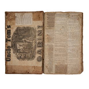
By: original cartographer unknown / Reissue by: David Thomas Valentine / Engraved by: George HaywardDate: original manuscript 1664 / Reissue 1859 (Published) New YorkDimensions: 21.75 x 27.25 inches ( 55.25 x 69.22 cm)This interesting map is a reissue of the well-known “Duke’s Plan” of the city of New York, a manuscript map which was originally published in 1664, and which resides in the British Library in London. David T. Valentine, a civil clerk in New York City in the mid-19th century, collected and reissued a number of the finest and most rare maps of Manhattan, including this fine so-called ‘Duke’s Plan’.The original of the map was discovered in the British Library by George H. Moore a visiting librarian of the New York Historical Society, who obtained permission for its reissuance. The reissued map received the stamp of approval from Richard Sims of the Manuscript Department of the British Library, and his notation stating that the reissue is true to the original is found in the lower right quadrant. As a manuscript map, it had never been seen by the general public before being published by Valentine.The Duke’s Plan is oriented east and covers the more developed southern area of the island, south of Wall Street. It was issued shortly after Charles II of England granted the recently conquered New Amsterdam to his brother, the Duke of York; hence, the renaming. The title cartouche states that the depiction renders the area as it appeared in September 1661, ‘Anno Domini’. Below the elaborate cartouche is the date 1664. The map is oriented east, and covers in detail the area to the south of Wall Street, but also extends to the north to what would now be lower mid-Manhattan. It also covers some small settlements in Brooklyn and New Jersey.The number of buildings on the map is somewhat surprising for such an early date, with fifty four in the area north of Wall Street and many streets in the southern region lined with Dutch-style housing reminiscent of Amsterdam. The fortress, the ‘Governours House and Garden’, and a marvelous large windmill are all depicted. The settlement is well-fortified with artillery in the form of cannons positioned along the northern edge of Wall Street and in one place on the island’s eastern edge.The map is beautifully embellished with numerous frigates of myriad design, most flying British colors. Condition: This folding map in B+ condition has been backed with archival paper, thus repairing fold separations. Some light soiling at original fold lines.
Condition
Included in Description.
Weight
0.5 lb
Buyer's Premium
- 25% up to $500,000.00
- 25% above $500,000.00
1664 / 1859 "The Duke's Plan" A Description of
Estimate $500 - $1,000
9 bidders are watching this item.
Shipping & Pickup Options
Item located in Chicago, IL, us$10 shipping in the US
Payment

Related Searches
TOP


![Japanese hand-painted architectural plan 1880: Heading: (Japan) Author: Title: Japanese hand-painted architectural manuscript plan of the Hachioji Jinja shrine Place Published: [Japan] Publisher: Date Published: [c.1880] Descriptio](https://p1.liveauctioneers.com/642/110056/56485225_1_x.jpg?height=310&quality=70&version=1506974396)

![India.- Anonymous (late 19th century) Sketch of the: India.- Anonymous (late 19th century) Sketch of the Fort and Citadel of Beejapoor [Bijapur], manuscript plan with references below, and two sheets with 4 pp. of 'Descriptions of Buildings in Bejapoor](https://p1.liveauctioneers.com/5458/121233/61714196_1_x.jpg?height=310&quality=70&version=1524745813)


![[MILITARY]. WINDHAM, William. A Plan of Discipline,: [MILITARY]. WINDHAM, William. A Plan of Discipline, Composed for the use of the Militia of the Country of Norfolk. London: printed for J. Shuckburgh, 1759. 3 parts in one volume, 4to. 52 plates (3 fol](https://p1.liveauctioneers.com/928/212515/108628864_1_x.jpg?height=310&quality=70&version=1627420959)


![1906 HISTORY of JAPAN & KINGDOM of SIAM Thailand 3 VOLUMES antique ILLUSTRATED: THE HISTORY OF JAPAN TOGETHER WITH A DESCRIPTION OF THE KINGDOM OF SIAM 1690-92. Glasgow: James Maclehose and Sons, 1906 3 volumes, complete by Engelbert Kaempfer 8vo: 6 by 9" pp. lxxxix, [3], 336, [3](https://p1.liveauctioneers.com/5584/328415/176935111_1_x.jpg?height=310&quality=70&version=1715112425)


![1681 ANTIQUE PIGSKIN BOUND FOLIO Lectiones Morales in Prophetam Jonam: 1681 ANTIQUE PIGSKIN BOUND FOLIO Lectiones Morales in Prophetam Jonam by Angelo Paciuchelli Published in Monachii [Munich] by Ioannis Iaecklini in 1681 Description: [xxviii], 928, [42] pp. (Folio) 31x](https://p1.liveauctioneers.com/5584/328415/176934955_1_x.jpg?height=310&quality=70&version=1715112425)


![19 issues of rare Gay Magazine METRA 1985-1986: [Queer interest], Metra: Midwest America's Leading Free Gay Magazine, 19 issues, published 1986-1987, a few duplicates, softcover, staplebound wraps, illustrated throughout in black and white, publish](https://p1.liveauctioneers.com/184/328649/177016396_1_x.jpg?height=310&quality=70&version=1714770323)


![George Washington Signed Discharge: Partly printed discharge document signed by George Washington, as Commander in Chief of the Armies of the United States. Newburgh, [New York], 4 January 1783. 1 page, ## x ## in. Undersigned by Washin](https://p1.liveauctioneers.com/7226/322253/173251475_1_x.jpg?height=310&quality=70&version=1710004847)
![[Ambrotype] Texas Confederate Soldier: Sixth plate ambrotype. Full leatherette case. Portrait of a possible Texas Confederate soldier. A silver star device was used to pin up the brim of his light-toned headgear, a look often seen in image](https://p1.liveauctioneers.com/7226/322253/173251509_1_x.jpg?height=310&quality=70&version=1710004847)


![Captured Bowie Knife w/ Period Note of Provenance: Captured Confederate D-hilt Bowie knife. [Kenansville, North Carolina]: [Louis Froelich factory]. With original metal and leather sheath with affixed period notes. First note with only remnants. Secon](https://p1.liveauctioneers.com/7226/325455/175169154_1_x.jpg?height=310&quality=70&version=1712370394)
