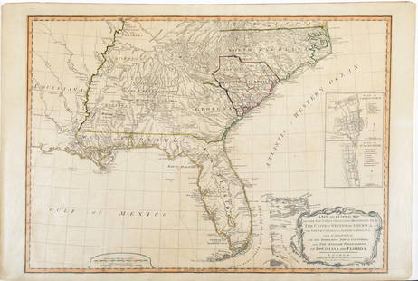
Jefferys, Western Coast of Louisiana and New Leon coast
Thomas Jefferys Sale History
View Price Results for Thomas JefferysRelated Maps & Atlases
More Items from Thomas Jefferys
View MoreRecommended Transportation & Travel Collectibles
View More


Item Details
Description
JEFFERYS, Thomas (1719-1771).
The Western Coast of Louisiana and the coast of New Leon.
Engraved map from The West India Atlas.
London, 1794.
21" x 27 1/2" sheet, 33" x 39" framed.
First published in 1775, this map was the "principal authority for the Texas coastline" until the beginning of the 19th century, according to Streeter. Jefferys' map is remarkable for being the first map to focus on the Texas coastline, as well as for its overwhelming geographical inaccuracies.
Buyer's Premium
- 25%
Jefferys, Western Coast of Louisiana and New Leon coast
Estimate $3,000 - $6,000
Get approved to bid.
Shipping & Pickup Options
Item located in New York, NY, usOffers In-House Shipping
Local Pickup Available
Payment

Related Searches
TOP


![Des Barres Map of NY Harbor: *** START PRICE IS THE RESERVE *** [America] DES BARRES, Joseph Frederick Wallet (1729-1824). A Chart of New York Harbour with the Soundings Views of Land Marks and Nautical directions for the Use of](https://p1.liveauctioneers.com/1968/163248/82424572_1_x.jpg?height=310&quality=70&version=1583340284)


![Jeffery's Map of the Gulf Coast from the Bahamas to Louisiana: JEFFERYS, Thomas (c. 1719-1771). The Coast of West Florida and Louisiana [WITH] The Peninsula and Gulf of Florida or Channel of Bahama with the Bahama Islands. Engraved map with hand color in outline.](https://p1.liveauctioneers.com/1968/273926/143704787_1_x.jpg?height=310&quality=70&version=1672435208)


![First Separate Map of the Houston, Texas Coastline: JEFFERYS, Thomas (c. 1719 - 1771). The Western Coast of Louisiana and the Coast of New Leon. Engraving with hand color. London: Robert Sayer, 1775.21 1/4" x 29 3/4" sheet, 23" x 31 1/2" framed. [WITH]](https://p1.liveauctioneers.com/1968/196011/98958029_1_x.jpg?height=310&quality=70&version=1614615886)


![Engraved Maps of Spain, c1650's (2) [180169]: (2) Engraved colored maps of Spain, copper plate relief. 1. Map of Navarra, Northern part of Spain, colors indicating borders, detailed map of mountain ranges and hills, as well as trees, ships. and b](https://p1.liveauctioneers.com/2699/331495/178785774_1_x.jpg?height=310&quality=70&version=1717094933)

![Océanique. Partie… Nle Hollande #52. Western Australia SW. VANDERMAELEN 1827 map: CAPTION PRINTED BELOW PICTURE: Océanique - Partie de la Nouvelle Hollande [Note sur la nouvelle Hollande] - No. 52 The southwestern coast of Western Australia, between Green Head and Esperance, i](https://p1.liveauctioneers.com/5584/332390/179263333_1_x.jpg?height=310&quality=70&version=1717528223)

![Map of Entrance to San Diego by Bache, 1851 [179997]: Map of entrance to San Diego by A.D Bache, "Survey of the Coast of the United States". Shaded relief and bay survey with sailing directions. Published in 1851. San Diego Salvatore Falcone Collection](https://p1.liveauctioneers.com/2699/331495/178785777_1_x.jpg?height=310&quality=70&version=1717094933)
![US Coast Survey Maps Pt. Pinos & Conceptions 1851 (2) [179998]: (2) United States Coast Survey Maps by A. M. Harrison. Point Pinos, proposed sites for lighthouses, from 1847 survey by H. A. Wise. Point Conceptions, Coast of California, proposed sites for lighthous](https://p1.liveauctioneers.com/2699/331495/178785796_1_x.jpg?height=310&quality=70&version=1717094933)


![[MAPS]. HOMANN, Johann Baptist, HOMANN HEIRS, and Georg Matthäus SEUTTER. [Composite Atlas].: [MAPS]. HOMANN, Johann Baptist (1663-1724), HOMANN HEIRS, and Georg Matthäus SEUTTER (1678-1757). [Composite Atlas]. [Nuremberg, Augsburg, and others: Homann Heirs and others, maps dated between](https://p1.liveauctioneers.com/197/329395/177650530_1_x.jpg?height=310&quality=70&version=1715364962)


