


FRAMED 1885 COLBY AND STUART MAP OF PORTLAND, MAINE
Similar Sale History
View More Items in Maps & Atlases


Related Maps & Atlases


![Maine Map, 1840 [181582]: 1840 Maine map by N. Curriers Litho, NY. Mounted to sheet music. 8.5x8.5". Maine](https://p1.liveauctioneers.com/2699/331495/178785758_1_x.jpg?height=310&quality=70&version=1717094933)


![Sanitary & Topographical "Viele Map" of Manhattan 1865 [182838]: Manhattan Island map surveyed by Mexican American & Civil War veteran Egbert Viele 1865. Viele was author of a color city map, a "Sanitary & Topographical Map of the City and Island of New York," firs](https://p1.liveauctioneers.com/2699/331495/178785766_1_x.jpg?height=310&quality=70&version=1717094933)
More Items in Maps & Atlases
View More
![[MAP]. TODESCHI, Pietro. [Nova et Acurata Totius Americae Tabula auct. G.I. Blaeu] America quarta: [MAP]. TODESCHI, Pietro. [Nova et Acurata Totius Americae Tabula auct. G.I. Blaeu] America quarta pars orbis quam plerunq, nuvum orbem appellitant primo detecta est anno 1492 a Christophoro Columbo...](https://p1.liveauctioneers.com/197/329395/177650542_1_x.jpg?height=310&quality=70&version=1715364962)


![[MAPS]. HOMANN, Johann Baptist, HOMANN HEIRS, and Georg Matthäus SEUTTER. [Composite Atlas].: [MAPS]. HOMANN, Johann Baptist (1663-1724), HOMANN HEIRS, and Georg Matthäus SEUTTER (1678-1757). [Composite Atlas]. [Nuremberg, Augsburg, and others: Homann Heirs and others, maps dated between](https://p1.liveauctioneers.com/197/329395/177650530_1_x.jpg?height=310&quality=70&version=1715364962)


![[MAP]. ORTELIUS, Abraham. Americae Sive Novi Orbis, Nova Descriptio. 1573.: [MAP]. ORTELIUS, Abraham (1527-1598). Americae Sive Novi Orbis, Nova Descriptio. Antwerp, 1573. Engraved map with hand-coloring. Framed and double glazed, visible area 375 x 521 mm (unexamined out of](https://p1.liveauctioneers.com/197/329395/177650534_1_x.jpg?height=310&quality=70&version=1715364962)
![Set of Twelve Satirical Anthropomorphic Maps of Europe: [SATIRICAL MAPS] A set of twelve satirical anthropomorphic maps of Europe. London: circa 1868. A set of 12 (believed complete) lithographed maps by Vincent Brooks, Day & Son, London, each offering](https://p1.liveauctioneers.com/292/330597/178279264_1_x.jpg?height=310&quality=70&version=1716409282)


![[MAP]. ORTELIUS, Abraham. Turcici Imperii Descriptio.1592.: [MAP]. ORTELIUS, Abraham (1527-1598). Turcici Imperii Descriptio. Antwerp, 1592. Engraved map with hand-coloring. Matted, framed, and double glazed, sight 406 x 521 mm (unexamined out of frame). Decor](https://p1.liveauctioneers.com/197/329395/177650538_1_x.jpg?height=310&quality=70&version=1715364962)
![[MAP]. ORTELIUS, Abraham. Romani Imperii Imago. 1592.: [MAP]. ORTELIUS, Abraham (1527-1598). Romani Imperii Imago. Antwerp, 1592. Engraved map with hand-coloring. Matted, framed, and double glazed, visible area 381 x 521 mm (unexamined out of frame). 6 de](https://p1.liveauctioneers.com/197/329395/177650537_1_x.jpg?height=310&quality=70&version=1715364962)
![[MAP]. SPEED, John. A New Mappe of the Romane Empire. 1676.: [MAP]. SPEED, John (ca 1551-1629). A New Mappe of the Romane Empire. London: Basset & Chiswell, 1676. Engraved map with hand-coloring. Framed and double glazed, sight 419 x 559 mm. Decorative cartouch](https://p1.liveauctioneers.com/197/329395/177650541_1_x.jpg?height=310&quality=70&version=1715364962)
Recommended Transportation & Travel Collectibles
View More

![[FLAGS]. 31-star American parade flag. Ca 1850-1859.: [FLAGS]. 31-star American parade flag. Ca 1850-1859. 22 x 36 1/2 in. cotton flag with 31 printed stars, configured in a double medallion surrounding a much larger central star, that is haloed in both](https://p1.liveauctioneers.com/197/329785/177758218_1_x.jpg?height=310&quality=70&version=1715625218)


Item Details
Description
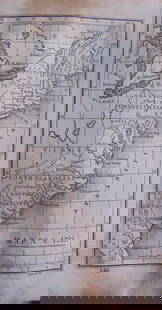
1885 George N. Colby and J. H. Stuart map of Portland, Maine. Prepared for and published in Colby's Atlas of Maine in 1885. The map depicts from Liconia to East Deering and from Woodfords to South Portland. Portland is illustrated in detail, with streets and buildings labeled, along with rail lines and each individual wharf. The adjacent towns of Deering, Cape Elizabeth, Cash Corner, and Liconia are included. An index of references divided between the lower left and lower right quadrants notes important businesses by street. In gold ribbed frame, green mat, under UV glass, OS: 23" x 32 1/2", SS: 16" x 25". Good condition.
Buyer's Premium
- 20%
FRAMED 1885 COLBY AND STUART MAP OF PORTLAND, MAINE
Estimate $200 - $300
2 bidders are watching this item.
Shipping & Pickup Options
Item located in Warren, ME, usOffers In-House Shipping
Local Pickup Available
Payment
Accepts seamless payments through LiveAuctioneers

TOP