


Burr Map of the counties of New York
Similar Sale History
View More Items in Maps & Atlases


Related Maps & Atlases


More Items in Maps & Atlases
View More![[MAPS]. HOMANN, Johann Baptist, HOMANN HEIRS, and Georg Matthäus SEUTTER. [Composite Atlas].: [MAPS]. HOMANN, Johann Baptist (1663-1724), HOMANN HEIRS, and Georg Matthäus SEUTTER (1678-1757). [Composite Atlas]. [Nuremberg, Augsburg, and others: Homann Heirs and others, maps dated between](https://p1.liveauctioneers.com/197/329395/177650530_1_x.jpg?height=310&quality=70&version=1715364962)
![[MAP]. TODESCHI, Pietro. [Nova et Acurata Totius Americae Tabula auct. G.I. Blaeu] America quarta: [MAP]. TODESCHI, Pietro. [Nova et Acurata Totius Americae Tabula auct. G.I. Blaeu] America quarta pars orbis quam plerunq, nuvum orbem appellitant primo detecta est anno 1492 a Christophoro Columbo...](https://p1.liveauctioneers.com/197/329395/177650542_1_x.jpg?height=310&quality=70&version=1715364962)
![[MAP]. ORTELIUS, Abraham. Americae Sive Novi Orbis, Nova Descriptio. 1573.: [MAP]. ORTELIUS, Abraham (1527-1598). Americae Sive Novi Orbis, Nova Descriptio. Antwerp, 1573. Engraved map with hand-coloring. Framed and double glazed, visible area 375 x 521 mm (unexamined out of](https://p1.liveauctioneers.com/197/329395/177650534_1_x.jpg?height=310&quality=70&version=1715364962)


![[MAP]. ORTELIUS, Abraham. Turcici Imperii Descriptio.1592.: [MAP]. ORTELIUS, Abraham (1527-1598). Turcici Imperii Descriptio. Antwerp, 1592. Engraved map with hand-coloring. Matted, framed, and double glazed, sight 406 x 521 mm (unexamined out of frame). Decor](https://p1.liveauctioneers.com/197/329395/177650538_1_x.jpg?height=310&quality=70&version=1715364962)
![Set of Twelve Satirical Anthropomorphic Maps of Europe: [SATIRICAL MAPS] A set of twelve satirical anthropomorphic maps of Europe. London: circa 1868. A set of 12 (believed complete) lithographed maps by Vincent Brooks, Day & Son, London, each offering](https://p1.liveauctioneers.com/292/330597/178279264_1_x.jpg?height=310&quality=70&version=1716409282)


![Sanitary & Topographical "Viele Map" of Manhattan 1865 [182838]: Manhattan Island map surveyed by Mexican American & Civil War veteran Egbert Viele 1865. Viele was author of a color city map, a "Sanitary & Topographical Map of the City and Island of New York," firs](https://p1.liveauctioneers.com/2699/331495/178785766_1_x.jpg?height=310&quality=70&version=1717094933)
![[MAP]. ORTELIUS, Abraham. Romani Imperii Imago. 1592.: [MAP]. ORTELIUS, Abraham (1527-1598). Romani Imperii Imago. Antwerp, 1592. Engraved map with hand-coloring. Matted, framed, and double glazed, visible area 381 x 521 mm (unexamined out of frame). 6 de](https://p1.liveauctioneers.com/197/329395/177650537_1_x.jpg?height=310&quality=70&version=1715364962)
![[MAP]. SPEED, John. A New Mappe of the Romane Empire. 1676.: [MAP]. SPEED, John (ca 1551-1629). A New Mappe of the Romane Empire. London: Basset & Chiswell, 1676. Engraved map with hand-coloring. Framed and double glazed, sight 419 x 559 mm. Decorative cartouch](https://p1.liveauctioneers.com/197/329395/177650541_1_x.jpg?height=310&quality=70&version=1715364962)
Recommended Transportation & Travel Collectibles
View More


Item Details
Description
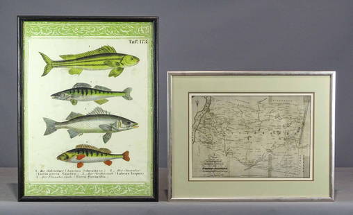
BURR, David H. (1803 - 1875).
Map of the counties of New York, Queens, Kings and Richmond.
Engraved map with original hand color in part.
New York: Burr, 1829.
14 1/4" x 19 1/2" sheet, 23 1/2" x 29" framed.
Comparable: Neal Auction Company, 2015 - $535.50; Doyle New York, 2005 - $960.
First edition. A fine map from Burr's "An Atlas of the State of New York Containing a Map of the State and of the Several Counties. Projected and Drawn by a Uniform Scale. . .under the Supervision & Direction of Simon De Witt, Surveyor General. . . ." "It is a magnificent publication and was the second atlas of an individual state ever published." (Ristow). Engraved by Rawdon Clark & Co. Albany & Rawdon, Wright & Co. N. York. This map also includes all of current day Nassau County, Long Island.
Buyer's Premium
- 22%
Burr Map of the counties of New York
Estimate $2,000 - $4,000
3 bidders are watching this item.
Shipping & Pickup Options
Item located in New York, NY, usOffers In-House Shipping
Local Pickup Available
Payment

TOP