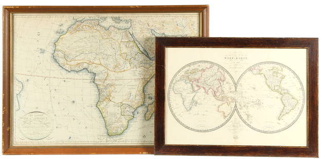
Lot of 6 Maps of Africa 1618-1813
Similar Sale History
View More Items in Maps & AtlasesRelated Maps & Atlases
More Items in Maps & Atlases
View MoreRecommended Transportation & Travel Collectibles
View More


Item Details
Description
Guinea
(under heading: Descriptio Gvineæ.)
By Petrus Kerius Pieter van der Keere
For atlas of Petrus Bertius (Pieter de Bert), Amsterdam, 1618 , page 652.
9 cm x 13 cm
Watermarked paper. Small faded ink stain on left margin and in Sierra Leone. European sailing ship and local craft depicted in the ocean. Highly decorative calligraphy. Page from a miniature atlas, Latin edition probably Tabularum Geographicarum, 1618 . Depicts West Africa from Senegal to the Bight of Biafra.
On the reverse, page 651, is a section of text in Latin headed by Descriptio Regni Tvnetani (Description of the Kingdom of Tunisia). BT-105 and BT-106 are maps from different editions of the same atlas;
Buyer's Premium
- 18.5%
Lot of 6 Maps of Africa 1618-1813
Estimate $500 - $600
2 bidders are watching this item.
Shipping & Pickup Options
Item located in Chicago, IL, usOffers In-House Shipping
Payment

Related Searches
TOP


![[MAP]. ORTELIUS, Abraham. Africae Tabula Nova. 1592.: [MAP]. ORTELIUS, Abraham (1527-1598). Africae Tabula Nova. Antwerp, 1592. Engraved map with hand-coloring. Matted, framed, and double glazed, visible area 406 x 533 mm (unexamined out of frame). Strap](https://p1.liveauctioneers.com/197/329395/177650533_1_x.jpg?height=310&quality=70&version=1715364962)

![1790 AFRICA TRAVELS Voyages dans le pays des Hottentots ILLUSTRATED antique RARE: Voyages dans le pays des Hottentots, a la Caffrerie, a la baye Botanique, et dans la Nouvelle Hollande [ Travels in the country of the Hottentots, at the Caffrie ] [ Voyages undertaken from 1777 to 17](https://p1.liveauctioneers.com/5584/329751/177744081_1_x.jpg?height=310&quality=70&version=1715718131)
![d'Anville (Jean Baptiste Bourguignon) [Untitled Composite Atlas with 102 map sheets], [probably: d'Anville (Jean Baptiste Bourguignon) [Untitled Composite Atlas with 102 map sheets], comprising 20 double-page maps, 9 two-sheet double-page maps, 3 two-sheet maps on folding double-pages [Asia, Afri](https://p1.liveauctioneers.com/5458/329231/177514974_1_x.jpg?height=310&quality=70&version=1715269091)


![[MAP]. ORTELIUS, Abraham. Romani Imperii Imago. 1592.: [MAP]. ORTELIUS, Abraham (1527-1598). Romani Imperii Imago. Antwerp, 1592. Engraved map with hand-coloring. Matted, framed, and double glazed, visible area 381 x 521 mm (unexamined out of frame). 6 de](https://p1.liveauctioneers.com/197/329395/177650537_1_x.jpg?height=310&quality=70&version=1715364962)


![[MAP]. TODESCHI, Pietro. [Nova et Acurata Totius Americae Tabula auct. G.I. Blaeu] America quarta: [MAP]. TODESCHI, Pietro. [Nova et Acurata Totius Americae Tabula auct. G.I. Blaeu] America quarta pars orbis quam plerunq, nuvum orbem appellitant primo detecta est anno 1492 a Christophoro Columbo...](https://p1.liveauctioneers.com/197/329395/177650542_1_x.jpg?height=310&quality=70&version=1715364962)


![[MAPS]. HOMANN, Johann Baptist, HOMANN HEIRS, and Georg Matthäus SEUTTER. [Composite Atlas].: [MAPS]. HOMANN, Johann Baptist (1663-1724), HOMANN HEIRS, and Georg Matthäus SEUTTER (1678-1757). [Composite Atlas]. [Nuremberg, Augsburg, and others: Homann Heirs and others, maps dated between](https://p1.liveauctioneers.com/197/329395/177650530_1_x.jpg?height=310&quality=70&version=1715364962)


