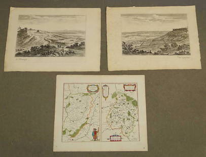
Map & view of Hawaii, c.1785
Similar Sale History
View More Items in Maps & AtlasesRelated Maps & Atlases
More Items in Maps & Atlases
View MoreRecommended Transportation & Travel Collectibles
View More


Item Details
Description
Heading: (Hawaii)
Author:
Title: French map of the Hawaiian Islands & view of Karakakooa, framed together.
Place Published: Paris
Publisher:
Date Published: c.1785
Description:
Due to the size and/or weight of this lot extra shipping and/or handling charges may apply.
Author:
Title: French map of the Hawaiian Islands & view of Karakakooa, framed together.
Place Published: Paris
Publisher:
Date Published: c.1785
Description:
Includes:
Bonne, Rigobert. Carte des Isles Sandwich. With inset map "Plan de la Baye de Karakakooa." 23.5x35 cm.
Benard. Vue de Karakakooa, partie des l'Isle Owhyhee. 23x50 cm.
Copper-engravings. Matted together and framed under plexiglass. Overall 70x68.3 cm (27½x26¾").
Due to the size and/or weight of this lot extra shipping and/or handling charges may apply.
Condition
View with a ¾" circle of worm damage at lower edge affecting a bit of the depiction of water and the "V" in the caption below image; else very good, not examined out of frame.
Buyer's Premium
- 25%
Map & view of Hawaii, c.1785
Estimate $300 - $500
6 bidders are watching this item.
Shipping & Pickup Options
Item located in Berkeley, CA, usSee Policy for Shipping
Payment

Related Searches
TOP


![[MAP] Early View of MESSINE Italy, by Aveline: Offered for sale by John Bale Books/ jbalebooks@gmail.com [Aveline] MESSINE, ancienement Messena Ville Archiep...Isle de Sicile. Aveline fecit et excudit C. P .R. No date, c. 1700's. Watermarked](https://p1.liveauctioneers.com/7142/237178/122920705_1_x.jpg?height=310&quality=70&version=1644600273)


![1587 Birds Eye View of Ghent -- [Untitled] Gent: Title/Content of Map: 1587 Birds Eye View of Ghent -- [Untitled] Gent Date: 1587 c. Cartographer: Anonymous Size: 8.3 x 10.6 in. A very nice and detailed birds' eye view map of the market city of Ghen](https://p1.liveauctioneers.com/5584/165933/83741827_1_x.jpg?height=310&quality=70&version=1586907661)

![HAND COLORED MAP OF PERU & COUNTRY OF THE AMAZONS, 1747, BY EMANUEL BOWEN, FRAMED: A New And Accurate Map Of Peru And The Country Of The Amazones. Drawn From The Most Authentick French Maps &C. And Regulated By Astronomical Observations, London]: William Innys [et al.], 1747. A deta](https://p1.liveauctioneers.com/957/328836/177180798_1_x.jpg?height=310&quality=70&version=1715021458)
![Royaumes de Siam, Tunquin, Pegu, Ava, Aracan'. Indochina. BELLIN 1751 old map: CAPTION PRINTED BELOW PICTURE: Carte des Royaumes de Siam, de Tunquin, Pegu, Ava, Aracan, &c [Map of the kingdoms of Siam, Tonkin, Pegu, Ava, Arakan, &c] DATE PRINTED: 1751 IMAGE SIZE: Approx 28.5 x 2](https://p1.liveauctioneers.com/5584/329387/177649212_1_x.jpg?height=310&quality=70&version=1715717898)
![Les voyages de Rubruquis, Marco Polo, Jenkinson'. BELLIN/SCHLEY 1749 old map: CAPTION PRINTED BELOW PICTURE: Carte pour les Voyages de Rubruquis, Marco Polo, Jenkinson, &c [Map showing the explorations of William of Rubruck, Marco Polo, Anthony Jenkinson, &c.] Northern Asia: Si](https://p1.liveauctioneers.com/5584/329387/177649177_1_x.jpg?height=310&quality=70&version=1715717898)


![[NEW YORK CITY – PICTORIAL MAPS]. Group of 3 pictorial maps...: [NEW YORK CITY – PICTORIAL MAPS]. Group of 3 pictorial maps. Including: ANNAND, George (1890—1980). Sinclair Pictorial Map of New York/New York World’s Fair. 26 ¾ x 27 5/8”](https://p1.liveauctioneers.com/928/325952/175495562_1_x.jpg?height=310&quality=70&version=1712935174)


![[Maps] Gio. Ant. Magnini, Italia, 1620: [Maps] Gio. Ant. Magnini, Italia, 1620, Giovanni Antonio Magnini. Italia, data in luce da Fabio suo figliuolo al Serenissimo Ferdinado Gonzaga Duca di Matoua edi Monserrato etc. Bologna, for Sebastian](https://p1.liveauctioneers.com/188/326797/176317457_1_x.jpg?height=310&quality=70&version=1713847031)
![[Maps] Martin Zeiler, Itinerarium Italiae, 1640: [Maps] Martin Zeiler, Itinerarium Italiae, 1640, Martini Zeilleri. Itinerarium Italiae Nov-Antiquae: oder, Raiss-Beschreibung durch Italien, Matthaus Merian, Frankfurt, 40 plates, most double-page, in](https://p1.liveauctioneers.com/188/326797/176317459_1_x.jpg?height=310&quality=70&version=1713847031)


![[MAP]. TODESCHI, Pietro. [Nova et Acurata Totius Americae Tabula auct. G.I. Blaeu] America quarta: [MAP]. TODESCHI, Pietro. [Nova et Acurata Totius Americae Tabula auct. G.I. Blaeu] America quarta pars orbis quam plerunq, nuvum orbem appellitant primo detecta est anno 1492 a Christophoro Columbo...](https://p1.liveauctioneers.com/197/329395/177650542_1_x.jpg?height=310&quality=70&version=1715364962)


