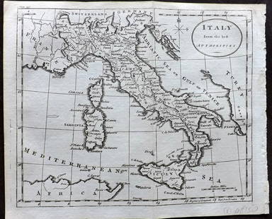
Pair of 18th Century Maps of Italy.
Thomas Jefferys Sale History
View Price Results for Thomas JefferysRelated Maps & Atlases
More Items from Thomas Jefferys
View MoreRecommended Transportation & Travel Collectibles
View More


Item Details
Description
Pair of 18th Century Maps of Italy. Includes: An Accurate Map of Italy from the Latest Improvements and Regulated by Astronomical Observations (London, R. Reynolds, 1768) and Italy by Thomas Jefferys (ca. 1770). Largest 9 x 14 ½”. Hand colored with strong plate marks. Light toning; very good.
Buyer's Premium
- 25%
Pair of 18th Century Maps of Italy.
Estimate $100 - $200
5 bidders are watching this item.
Shipping & Pickup Options
Item located in Chicago, IL, usSee Policy for Shipping
Payment

Auction Curated By

President
TOP


![[Maps] Gio. Ant. Magnini, Italia, 1620: [Maps] Gio. Ant. Magnini, Italia, 1620, Giovanni Antonio Magnini. Italia, data in luce da Fabio suo figliuolo al Serenissimo Ferdinado Gonzaga Duca di Matoua edi Monserrato etc. Bologna, for Sebastian](https://p1.liveauctioneers.com/188/326797/176317457_1_x.jpg?height=310&quality=70&version=1713847031)


![[Maps] Martin Zeiler, Itinerarium Italiae, 1640: [Maps] Martin Zeiler, Itinerarium Italiae, 1640, Martini Zeilleri. Itinerarium Italiae Nov-Antiquae: oder, Raiss-Beschreibung durch Italien, Matthaus Merian, Frankfurt, 40 plates, most double-page, in](https://p1.liveauctioneers.com/188/326797/176317459_1_x.jpg?height=310&quality=70&version=1713847031)

