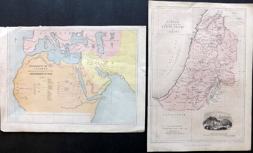
Wells, Edward 1817 Pair of Maps of Israel, Holy Land
Similar Sale History
View More Items in Maps & AtlasesRelated Maps & Atlases
More Items in Maps & Atlases
View MoreRecommended Transportation & Travel Collectibles
View More


Item Details
Description
"A Map of Canaan shewing the Captivities of Israel and Judah" and "A Map of Canaan adapted to the Gospel History" Copper Engraved Map Published 1817, London for "A Companion to the Holy Bible; The Sunject, Sacred Geography..." by Edward Wells. Paper Size: 10.5 x 8 inch (27 x 21cm) Good Condition
Buyer's Premium
- 22%
Wells, Edward 1817 Pair of Maps of Israel, Holy Land
Estimate $30 - $40
Shipping & Pickup Options
Item located in Chesterfield, ukSee Policy for Shipping
Payment

TOP


![16th c. Map, Israel, Middle East - TRIBUS ASER by Christian van Adrichom: Description16th c. Engraved Map of Israel, Middle East - TRIBUS ASER [Territory of the Tribe of Asher in the Holy Land] by Christiaan van Adrichem, (1533-1585) and Arnold Mylius (1540-1604) | Publishe](https://p1.liveauctioneers.com/6084/291748/157234438_1_x.jpg?height=310&quality=70&version=1689539413)


![[MAP]. ORTELIUS, Abraham. Presbiteri Iohannis, sive, Abissinorum Imperii Descriptio. 1592.: [MAP]. ORTELIUS, Abraham. (1527-1598). Presbiteri Iohannis, sive, Abissinorum Imperii Descriptio. Antwerp, 1592. Engraved map with hand-coloring. Matted, framed, and double glazed, visible area 406 x](https://p1.liveauctioneers.com/197/329395/177650536_1_x.jpg?height=310&quality=70&version=1715364962)


![[Maps] Martin Zeiler, Itinerarium Italiae, 1640: [Maps] Martin Zeiler, Itinerarium Italiae, 1640, Martini Zeilleri. Itinerarium Italiae Nov-Antiquae: oder, Raiss-Beschreibung durch Italien, Matthaus Merian, Frankfurt, 40 plates, most double-page, in](https://p1.liveauctioneers.com/188/326797/176317459_1_x.jpg?height=310&quality=70&version=1713847031)
![[Maps] Gio. Ant. Magnini, Italia, 1620: [Maps] Gio. Ant. Magnini, Italia, 1620, Giovanni Antonio Magnini. Italia, data in luce da Fabio suo figliuolo al Serenissimo Ferdinado Gonzaga Duca di Matoua edi Monserrato etc. Bologna, for Sebastian](https://p1.liveauctioneers.com/188/326797/176317457_1_x.jpg?height=310&quality=70&version=1713847031)


