


Jedediah Smith and His Maps of the American West
Similar Sale History
View More Items in Maps & Atlases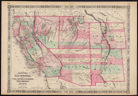


![Central America Caribbean Gulf of Mexico chart Ports lighthouses LARGE 1927 map: TITLE/CONTENT OF MAP: Central American and West Indian Ports [inset The Lesser Antilles; The Windward Passage; Bermudas; Kingston; Havana; Salina Cruz; Puerto Mexico; Mouths of the Mississippi] DATE P](https://p1.liveauctioneers.com/5584/316569/169897699_1_x.jpg?height=310&quality=70&version=1706046386)


Related Maps & Atlases
![French Map of America Southeast [179304]: Northeastern American map published 1788 from a French cartographer. Map measures 9"x 13". Published during America's War of Independence from Great Britain (1176-1783), this map features the mid-Atla](https://p1.liveauctioneers.com/2699/331495/178785746_1_x.jpg?height=310&quality=70&version=1717094933)
![Jacob Monk 1853 Map of North America [173506]: Large wall map, typical nvarnish finish, mounted to board for viewing. "New map of that portion of North America exhibiting the United States and Territories, the Canadas, New Brunswick, Nova Scotia,](https://p1.liveauctioneers.com/2699/331495/178785775_1_x.jpg?height=310&quality=70&version=1717094933)


![Meteorological Chart of the Earth c1845 (2) [180794]: A pair of antique maps of the Southern and Northern hemispheres, c1845. Mercator maps, published by John W. Parker, West Strand, London. Each measures about 17" x 22". Please see photo(s) for more det](https://p1.liveauctioneers.com/2699/331495/178785749_1_x.jpg?height=310&quality=70&version=1717094933)


![WEST AFRICA Explorers' routes Senegal Ashanti. Mountains of Kong. SDUK 1857 map: Title: WEST AFRICA Explorers' routes Senegal Ashanti. Mountains of Kong. SDUK 1857 map Description: WEST AFRICA, I [Senegal River to Cape St Paul]. Engraved by J & C Walker (1857). Antique steel engra](https://p1.liveauctioneers.com/5584/330582/178266235_1_x.jpg?height=310&quality=70&version=1716924723)


More Items in Maps & Atlases
View More
![[MAP]. TODESCHI, Pietro. [Nova et Acurata Totius Americae Tabula auct. G.I. Blaeu] America quarta: [MAP]. TODESCHI, Pietro. [Nova et Acurata Totius Americae Tabula auct. G.I. Blaeu] America quarta pars orbis quam plerunq, nuvum orbem appellitant primo detecta est anno 1492 a Christophoro Columbo...](https://p1.liveauctioneers.com/197/329395/177650542_1_x.jpg?height=310&quality=70&version=1715364962)


![[MAPS]. HOMANN, Johann Baptist, HOMANN HEIRS, and Georg Matthäus SEUTTER. [Composite Atlas].: [MAPS]. HOMANN, Johann Baptist (1663-1724), HOMANN HEIRS, and Georg Matthäus SEUTTER (1678-1757). [Composite Atlas]. [Nuremberg, Augsburg, and others: Homann Heirs and others, maps dated between](https://p1.liveauctioneers.com/197/329395/177650530_1_x.jpg?height=310&quality=70&version=1715364962)

![[MAP]. ORTELIUS, Abraham. Americae Sive Novi Orbis, Nova Descriptio. 1573.: [MAP]. ORTELIUS, Abraham (1527-1598). Americae Sive Novi Orbis, Nova Descriptio. Antwerp, 1573. Engraved map with hand-coloring. Framed and double glazed, visible area 375 x 521 mm (unexamined out of](https://p1.liveauctioneers.com/197/329395/177650534_1_x.jpg?height=310&quality=70&version=1715364962)
![Set of Twelve Satirical Anthropomorphic Maps of Europe: [SATIRICAL MAPS] A set of twelve satirical anthropomorphic maps of Europe. London: circa 1868. A set of 12 (believed complete) lithographed maps by Vincent Brooks, Day & Son, London, each offering](https://p1.liveauctioneers.com/292/330597/178279264_1_x.jpg?height=310&quality=70&version=1716409282)


![[MAP]. ORTELIUS, Abraham. Turcici Imperii Descriptio.1592.: [MAP]. ORTELIUS, Abraham (1527-1598). Turcici Imperii Descriptio. Antwerp, 1592. Engraved map with hand-coloring. Matted, framed, and double glazed, sight 406 x 521 mm (unexamined out of frame). Decor](https://p1.liveauctioneers.com/197/329395/177650538_1_x.jpg?height=310&quality=70&version=1715364962)
![[MAP]. ORTELIUS, Abraham. Romani Imperii Imago. 1592.: [MAP]. ORTELIUS, Abraham (1527-1598). Romani Imperii Imago. Antwerp, 1592. Engraved map with hand-coloring. Matted, framed, and double glazed, visible area 381 x 521 mm (unexamined out of frame). 6 de](https://p1.liveauctioneers.com/197/329395/177650537_1_x.jpg?height=310&quality=70&version=1715364962)
![[MAP]. SPEED, John. A New Mappe of the Romane Empire. 1676.: [MAP]. SPEED, John (ca 1551-1629). A New Mappe of the Romane Empire. London: Basset & Chiswell, 1676. Engraved map with hand-coloring. Framed and double glazed, sight 419 x 559 mm. Decorative cartouch](https://p1.liveauctioneers.com/197/329395/177650541_1_x.jpg?height=310&quality=70&version=1715364962)
Recommended Transportation & Travel Collectibles
View More

![[FLAGS]. 31-star American parade flag. Ca 1850-1859.: [FLAGS]. 31-star American parade flag. Ca 1850-1859. 22 x 36 1/2 in. cotton flag with 31 printed stars, configured in a double medallion surrounding a much larger central star, that is haloed in both](https://p1.liveauctioneers.com/197/329785/177758218_1_x.jpg?height=310&quality=70&version=1715625218)


Item Details
Description
Heading:
Author: Morgan, Dale & Carl I. Wheat
Title: Jedediah Smith and His Maps of the American West
Place Published: San Francisco
Publisher:California Historical Society
Date Published: 1954
Description:
Author: Morgan, Dale & Carl I. Wheat
Title: Jedediah Smith and His Maps of the American West
Place Published: San Francisco
Publisher:California Historical Society
Date Published: 1954
Description:
[6], 86 pp. Intro. by Wheat. Illustrated with reproductions of 7 maps (6 folding, 3 inserted loose in rear pocket). (Folio) original red cloth, gilt lettered spine. One of 530 copies printed by Lawton Kennedy. First Edition.
Scholarly study of the influence of "the early West's greatest single explorer" on the mapping of the West. Smith was the first man to cross the Sierra Nevada and open the southwestern trail to California. He also pioneered the route from California to the Hudson's Bay Co. territory, established posts on the Columbia and mapped watersheds of the Missouri, Yellowstone, Platte, Rio Grande, Colorado, Snake and Columbia rivers.
Condition
Light rubbing to extremities; near fine or better.
Buyer's Premium
- 25%
Jedediah Smith and His Maps of the American West
Estimate $400 - $600
2 bidders are watching this item.
Shipping & Pickup Options
Item located in Berkeley, CA, usSee Policy for Shipping
Payment

Related Searches
TOP