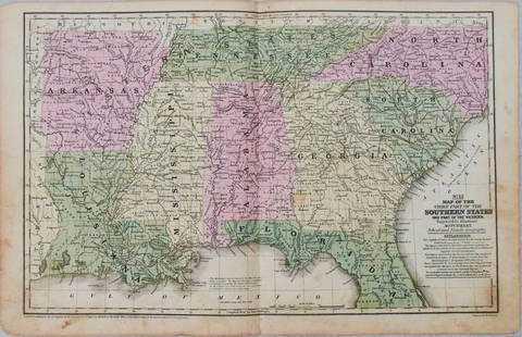
MAP - Southern US & Mexico. D'Anville
Similar Sale History
View More Items in Maps & AtlasesRelated Maps & Atlases
More Items in Maps & Atlases
View MoreRecommended Transportation & Travel Collectibles
View More


Item Details
Description
Southern United States, Mexico & Central America. D'Anville/Santini, Carte du Mexique, et de la Nouvelle Espagne, Contenant la Partie Australe de l'Amerique Septentle., 1779 (dated). Black & White. A lovely map of Central America, Mexico, the Gulf Coast, Florida, and a portion of Cuba from the cartography of D'Anville. The southern tip of Florida is shown as an archipelago of large islands. Tecas is named on the coast of present-day Texas, and sailing routes are shown along the coasts. The verdant cartouche shows a waterfall and a crocodile, natives, trees, and exotic birds.
LITERATURE: Phillips (Atlases) #647-49.
LITERATURE: Phillips (Atlases) #647-49.
Condition
An excellent impression on paper with the watermark of "Imperial VC" and professional repairs to a few tiny worm tracks in the bottom blank margin. Grade: A
Dimensions
17.6 x 22.5 in
Buyer's Premium
- 20%
MAP - Southern US & Mexico. D'Anville
Estimate $300 - $375
1 bidder is watching this item.
Get approved to bid.
Shipping & Pickup Options
Item located in Glen Allen, VA, usSee Policy for Shipping
Payment
Accepts seamless payments through LiveAuctioneers

Related Searches
TOP


![1857 Emory Maps of Magnetic Declanation Lines and Sections along the US Mexican Border -- United: Title: 1857 Emory Maps of Magnetic Declanation Lines and Sections along the US Mexican Border -- United States & Mexican Boundary Survey [with] Section Constructed from Surveys Under the Direction of](https://p1.liveauctioneers.com/5584/331064/178466398_1_x.jpg?height=310&quality=70&version=1716924723)


![Arizona/New Mexico Map, 1883 [181626]: 1883 map of Arizona and New Mexico by Thos. Donaldson. 15x18", 5" right side tear and others. Please inspect. New Mexico Arizona](https://p1.liveauctioneers.com/dist/images/placeholder.jpg?height=310&quality=70)
![Western US Map, 1857 [181625]: 1857 map of the US Between Mississippi River and the Pacific Ocean by W H Emory. A style of map as would be used for boundary surveys. Shows Genoa and Ft. Tejon, NV in what was Utah Unexplored Territo](https://p1.liveauctioneers.com/2699/331495/178785798_1_x.jpg?height=310&quality=70&version=1717094933)


![[MAP]. TODESCHI, Pietro. [Nova et Acurata Totius Americae Tabula auct. G.I. Blaeu] America quarta: [MAP]. TODESCHI, Pietro. [Nova et Acurata Totius Americae Tabula auct. G.I. Blaeu] America quarta pars orbis quam plerunq, nuvum orbem appellitant primo detecta est anno 1492 a Christophoro Columbo...](https://p1.liveauctioneers.com/197/329395/177650542_1_x.jpg?height=310&quality=70&version=1715364962)

![[MAPS]. HOMANN, Johann Baptist, HOMANN HEIRS, and Georg Matthäus SEUTTER. [Composite Atlas].: [MAPS]. HOMANN, Johann Baptist (1663-1724), HOMANN HEIRS, and Georg Matthäus SEUTTER (1678-1757). [Composite Atlas]. [Nuremberg, Augsburg, and others: Homann Heirs and others, maps dated between](https://p1.liveauctioneers.com/197/329395/177650530_1_x.jpg?height=310&quality=70&version=1715364962)


![[MAP]. ORTELIUS, Abraham. Americae Sive Novi Orbis, Nova Descriptio. 1573.: [MAP]. ORTELIUS, Abraham (1527-1598). Americae Sive Novi Orbis, Nova Descriptio. Antwerp, 1573. Engraved map with hand-coloring. Framed and double glazed, visible area 375 x 521 mm (unexamined out of](https://p1.liveauctioneers.com/197/329395/177650534_1_x.jpg?height=310&quality=70&version=1715364962)

![Set of Twelve Satirical Anthropomorphic Maps of Europe: [SATIRICAL MAPS] A set of twelve satirical anthropomorphic maps of Europe. London: circa 1868. A set of 12 (believed complete) lithographed maps by Vincent Brooks, Day & Son, London, each offering](https://p1.liveauctioneers.com/292/330597/178279264_1_x.jpg?height=310&quality=70&version=1716409282)


![[MAP]. ORTELIUS, Abraham. Turcici Imperii Descriptio.1592.: [MAP]. ORTELIUS, Abraham (1527-1598). Turcici Imperii Descriptio. Antwerp, 1592. Engraved map with hand-coloring. Matted, framed, and double glazed, sight 406 x 521 mm (unexamined out of frame). Decor](https://p1.liveauctioneers.com/197/329395/177650538_1_x.jpg?height=310&quality=70&version=1715364962)
![[MAP]. ORTELIUS, Abraham. Romani Imperii Imago. 1592.: [MAP]. ORTELIUS, Abraham (1527-1598). Romani Imperii Imago. Antwerp, 1592. Engraved map with hand-coloring. Matted, framed, and double glazed, visible area 381 x 521 mm (unexamined out of frame). 6 de](https://p1.liveauctioneers.com/197/329395/177650537_1_x.jpg?height=310&quality=70&version=1715364962)
![[MAP]. SPEED, John. A New Mappe of the Romane Empire. 1676.: [MAP]. SPEED, John (ca 1551-1629). A New Mappe of the Romane Empire. London: Basset & Chiswell, 1676. Engraved map with hand-coloring. Framed and double glazed, sight 419 x 559 mm. Decorative cartouch](https://p1.liveauctioneers.com/197/329395/177650541_1_x.jpg?height=310&quality=70&version=1715364962)


![[FLAGS]. 31-star American parade flag. Ca 1850-1859.: [FLAGS]. 31-star American parade flag. Ca 1850-1859. 22 x 36 1/2 in. cotton flag with 31 printed stars, configured in a double medallion surrounding a much larger central star, that is haloed in both](https://p1.liveauctioneers.com/197/329785/177758218_1_x.jpg?height=310&quality=70&version=1715625218)


![[FLAGS]. 13-star American flag, possibly a US Navy boat flag. Ca late-19th century.: [FLAGS]. 13-star American flag, possibly a US Navy boat flag. Ca late-19th century. 35 x 71 1/2 in. hand-sewn and machine-sewn wool flag with 13 double-appliquéd cotton stars configured in 3/2/3/2/3](https://p1.liveauctioneers.com/197/329785/177758215_1_x.jpg?height=310&quality=70&version=1715625218)


