


Egon Klemp AMERICA IN MAPS DATING FROM 1500 TO 1856
Similar Sale History
View More Items in Maps & Atlases


Related Maps & Atlases
![South & Central America Map Lot c1800's [180163]: Collection of (6) maps of South and Central America. (2) Published by S. August Mitchell Jr., Venezuela, Guiana, Peru; Ecuador, "Chili", Brazil, Bolivia, Paraguay, Uruguay, with intricate floral borde](https://p1.liveauctioneers.com/2699/331495/178785795_1_x.jpg?height=310&quality=70&version=1717094933)
![North America Map circa 1800s [179302]: Early map of the North American continent circa 1810. Shows the western area as New Albion, southwest Canada as New Caledonia and the Russian Possessions of western Canada and Alaska. Also noted are s](https://p1.liveauctioneers.com/2699/331495/178785793_1_x.jpg?height=310&quality=70&version=1717094933)


![Americae Australis / Peruana by Bertius / Langenes. South America 1603 old map: CAPTION PRINTED BELOW PICTURE: Descriptio Americae Australis / Peruana [South America & Terra Australis] The map shows part of Terra Australia incognita in the southern Atlantic Ocean DATE PRINTED: 16](https://p1.liveauctioneers.com/5584/332390/179262972_1_x.jpg?height=310&quality=70&version=1717528223)
![French Map of America Southwest & Mexico [179298]: French map the American Southwest and Mexico. This is a double truck from an 18th century book and measures 10x 14". Map from 1787 during the reign of Louie XVI the king France who beheaded in1793.Riv](https://p1.liveauctioneers.com/2699/331495/178785763_1_x.jpg?height=310&quality=70&version=1717094933)


More Items in Maps & Atlases
View More![[MAPS]. HOMANN, Johann Baptist, HOMANN HEIRS, and Georg Matthäus SEUTTER. [Composite Atlas].: [MAPS]. HOMANN, Johann Baptist (1663-1724), HOMANN HEIRS, and Georg Matthäus SEUTTER (1678-1757). [Composite Atlas]. [Nuremberg, Augsburg, and others: Homann Heirs and others, maps dated between](https://p1.liveauctioneers.com/197/329395/177650530_1_x.jpg?height=310&quality=70&version=1715364962)
![[MAP]. TODESCHI, Pietro. [Nova et Acurata Totius Americae Tabula auct. G.I. Blaeu] America quarta: [MAP]. TODESCHI, Pietro. [Nova et Acurata Totius Americae Tabula auct. G.I. Blaeu] America quarta pars orbis quam plerunq, nuvum orbem appellitant primo detecta est anno 1492 a Christophoro Columbo...](https://p1.liveauctioneers.com/197/329395/177650542_1_x.jpg?height=310&quality=70&version=1715364962)
![[MAP]. ORTELIUS, Abraham. Americae Sive Novi Orbis, Nova Descriptio. 1573.: [MAP]. ORTELIUS, Abraham (1527-1598). Americae Sive Novi Orbis, Nova Descriptio. Antwerp, 1573. Engraved map with hand-coloring. Framed and double glazed, visible area 375 x 521 mm (unexamined out of](https://p1.liveauctioneers.com/197/329395/177650534_1_x.jpg?height=310&quality=70&version=1715364962)


![[MAP]. ORTELIUS, Abraham. Turcici Imperii Descriptio.1592.: [MAP]. ORTELIUS, Abraham (1527-1598). Turcici Imperii Descriptio. Antwerp, 1592. Engraved map with hand-coloring. Matted, framed, and double glazed, sight 406 x 521 mm (unexamined out of frame). Decor](https://p1.liveauctioneers.com/197/329395/177650538_1_x.jpg?height=310&quality=70&version=1715364962)
![Set of Twelve Satirical Anthropomorphic Maps of Europe: [SATIRICAL MAPS] A set of twelve satirical anthropomorphic maps of Europe. London: circa 1868. A set of 12 (believed complete) lithographed maps by Vincent Brooks, Day & Son, London, each offering](https://p1.liveauctioneers.com/292/330597/178279264_1_x.jpg?height=310&quality=70&version=1716409282)


![Sanitary & Topographical "Viele Map" of Manhattan 1865 [182838]: Manhattan Island map surveyed by Mexican American & Civil War veteran Egbert Viele 1865. Viele was author of a color city map, a "Sanitary & Topographical Map of the City and Island of New York," firs](https://p1.liveauctioneers.com/2699/331495/178785766_1_x.jpg?height=310&quality=70&version=1717094933)
![[MAP]. ORTELIUS, Abraham. Romani Imperii Imago. 1592.: [MAP]. ORTELIUS, Abraham (1527-1598). Romani Imperii Imago. Antwerp, 1592. Engraved map with hand-coloring. Matted, framed, and double glazed, visible area 381 x 521 mm (unexamined out of frame). 6 de](https://p1.liveauctioneers.com/197/329395/177650537_1_x.jpg?height=310&quality=70&version=1715364962)
![[MAP]. SPEED, John. A New Mappe of the Romane Empire. 1676.: [MAP]. SPEED, John (ca 1551-1629). A New Mappe of the Romane Empire. London: Basset & Chiswell, 1676. Engraved map with hand-coloring. Framed and double glazed, sight 419 x 559 mm. Decorative cartouch](https://p1.liveauctioneers.com/197/329395/177650541_1_x.jpg?height=310&quality=70&version=1715364962)
Recommended Transportation & Travel Collectibles
View More


Item Details
Description
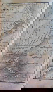
Egon Klemp AMERICA IN MAPS DATING FROM 1500 TO 1856 1976 Limited Edition Elephant Folio Illustrated Color Fold-Out Facsimile Volume Bibliographical History
Title: America in Maps: Dating from 1500 to 1856
Author: uncredited
Editor: Egon Klemp
Publisher: Holmes & Meier
City: New York and London
Year: 1976
Printing Information: Limited Edition
Binding Style: Hardcover
Pagination: 293 pages
Width: 14.25" Height: 20.25"
Book Details: Bound in green cloth with white spine lettering, this limited edition elephant folio is numbered 204 of 1200. This volume is presented in a decoratively illustrated paper-covered slipcase. Maps included in this volume are in color and black and white, and some fold out.
From the Preface: "This facsimile volume contains a representative selection of maps produced from the time of Columbus’s discovery of America until the middle of the nineteenth century, when the initial exploration and mapping of North and South America were brought to a close. We have selected many rare manuscript maps and printed maps which are not readily accessible because they are dispersed throughout many libraries and archives. We have given priority to maps from the first half of the sixteenth century, when the coastline of America was being explored and larger expeditions were penetrating the interior. We have also included a good number of maps from the eighteenth century since the art of surveying and mapmaking improved considerably during this period…Each map is provided with textual commentary to facilitate use and understanding. Apart from bibliographical information, these commentaries provide references to the origin and content of each map."
Condition / Notes: This handsome elephant folio shows very well, with minimal indications of age and wear. The binding and text block are sound. Text and illustrations are clear and crisp on clean pages.
For lots which include only books, our shipping charge applies to any address within the fifty United States. For lots which are not books, the stated shipping cost in this listing will apply only to addresses within the continental 48 states. Within those parameters, the shipping cost for this lot will be: $15.50
Buyer's Premium
- 25%
Egon Klemp AMERICA IN MAPS DATING FROM 1500 TO 1856
Estimate $200 - $300
11 bidders are watching this item.
Shipping & Pickup Options
Item located in Ithaca, NY, usSee Policy for Shipping
Payment

Related Searches
TOP