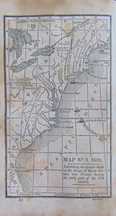
Poirson & Tardieu l'Aine Map of Great Britain, 1803
Similar Sale History
Recommended Items


Item Details
Description
Cartographer J.B. (Jean-Baptiste) Poirson (French, 1760-1831), Engraver: Jean Baptiste Pierre Tardieu l'Aine (French, 1746-1816). "Angleterre Ecosse et Irlande, on Royaumes unis de la Grande Bretagne" (England, Scotland, and Ireland or United Kingdoms of Great Britain) - Published in France, 1803. A detailed map of England and Ireland with original outline coloring. Jean-Baptiste Poirson was a renowned French cartographer who was active between 1790 and 1830. Several of his maps were engraved by Jean Baptiste Pierre Tardieu l'Aine. Size: 16" W x 21.5" H (40.6 cm x 54.6 cm)
Provenance: ex-Denenberg Fine Arts, Los Angeles, California, USA
All items legal to buy/sell under U.S. Statute covering cultural patrimony Code 2600, CHAPTER 14, and are guaranteed to be as described or your money back.
A Certificate of Authenticity will accompany all winning bids.
We ship worldwide to most countries and handle all shipping in-house for your convenience.
#136700
Condition
Paper shows expected toning with losses and tears to edges. Visible center fold. Some staining and foxing as shown.
Buyer's Premium
- 24.5%
Poirson & Tardieu l'Aine Map of Great Britain, 1803
Estimate $400 - $600
1 bidder is watching this item.
Get approved to bid.
Shipping & Pickup Options
Item located in Louisville, CO, usSee Policy for Shipping
Payment

Related Searches
TOP


![British Case Alaska Boundary Commission Appendix.: [Americana] 18 sheets of maps, 2 index maps. Great Britain/Alaska Boundary Tribunal. “British case, Alaska boundary. Appendix Vol. III. -- : portfolio of maps accompanying International Boundary](https://p1.liveauctioneers.com/179/209052/106367317_1_x.jpg?height=310&quality=70&version=1624651037)


![French Map of America Southeast [179304]: Northeastern American map published 1788 from a French cartographer. Map measures 9"x 13". Published during America's War of Independence from Great Britain (1176-1783), this map features the mid-Atla](https://p1.liveauctioneers.com/2699/331495/178785746_1_x.jpg?height=310&quality=70&version=1717094933)


