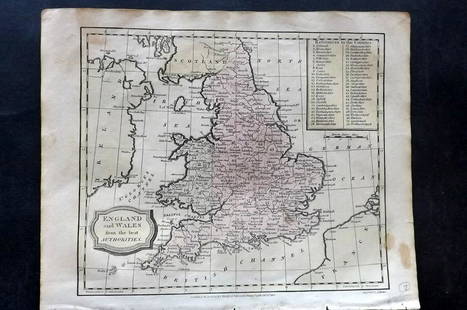
Scarce folding map of England & Wales 1820
Similar Sale History
View More Items in CollectiblesRelated Collectibles
More Items in Collectibles
View More


Item Details
Description
Heading:
Author: Bumpus, John
Title: A New map of England and Wales. Drawn from the latest surveys
Place Published: London
Publisher:
Date Published: 1820
Description:
Author: Bumpus, John
Title: A New map of England and Wales. Drawn from the latest surveys
Place Published: London
Publisher:
Date Published: 1820
Description:
Engraved map, hand-colored. 101x79.5 cm (39¾x31¼"), backed with linen, sectioned for folding.
Large and scarce map of England and Wales. Shows turnpike roads, routes of the mail coaches, bye roads, rivers, navigable canals, and distances between towns. Inset: The Scilly Islands. OCLC/WorldCat lists only one example, at Macquarie University in Australia. The slipcase is present, but well worn and falling apart.
Condition
Map with some soiling, a bit ow wear at folds, very good, coloring bright.
Buyer's Premium
- 25%
Scarce folding map of England & Wales 1820
Estimate $300 - $500
1 bidder is watching this item.
Shipping & Pickup Options
Item located in San Francisco, CA, usSee Policy for Shipping
Payment

Related Searches
TOP


![L' Asie. Asia Tartary China Mughal Empire. BUFFIER c1818 old antique map chart: CAPTION PRINTED BELOW PICTURE: L' Asie [Asia] DATE PRINTED: c1818 IMAGE SIZE: Approx 14.0 x 18.0cm, 5.5 x 7 inches (Medium); Please note that this is a folding map. TYPE: Antique engraved map CONDITIO](https://p1.liveauctioneers.com/5584/329387/177649271_1_x.jpg?height=310&quality=70&version=1715717898)


