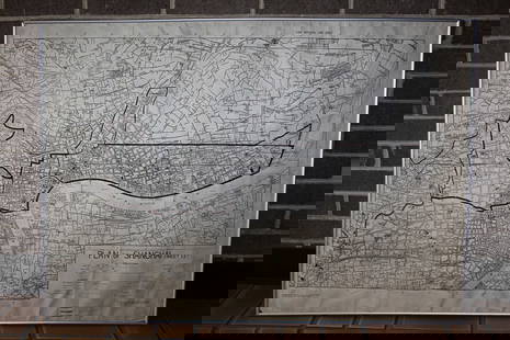
Sanson: Antique Map of Central Europe, 1645
Similar Sale History
View More Items in Maps & AtlasesRelated Maps & Atlases
More Items in Maps & Atlases
View MoreRecommended Transportation & Travel Collectibles
View More


Item Details
Description
L'Allemagne par cercles [This title has been overlaid onto the original title of the map: "Carte Generale de l'Empire d'Allemagne et Pays Circonvoisins."]' The map depicts Greater Germany - The Holy Roman Empire - in the middle of the seventeenth century. The map covers central Europe, including present day Netherlands, Germany, Slovenia, Austria, Switzerland, the Czech Republic and northern Italy to the Adriatic Sea and much of Belgium, Hungary, Poland, Slovakia and Croatia
Date Printed: 1645 Image Size: Approx 41.5 x 57.0cm, 16.25 x 22.5 inches (Large); Please note that this is a folding map. Type: Antique copperplate map with original outline colouring Condition: Good; suitable for framing. Verso: There is nothing printed on the reverse side, which is plain Folding: This is a folding map. Artist/Cartographer/Engraver: "Par N. Sanson Geog. Ord du Roy. A Paris par M. Tavernier Idrographe et Graveur ordinaire du Roy pour les Cartes Geographiques. Et a present chez Mariette, rue St Jacques à l'Esperance avec privilege du Roy pour 20 ans 1645". Nicolas Sanson (16001667) was a French cartographer, sometimes called the 'father of French cartography'. Provenance: "L'Allemagne, descrite en plusieurs cartes & differens traittés de geographie, & d'histoire, suivant les plus belles & les principales distinctions, qui se peuvent remarquer dans tous les autheurs anciens, & nouveaux, par N. Sanson d'Abbeville, Geographe du Roy. A Paris, Chez l'autheur, Rue de l'Arbre-sec & prés la petite porte du Cloitre de Saint Germain de l'Auxerrois. MDCLI. Avec privilege du Roy pour vingt ans
Nicolas Sanson (1600-1667) was a French cartographer, often referred to as the "father of French cartography." His reputable skill led him to be appointed royal geographer, and he gave lessons in geography both to Louis XIII and to Louis XIV.
Shipping: Domestic: Flat-rate of $19.00 to anywhere within the contiguous U.S. International: Foreign shipping rates are determined by destination. Location: This item ships from United Kingdom.
Your purchase is protected:
Photos, descriptions, and estimates were prepared with the utmost care by a fully certified expert and appraiser. All items in this sale are guaranteed authentic.
In the rare event that the item did not conform to the lot description in the sale, Jasper52 specialists are here to help. Buyers may return the item for a full refund provided you notify Jasper52 within 5 days of receiving the item.
Nicolas Sanson (1600-1667) was a French cartographer, often referred to as the "father of French cartography." His reputable skill led him to be appointed royal geographer, and he gave lessons in geography both to Louis XIII and to Louis XIV.
Shipping:
Your purchase is protected:
Photos, descriptions, and estimates were prepared with the utmost care by a fully certified expert and appraiser. All items in this sale are guaranteed authentic.
In the rare event that the item did not conform to the lot description in the sale, Jasper52 specialists are here to help. Buyers may return the item for a full refund provided you notify Jasper52 within 5 days of receiving the item.
Condition
Good; suitable for framing.
Buyer's Premium
- 10%
Sanson: Antique Map of Central Europe, 1645
Estimate $180 - $200
1 bidder is watching this item.
Get approved to bid.
Shipping & Pickup Options
Item located in United KingdomSee Policy for Shipping
Payment
See More Items From This Jasper52 Seller

Auction Curated By

Maps Expert
TOP


![Antique H/C Map EUROPE SOUS CHARLEMAGNE EN 814: EMPIRES D'OCCIDENT ET D'ORIENT: Antique 19th Century French Map EUROPE SOUS CHARLEMAGNE EN 814: EMPIRES D'OCCIDENT ET D'ORIENT [EUROPE UNDER CHARLEMAGNE IN 814: EMPIRES OF THE WEST AND EAST] by Charles V. Monin (French, 1830 - 1880)](https://p1.liveauctioneers.com/6084/330420/178181958_1_x.jpg?height=310&quality=70&version=1716391551)


![[MAP]. TODESCHI, Pietro. [Nova et Acurata Totius Americae Tabula auct. G.I. Blaeu] America quarta: [MAP]. TODESCHI, Pietro. [Nova et Acurata Totius Americae Tabula auct. G.I. Blaeu] America quarta pars orbis quam plerunq, nuvum orbem appellitant primo detecta est anno 1492 a Christophoro Columbo...](https://p1.liveauctioneers.com/197/329395/177650542_1_x.jpg?height=310&quality=70&version=1715364962)


![[MAPS]. HOMANN, Johann Baptist, HOMANN HEIRS, and Georg Matthäus SEUTTER. [Composite Atlas].: [MAPS]. HOMANN, Johann Baptist (1663-1724), HOMANN HEIRS, and Georg Matthäus SEUTTER (1678-1757). [Composite Atlas]. [Nuremberg, Augsburg, and others: Homann Heirs and others, maps dated between](https://p1.liveauctioneers.com/197/329395/177650530_1_x.jpg?height=310&quality=70&version=1715364962)


![[MAP]. ORTELIUS, Abraham. Turcici Imperii Descriptio.1592.: [MAP]. ORTELIUS, Abraham (1527-1598). Turcici Imperii Descriptio. Antwerp, 1592. Engraved map with hand-coloring. Matted, framed, and double glazed, sight 406 x 521 mm (unexamined out of frame). Decor](https://p1.liveauctioneers.com/197/329395/177650538_1_x.jpg?height=310&quality=70&version=1715364962)


