


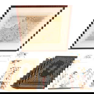
18th Century English Map of Huntingdon County
Similar Sale History


Recommended Items


Item Details
Description
Map dates to 1763, and depicts Huntingdon County, England. Nicely hand-colored. Printed by John Bowles.
Dimensions are: Image Size - 28 5/8" X 21 3/4", Overall - 30 1/2" X 23 3/4". All measurements are approximate.
Condition: Not examined out of frame. Fold line to center as made. Fine - Very Fine.
Provenance: A Fairfax, VA Estate
Dimensions are: Image Size - 28 5/8" X 21 3/4", Overall - 30 1/2" X 23 3/4". All measurements are approximate.
Condition: Not examined out of frame. Fold line to center as made. Fine - Very Fine.
Provenance: A Fairfax, VA Estate
Buyer's Premium
- 25%
18th Century English Map of Huntingdon County
Estimate $100 - $200
1 bidder is watching this item.
Shipping & Pickup Options
Item located in Ashburn, VA, usSee Policy for Shipping
Payment
Accepts seamless payments through LiveAuctioneers

Related Searches
TOP