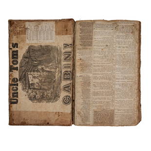
1848 1st ed French ATLAS 95 Maps France Colonies
Similar Sale History
View More Items in BooksRelated Books
More Items in Books
View MoreRecommended Books, Magazines & Papers
View More


Item Details
Description
1848 1st ed French ATLAS 95 Maps France Colonies Brittany Herault Illustrated
A rare 19th-century French atlas published by Migeon and collected by Vuillemin. Each of these extremely desirable engravings include more than just the map, they are printed with city views, portraits, coats-of-arms, and other figures that coincide with the color map itself. These maps deal with various colonies and counties in France with 95 beautifully illustrated pagesHerault
Brittany
Finistere
Cantal
Ain
And more!
Item number: #1115
Price: $550
VUILLEMIN, Alexandre Aimé
La France nouvel atlas illustre des departements & des colonies
Paris : J. Migeon, [ca 1848]. First edition.
Details:
Collation complete with all pages: 128p
95 maps
Binding: Hardcover; tight & secure
Language: French
Size: ~9.5in X 12.5in (24cm x 31.5cm)
Our Guarantee:
Very Fast. Very Safe. Free Shipping Worldwide.Customer satisfaction is our priority! Notify us with 7 days of receiving, and we will offer a full refund without reservation!
Condition
Excellent.
Buyer's Premium
- 0%
1848 1st ed French ATLAS 95 Maps France Colonies
Estimate $550 - $1,100
7 bidders are watching this item.
Shipping & Pickup Options
Item located in Columbia, MO, usSee Policy for Shipping
Payment

Related Searches
TOP


![Recipes, The Cooking of Provincial France, 1st Time Life Ed. 1968: "Recipes: The Cooking of Provincial France" published by Time Life Books, 1968. First Edition. Spiral bound soft cover, 6" x 9"; 112 pages including two Indexes [in English + original French], very go](https://p1.liveauctioneers.com/6304/312954/168586953_1_x.jpg?height=310&quality=70&version=1706371632)


![1652 THYSIUS antique VELLUM Historae Batavicae from JULIUS CAESAR till this time: [1652] Antonius THYSIUS Compendium historae Batavicae, a Julio Cæsare usque ad hæc tempora. Lugduni Batavorum, Ex officina Ioannis Maire, 1652. Size 2 3/4 by 4 3/4" Overlapping vellum. Very](https://p1.liveauctioneers.com/5584/328415/176935094_1_x.jpg?height=310&quality=70&version=1715112425)


![19 issues of rare Gay Magazine METRA 1985-1986: [Queer interest], Metra: Midwest America's Leading Free Gay Magazine, 19 issues, published 1986-1987, a few duplicates, softcover, staplebound wraps, illustrated throughout in black and white, publish](https://p1.liveauctioneers.com/184/328649/177016396_1_x.jpg?height=310&quality=70&version=1714770323)


