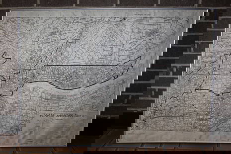
The Admiral's Map after Waldseemuller, showing New
Similar Sale History
View More Items in Maps & AtlasesRelated Maps & Atlases
More Items in Maps & Atlases
View MoreRecommended Transportation & Travel Collectibles
View More


Item Details
Description
Oceani Occidentalis Seu Terrae Novae Tabula. Lorenz Fries (1489/1491-1550) After M. Waldseemuller, After Ptolemy. State 2. Woodcut on paper. Strasbourg, 1525. 15 x 19 3/4 inches sheet. Lorenz Fries reduced version of Waldseemuller’s map of 1513, Often refereed to as the Admiral’s Map. The Waldseemuller prototype was the first printed atlas map to focus on the New World. Fries supplemented the work of Waldseemuller with an inscription about Columbus not found in the 1513 version of the map and added vignettes of cannibalistic Indians and an opossum.
Buyer's Premium
- 25%
The Admiral's Map after Waldseemuller, showing New
Estimate $8,000 - $12,000
2 bidders are watching this item.
Get approved to bid.
Shipping & Pickup Options
Item located in New York, NY, usSee Policy for Shipping
Payment

Related Searches
TOP


![Zahn World Map: *** START PRICE IS THE RESERVE *** [World] ZAHN, Johann (1631-1707). Facies Una Hemispaerri Terrestris and Facies Altera Hemishpaerii Tarrastris... Double hemishperic world map on two engraved sheets.](https://p1.liveauctioneers.com/1968/163248/82424687_1_x.jpg?height=310&quality=70&version=1583340284)
![Homann World Map: *** START PRICE IS THE RESERVE *** [World] HOMANN, Heirs (18th century). Planiglobii Terrestris Mappa Universalis utrumque. Engraved map with original hand color in part. Nuremberg: Homann Heirs, 1746](https://p1.liveauctioneers.com/1968/163248/82424684_1_x.jpg?height=310&quality=70&version=1583340284)


![Homann Atlas Compeniarius, 1748: HOMANN, Johann Baptist (1663-1724). Atlas Compeniarius quinquaginta selectarum tabularum geographicarum Homanni. Nuremberg: Heirs of J.B. Homann, 1748 [maps dated 1741-1749]. Folio (21 x 12 inches). E](https://p1.liveauctioneers.com/1968/250616/130196470_1_x.jpg?height=310&quality=70&version=1654190895)
![[MAP]. SPEED, John. A New Mappe of the Romane Empire. 1676.: [MAP]. SPEED, John (ca 1551-1629). A New Mappe of the Romane Empire. London: Basset & Chiswell, 1676. Engraved map with hand-coloring. Framed and double glazed, sight 419 x 559 mm. Decorative cartouch](https://p1.liveauctioneers.com/197/329395/177650541_1_x.jpg?height=310&quality=70&version=1715364962)
![HAND COLORED MAP OF PERU & COUNTRY OF THE AMAZONS, 1747, BY EMANUEL BOWEN, FRAMED: A New And Accurate Map Of Peru And The Country Of The Amazones. Drawn From The Most Authentick French Maps &C. And Regulated By Astronomical Observations, London]: William Innys [et al.], 1747. A deta](https://p1.liveauctioneers.com/957/328836/177180798_1_x.jpg?height=310&quality=70&version=1715021458)


![Les voyages de Rubruquis, Marco Polo, Jenkinson'. BELLIN/SCHLEY 1749 old map: CAPTION PRINTED BELOW PICTURE: Carte pour les Voyages de Rubruquis, Marco Polo, Jenkinson, &c [Map showing the explorations of William of Rubruck, Marco Polo, Anthony Jenkinson, &c.] Northern Asia: Si](https://p1.liveauctioneers.com/5584/329387/177649177_1_x.jpg?height=310&quality=70&version=1715717898)


![[MAP]. TODESCHI, Pietro. [Nova et Acurata Totius Americae Tabula auct. G.I. Blaeu] America quarta: [MAP]. TODESCHI, Pietro. [Nova et Acurata Totius Americae Tabula auct. G.I. Blaeu] America quarta pars orbis quam plerunq, nuvum orbem appellitant primo detecta est anno 1492 a Christophoro Columbo...](https://p1.liveauctioneers.com/197/329395/177650542_1_x.jpg?height=310&quality=70&version=1715364962)


![[MAPS]. HOMANN, Johann Baptist, HOMANN HEIRS, and Georg Matthäus SEUTTER. [Composite Atlas].: [MAPS]. HOMANN, Johann Baptist (1663-1724), HOMANN HEIRS, and Georg Matthäus SEUTTER (1678-1757). [Composite Atlas]. [Nuremberg, Augsburg, and others: Homann Heirs and others, maps dated between](https://p1.liveauctioneers.com/197/329395/177650530_1_x.jpg?height=310&quality=70&version=1715364962)


