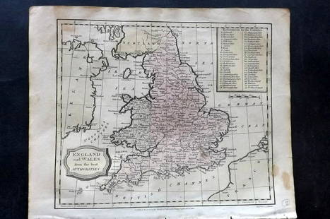
Blaeu map of England & Wales 1640
Similar Sale History
Recommended Items


Item Details
Description
Heading:
Author: Blaeu, Willem
Title: Anglia Regnum
Place Published: Amsterdam
Publisher:
Date Published: c.1640
Description:
Author: Blaeu, Willem
Title: Anglia Regnum
Place Published: Amsterdam
Publisher:
Date Published: c.1640
Description:
Copper-engraved map, hand-colored in outline, colored decorative cartouche & armorial shields. 38.5x49.8 cm (15¼x19½").
Attractive map of England and Wales introduced by Willem Blaeu in advance of his rivals', Hondius and Jansson, similar map. The outline and place names are based on Speed. It is decorated with four ships, a scale of miles flanked by sheep and a cherub, and two richly colored coats of arms, of Great Britain and of England, above the title cartouche. French text on verso.
Condition
Paper repair in lower margin; fine or nearly so.
Buyer's Premium
- 23%
Blaeu map of England & Wales 1640
Estimate $400 - $600
Shipping & Pickup Options
Item located in San Francisco, CA, usSee Policy for Shipping
Payment

Related Searches
TOP


![Seaton, Robert: Seaton, Robert The New Map of England & Wales, with the adjacent countries Compiled by Surveyors employed in the Ordnance Department. London: engraved by James Neele & Co., [c. 1830]. Very large hand-](https://p1.liveauctioneers.com/94/330664/178342434_1_x.jpg?height=310&quality=70&version=1716466933)


![Speed, John: Speed, John The Invasions of England and Ireland with al [sic] their Civill Wars since the Conquest Performed by John Speed and are to be solde in Popes head alley by George Humble, [1627, or later].](https://p1.liveauctioneers.com/94/330664/178342436_1_x.jpg?height=310&quality=70&version=1716466933)


![GOLDEN COCKEREL PRESS LAWRENCE (T.E.) Secret Despatches from Arabia, The Golden Cockerel Press (8): GOLDEN COCKEREL PRESS LAWRENCE (T.E.) Secret Despatches from Arabia, limited to 1000 copies, [1939]; Men in Print. Essays in Literary Criticism, limited to 500 copies, [1940]--BESTERMAN (THEODORE edi](https://p1.liveauctioneers.com/1043/319451/178359369_1_x.jpg?height=310&quality=70&version=1716978934)


