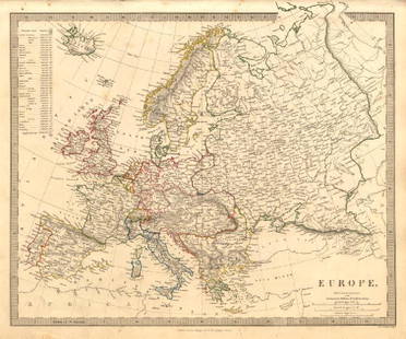
Map of Prussia. Europe. 1854.
Similar Sale History
View More Items in Maps & AtlasesRelated Maps & Atlases
More Items in European Maps & Atlases
View MoreRecommended Transportation & Travel Collectibles
View More


Item Details
Description
Print of hand colored steel engraving titled „Carte Physiquen et Politique de la Prusse”.
Drawn by L. Dussieux.
Engraved by unknown.
From „Atlas General De Geographie physique, politique et historique par L. Dussieux. Atlas de Geographie ancienne, du moyen age et Moderne“. Paris. 1854.
Louis-Étienne Dussieux, born April 5, 1815 in Lyon and died February 11, 1894 in Paris. He was a French historian-geographer.
Prussia was a historic state originating out of the Duchy of Prussia and the Margraviate of Brandenburg, and centered on the region of Prussia. For centuries, the House of Hohenzollern ruled Prussia, successfully expanding its size by way of an unusually well-organised and effective army. Prussia, with its capital in Königsberg and from 1701 moved to Berlin, shaped the history of Germany. In 1871, German states united to create the German Empire under Prussian leadership. In November 1918, the monarchies were abolished and the nobility lost its political power during the German Revolution of 1918–19. The Kingdom of Prussia was thus abolished in favour of a republic—the Free State of Prussia, a state of Germany from 1918 until 1933. From 1933, Prussia lost its independence as a result of the Prussian coup, when the Nazi regime was successfully establishing its "Gleichschaltung" laws in pursuit of a unitary state. With the end of the Nazi regime, the division of Germany into allied-occupation zones and the separation of its territories east of the Oder–Neisse line, which were incorporated into Poland and the Soviet Union, the State of Prussia ceased to exist de facto in 1945. Prussia existed de jure until its formal liquidation by the Allied Control Council Enactment No. 46 of 25 February 1947.
Condition
Approx. image size 39, 2 x 27, 4/43, 4 x 31, 7 cm.
Condition: good.
Buyer's Premium
- 0%
Map of Prussia. Europe. 1854.
Estimate €7 - €9
1 bidder is watching this item.
Get approved to bid.
Shipping & Pickup Options
Item located in Vilnius, ltSee Policy for Shipping
Payment

TOP


![Antique H/C Map EUROPE SOUS CHARLEMAGNE EN 814: EMPIRES D'OCCIDENT ET D'ORIENT: Antique 19th Century French Map EUROPE SOUS CHARLEMAGNE EN 814: EMPIRES D'OCCIDENT ET D'ORIENT [EUROPE UNDER CHARLEMAGNE IN 814: EMPIRES OF THE WEST AND EAST] by Charles V. Monin (French, 1830 - 1880)](https://p1.liveauctioneers.com/6084/330420/178181958_1_x.jpg?height=310&quality=70&version=1716391551)


![Set of Twelve Satirical Anthropomorphic Maps of Europe: [SATIRICAL MAPS] A set of twelve satirical anthropomorphic maps of Europe. London: circa 1868. A set of 12 (believed complete) lithographed maps by Vincent Brooks, Day & Son, London, each offering](https://p1.liveauctioneers.com/292/330597/178279264_1_x.jpg?height=310&quality=70&version=1716409282)
![A block puzzle with maps of Europe, England, Ireland, Scotland, America and the World: [BLOCK PUZZLE] Boxed set of 20 cubical blocks, each face with a portion of one of six hand-colored lithographed maps. Probably Irish: mid-nineteenth century. Blocks overall 7 5/8 x 6 1/4 inches (19.5](https://p1.liveauctioneers.com/292/330597/178279620_1_x.jpg?height=310&quality=70&version=1716409282)


![Maps of Europe, c1800's (4) [180165]: (4) Maps of Europe from atlas. 1. Map of Europe, borders colored in purple, legend includes railways, submarine telegraphs, boundaries of countries, capitals. Images of ships indicate oceans. 27.5 x 1](https://p1.liveauctioneers.com/2699/331495/178785788_1_x.jpg?height=310&quality=70&version=1717094933)


![[MAPS]. HOMANN, Johann Baptist, HOMANN HEIRS, and Georg Matthäus SEUTTER. [Composite Atlas].: [MAPS]. HOMANN, Johann Baptist (1663-1724), HOMANN HEIRS, and Georg Matthäus SEUTTER (1678-1757). [Composite Atlas]. [Nuremberg, Augsburg, and others: Homann Heirs and others, maps dated between](https://p1.liveauctioneers.com/197/329395/177650530_1_x.jpg?height=310&quality=70&version=1715364962)


