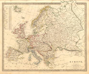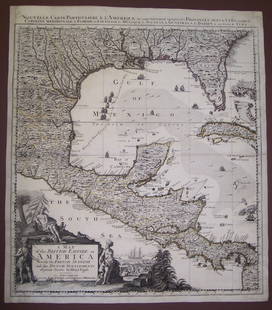
Map of Austrian Empire. 1854.
Similar Sale History
View More Items in Maps & AtlasesRelated Maps & Atlases
More Items in European Maps & Atlases
View MoreRecommended Transportation & Travel Collectibles
View More


Item Details
Description
Print of hand colored steel engraving titled „Carte Physique et Politique de L’ Empire D’Autriche“.
Drawn by L. Dussieux.
Engraved by unknown.
From „Atlas General De Geographie physique, politique et historique par L. Dussieux. Atlas de Geographie ancienne, du moyen age et Moderne“. Paris. 1854.
Louis-Étienne Dussieux, born April 5, 1815 in Lyon and died February 11, 1894 in Paris. He was a French historian-geographer.
The Austrian Empire was an empire in Central Europe created out of the realms of the Habsburgs by proclamation in 1804. It was a multinational empire and one of Europe's great powers. Geographically it was the second largest country in Europe after the Russian Empire (621,538 square kilometres [239,977 sq mi]). It was also the third most populous after Russia and France, as well as the largest and strongest country in the German Confederation. Proclaimed in response to the First French Empire, it overlapped with the Holy Roman Empire until the latter's dissolution in 1806. The Ausgleich of 1867 elevated Hungary's status. It became a separate entity from the Empire entirely, joining with it in the dual monarchy of Austria-Hungary.
Condition
Approx. image size 39, 3 x 27, 8/43, 4 x 31, 7 cm.
Condition: good.
Buyer's Premium
- 0%
Map of Austrian Empire. 1854.
Estimate €7 - €9
1 bidder is watching this item.
Get approved to bid.
Shipping & Pickup Options
Item located in Vilnius, ltSee Policy for Shipping
Payment

Related Searches
TOP


![Map of German Empire, c1800's [180903]: Historical map of Germany, with inset of the Western Provinces of Prussia, Comprehending Westphalia and the Rhine Province. Borders defined in orange ink. Railways open and constructed defined in lege](https://p1.liveauctioneers.com/2699/331495/178785779_1_x.jpg?height=310&quality=70&version=1717094933)
![Maps of Asia & India, c1800's (2) [180164]: (2) Maps of Asia, from atlas, c. 1800's. The First is a map of the continent of Asia, highlighting the Russian Empire and the Chinese empire. Map legend includes "Geographical miles", "British Miles",](https://p1.liveauctioneers.com/2699/331495/178785787_1_x.jpg?height=310&quality=70&version=1717094933)

![West Africa. Sahara caravan routes. Tribes Kingdoms Empires. LIZARS 1842 map: Title: West Africa. Sahara caravan routes. Tribes Kingdoms Empires. LIZARS 1842 map Description: Part of Africa [north-west sheet] by William Home Lizars (1842). Antique 19th century atlas map with or](https://p1.liveauctioneers.com/5584/330582/178266304_1_x.jpg?height=310&quality=70&version=1716924723)


![[MAP]. ORTELIUS, Abraham. Turcici Imperii Descriptio.1592.: [MAP]. ORTELIUS, Abraham (1527-1598). Turcici Imperii Descriptio. Antwerp, 1592. Engraved map with hand-coloring. Matted, framed, and double glazed, sight 406 x 521 mm (unexamined out of frame). Decor](https://p1.liveauctioneers.com/197/329395/177650538_1_x.jpg?height=310&quality=70&version=1715364962)
![[MAP]. ORTELIUS, Abraham. Romani Imperii Imago. 1592.: [MAP]. ORTELIUS, Abraham (1527-1598). Romani Imperii Imago. Antwerp, 1592. Engraved map with hand-coloring. Matted, framed, and double glazed, visible area 381 x 521 mm (unexamined out of frame). 6 de](https://p1.liveauctioneers.com/197/329395/177650537_1_x.jpg?height=310&quality=70&version=1715364962)


![Abissinorum Imperium. Bertius/Langenes. Abyssinian Empire. East Africa 1603 map: Title: Abissinorum Imperium. Bertius/Langenes. Abyssinian Empire. East Africa 1603 map Description: Descriptio Abissinorum / Abissinorum Imperium [The Empire of Abyssinia]. Drawn by Petrus Bertius, fr](https://p1.liveauctioneers.com/5584/330582/178266299_1_x.jpg?height=310&quality=70&version=1716924723)

![Antique H/C Map EUROPE SOUS CHARLEMAGNE EN 814: EMPIRES D'OCCIDENT ET D'ORIENT: Antique 19th Century French Map EUROPE SOUS CHARLEMAGNE EN 814: EMPIRES D'OCCIDENT ET D'ORIENT [EUROPE UNDER CHARLEMAGNE IN 814: EMPIRES OF THE WEST AND EAST] by Charles V. Monin (French, 1830 - 1880)](https://p1.liveauctioneers.com/6084/330420/178181958_1_x.jpg?height=310&quality=70&version=1716391551)


![[MAPS]. HOMANN, Johann Baptist, HOMANN HEIRS, and Georg Matthäus SEUTTER. [Composite Atlas].: [MAPS]. HOMANN, Johann Baptist (1663-1724), HOMANN HEIRS, and Georg Matthäus SEUTTER (1678-1757). [Composite Atlas]. [Nuremberg, Augsburg, and others: Homann Heirs and others, maps dated between](https://p1.liveauctioneers.com/197/329395/177650530_1_x.jpg?height=310&quality=70&version=1715364962)


