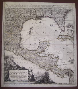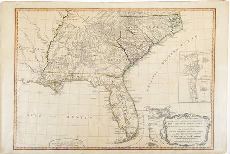
Chart of the West Indies and Spanish Dominions...
Similar Sale History
View More Items in Maps & AtlasesRelated Maps & Atlases
More Items in British Maps & Atlases
View MoreRecommended Transportation & Travel Collectibles
View More


Item Details
Description
Chart of the West Indies and Spanish Dominions in North AmericaAaron Arrowsmith (1750 - 1823). Engraved wall map with original hand color, backed on linen. London: A. Arrowsmith, 1803. In four sections: each app. 25” x 38 ½” (total dimensions: 4’2” x 5’5”). This seminal chart of Florida, the West Indies, and the Spanish dominions in America is the most celebrated map by Arrowsmith, and today the most rare. An acclaimed British cartographer, Aaron Arrowsmith drafted accurate, detailed charts that earned him the titles of Hydrographer to the King of England and Geographer to the Prince of Wales, extremely important distinctions during an era when Britain ruled the seas. One of the first great British cartographers of North America, Arrowsmith introduced a new standard of excellence in mapmaking in the late 18th century and almost single-handedly made London the center for the cartographic trade. Arrowsmith’s phenomenally rare, seminal chart of Florida, the West Indies, and the Spanish dominions in America was perhaps his most celebrated map, and today the most rare. Issued in the same year as the Louisiana Purchase, Arrowsmith’s map was invaluable for navigators and Europeans who held commercial interest in the Gulf of Mexico. Perhaps its most significant quality was its unequaled accuracy. No map up until this time held such precise and flawless detail, and certainly not on such a large scale. The map also held great esthetic appeal with its vivid outline color and crisply engraved lines. Arrowsmith built his great success on this ability to attract both commercial and general viewers through his combination of visual and scientific appeal. Advances in engraving techniques in early 19th-century England resulted in the ability to include a tremendous amount of written information on the map, and the vast scale allowed for minute detail; names on the coast of the Gulf were given in Spanish, sometimes with explanations in English. In Texas, Arrowsmith showed the Nueces River, the Rio del Norte, and inland, San Antonio. Galveston Bay is also delineated, with numbers indicating depths, and the detail is similarly meticulous throughout. Notations were included for place names, detailed depth soundings and locations of any navigational hazards, even including rocks above the water line, and dunes and spits along the coastline. Also included are notes about tides, current speeds, and magnetic variances. Arrowsmith included a great deal of practical information, such as location of fresh water and spots where vegetables could be found growing. His unique historical notes were of anecdotal interest to navigators, pointing out spots where ships had been grounded, and, for example, where Columbus had landed. The most influential and respected map publisher of the late 18th and early 19th centuries, Arrowsmith issued maps that were the result of careful synthesis rather than systematic, scientific inquiry. His role in cartographic production was to gather the best available information from a wide variety of sources, weigh the relative merits of conflicting data, and compile the most accurate depiction possible of an area. Arrowsmith accomplished this synthesis better than any other commercial mapmaker of his day and, as a result, his maps were the most sought after and highly prized on three continents. This is only more true now that their historical value has become inestimable and their numbers have dwindled due to the effects of time and general neglect. Perhaps his most rare map, this chart of Florida and the West Indies is also one of his most noted, and represents a cornerstone item for any collection relating to these areas.
Buyer's Premium
- 25%
Chart of the West Indies and Spanish Dominions...
Estimate $18,000 - $22,000
2 bidders are watching this item.
Shipping & Pickup Options
Item located in New York, NY, usSee Policy for Shipping
Payment

Related Searches
TOP


![Des Barres Map of NY Harbor: *** START PRICE IS THE RESERVE *** [America] DES BARRES, Joseph Frederick Wallet (1729-1824). A Chart of New York Harbour with the Soundings Views of Land Marks and Nautical directions for the Use of](https://p1.liveauctioneers.com/1968/163248/82424572_1_x.jpg?height=310&quality=70&version=1583340284)


![Vancouver's Map showing Showing Cook’s Inlet & Future: [America, West] VANCOUVER, George (1757-1798). A chart shewing part of the coast of N.W. America with the tracks of his Majesty's Sloop Discovery and Armed Tender Chatham commanded by George Vancouver](https://p1.liveauctioneers.com/1968/232715/120470668_1_x.jpg?height=310&quality=70&version=1641404127)
![Arrowsmith Map of West Indies: *** START PRICE IS THE RESERVE *** [America] ARROWSMITH, Aaron (1750-1823). Chart of the West Indies and Spanish Dominions. Engraved map in four parts with hand color in outline. London: Arrowsmith, 1](https://p1.liveauctioneers.com/1968/163248/82424562_1_x.jpg?height=310&quality=70&version=1583340284)


![South-west & Central Europe. Switzerland includes Haute-Savoie. THOMSON 1817 map: CAPTION PRINTED BELOW PICTURE: [Europe after the Congress of Vienna - South-west sheet] An oddly-misshapen Switzerland erroneously includes what is now the French departement of Haute Savoie and part](https://p1.liveauctioneers.com/5584/328641/177014438_1_x.jpg?height=310&quality=70&version=1715113718)


![[Maps] Gio. Ant. Magnini, Italia, 1620: [Maps] Gio. Ant. Magnini, Italia, 1620, Giovanni Antonio Magnini. Italia, data in luce da Fabio suo figliuolo al Serenissimo Ferdinado Gonzaga Duca di Matoua edi Monserrato etc. Bologna, for Sebastian](https://p1.liveauctioneers.com/188/326797/176317457_1_x.jpg?height=310&quality=70&version=1713847031)


![[Maps] Martin Zeiler, Itinerarium Italiae, 1640: [Maps] Martin Zeiler, Itinerarium Italiae, 1640, Martini Zeilleri. Itinerarium Italiae Nov-Antiquae: oder, Raiss-Beschreibung durch Italien, Matthaus Merian, Frankfurt, 40 plates, most double-page, in](https://p1.liveauctioneers.com/188/326797/176317459_1_x.jpg?height=310&quality=70&version=1713847031)

