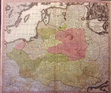
Map of The Kingdom of Bavaria. 1847.
Similar Sale History
View More Items in Maps & AtlasesRelated Maps & Atlases
More Items in European Maps & Atlases
View MoreRecommended Transportation & Travel Collectibles
View More


Item Details
Description
Print of steel engraving, hand colored titled „Des Knigreichs Baiern Ober Pfalz mit Regensburg und Niedern - Baiern.
Author Justus Perthes.
Engraved by unknown.
From Justus Perthes Stielers, „Schul-atlas 1847, Germany.
Justus Perthes Publishers (German: Justus Perthes Verlag) was established in 1785 in Gotha, Germany. Justus Perthes was publisher of geographic atlases. He published Petermanns Geographische Mitteilungen and also the Almanach de Gotha (Gothaischers Hofkalender).
Approx. image size 21, 2 x 19, 4/26, 5 x 21, 9 cm.
Condition
Condition: medium.
Buyer's Premium
- 0%
Map of The Kingdom of Bavaria. 1847.
Estimate €5 - €7
Get approved to bid.
Shipping & Pickup Options
Item located in Vilnius, ltSee Policy for Shipping
Payment

Related Searches
TOP


![Gastaldi Map of Africa: *** START PRICE IS THE RESERVE *** [Africa]. GASTALDI, Giacomo (1500-1566) & FORLANI, Paolo (fl. 1560-1571). La Descrittione dell'Africa. Engraved Map. Venice: Paolo Forlani, 1562. 19 x 25 1/4 inches](https://p1.liveauctioneers.com/1968/163248/82424552_1_x.jpg?height=310&quality=70&version=1583340284)


![[MAP]. ORTELIUS, Abraham. Presbiteri Iohannis, sive, Abissinorum Imperii Descriptio. 1592.: [MAP]. ORTELIUS, Abraham. (1527-1598). Presbiteri Iohannis, sive, Abissinorum Imperii Descriptio. Antwerp, 1592. Engraved map with hand-coloring. Matted, framed, and double glazed, visible area 406 x](https://p1.liveauctioneers.com/197/329395/177650536_1_x.jpg?height=310&quality=70&version=1715364962)


![Nouveau Royaume de Grenade, Nouvelle Andalousie et Guyane. BONNE 1790 old map: TITLE/CONTENT OF MAP: Nouveau Royaume de Grenade, Nouvelle Andalousie et Guyane [The new Kingdom of Granada, New Andalusia and Guyana] DATE PRINTED: 1790 IMAGE SIZE: Approx 24.0 x 35.5cm, 9.5 x 14 inc](https://p1.liveauctioneers.com/5584/330116/177980526_1_x.jpg?height=310&quality=70&version=1716324705)
![Nouveau Royaume de Grenade, Nouvelle Andalousie et Guyane. BONNE 1788 old map: TITLE/CONTENT OF MAP: Nouveau Royaume de Grenade, Nouvelle Andalousie et Guyane [The new Kingdom of Granada, New Andalusia and Guyana] DATE PRINTED: 1788 IMAGE SIZE: Approx 24.0 x 35.5cm, 9.5 x 14 inc](https://p1.liveauctioneers.com/5584/330116/177980440_1_x.jpg?height=310&quality=70&version=1716324705)


![[FLAGS]. 31-star American parade flag. Ca 1850-1859.: [FLAGS]. 31-star American parade flag. Ca 1850-1859. 22 x 36 1/2 in. cotton flag with 31 printed stars, configured in a double medallion surrounding a much larger central star, that is haloed in both](https://p1.liveauctioneers.com/197/329785/177758218_1_x.jpg?height=310&quality=70&version=1715625218)


