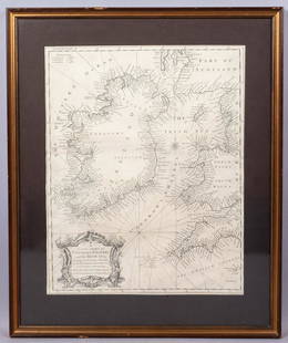
Maps of Great Britain and Ireland (6)
Similar Sale History


Recommended Items


Item Details
Description
BOWEN, Emanuel (c. 1694-1767). A New Map of Ireland. From the Best Observations. 1764. 14 1/8 x 9 1/8 inches; MERCATOR, Gerardus (1512-1594) and HONDIUS. Irlandia regnum. 1613. 16 1/2 x 20 3/4 inches; ORTELIUS, Abraham (1527-1598). Britannica Rum Insularum Typus. 1608. 16 7/8 x 21 1/4 inches; OGILBY, John (1600-1676). The Road from Hereford to Leicester. 1675. 15 1/4 x 19 inches; JANSSONIUS, Jan (1588-1664). Sea chart - British Isles c.1660. 19 7/8 x 23 7/8 inches; MOULE, Thomas (1784-1851). Isle of Wight. 1840. 8 1/4 x 10 3/4 inches.
Buyer's Premium
- 25%
Maps of Great Britain and Ireland (6)
Estimate $500 - $600
2 bidders are watching this item.
Shipping & Pickup Options
Item located in New York, NY, usSee Policy for Shipping
Payment

Related Searches
TOP


![1869 Mitchell Map of Great Britain, Ireland [verso]: Title: 1869 Mitchell Map of Great Britain, Ireland [verso] Scandinavia-- XXX Great Britain and Ireland [verso] XXXI The Western Part of Russia with Denmark Sweden & Norway Cartographer: S Mithchell Ye](https://p1.liveauctioneers.com/5584/208823/106313420_1_x.jpg?height=310&quality=70&version=1625000702)


![Origin of Commerce of the British Empire: Heading: Author: [Anderson, Adam] Title: An Historical and Chronological Deduction of the Origin of Commerce From the Earliest Accounts to the Present Time. To Which is Prefixed, an Introduction, Exh](https://p1.liveauctioneers.com/642/326037/175553744_1_x.jpg?height=310&quality=70&version=1713477451)


