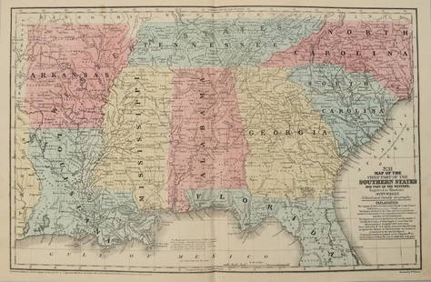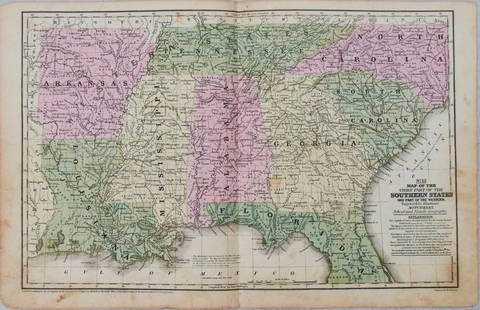
1856 Western States Map by Mitchell
Similar Sale History
View More Items in Maps & AtlasesRelated Maps & Atlases
More Items in Maps & Atlases
View MoreRecommended Transportation & Travel Collectibles
View More


Item Details
Description
Title: 1856 Western States Map by MitchellDate/Period: 1856Materials: Hand colored steel engravingSize: 18” x 9”Discover the Western states, now known as the Midwestern states, as they were in 1856 with this map by Mitchell and Cowperthwait, published in Philadelphia as part of “Mitchell’s School Atlas”. This hand-colored steel engraving shows Ohio, Indiana, Kentucky, Illinois, Iowa, Missouri, and parts of Michigan and Virginia (current West Virginia). Measuring 18" x 9", this map is in good condition, with some foxing. Its authenticity is guaranteed.
Buyer's Premium
- 15%
1856 Western States Map by Mitchell
Estimate $30 - $40
Shipping & Pickup Options
Item located in New York, US$14 shipping in the US
Payment
Accepts seamless payments through LiveAuctioneers
See More Items From This Jasper52 Seller

TOP


![1869 Mitchell Map of the Northern and [verso] Western Portions of South America -- XXV Venezuela,: Title: 1869 Mitchell Map of the Northern and [verso] Western Portions of South America -- XXV Venezuela, United States of Columbia and Ecuador [verso] XXVII Peru and Bolivia Cartographer: S Mithchell](https://p1.liveauctioneers.com/5584/249663/129591905_1_x.jpg?height=310&quality=70&version=1654033541)


![1878 Mitchell Map of Virginia and West Virginia [verso] New Jersey, Maryland and Delaware -- County: Title: 1878 Mitchell Map of Virginia and West Virginia [verso] New Jersey, Maryland and Delaware -- County Map ofVirginia and West Virginia [Verso} County Map of Maryland and Delaware [with] County Ma](https://p1.liveauctioneers.com/5584/329422/177662152_1_x.jpg?height=310&quality=70&version=1715717898)


![1898 Rand McNally Map of Texas [verso] Indian Territory and Oklahoma -- Texas [verso] Oklahoma and: Title: 1898 Rand McNally Map of Texas [verso] Indian Territory and Oklahoma -- Texas [verso] Oklahoma and Indian Territory Cartographer: Rand McNally Year / Place: 1898, Chicago Map Dimension (in.): 9](https://p1.liveauctioneers.com/5584/329422/177662173_1_x.jpg?height=310&quality=70&version=1715717898)


![1878 Mitchell Map of Washington, Oregon, Idaho, much of Montana [verso] Territory of Idaho: Title: 1878 Mitchell Map of Washington, Oregon, Idaho, much of Montana [verso] Territory of Idaho Cartographer: S Mitchell Year / Place: 1878, Philadelphia Map Dimension (in.): 10.8 X 13.4 in. This is](https://p1.liveauctioneers.com/5584/329422/177662232_1_x.jpg?height=310&quality=70&version=1715717898)


![[Maps] Gio. Ant. Magnini, Italia, 1620: [Maps] Gio. Ant. Magnini, Italia, 1620, Giovanni Antonio Magnini. Italia, data in luce da Fabio suo figliuolo al Serenissimo Ferdinado Gonzaga Duca di Matoua edi Monserrato etc. Bologna, for Sebastian](https://p1.liveauctioneers.com/188/326797/176317457_1_x.jpg?height=310&quality=70&version=1713847031)
![[Maps] Martin Zeiler, Itinerarium Italiae, 1640: [Maps] Martin Zeiler, Itinerarium Italiae, 1640, Martini Zeilleri. Itinerarium Italiae Nov-Antiquae: oder, Raiss-Beschreibung durch Italien, Matthaus Merian, Frankfurt, 40 plates, most double-page, in](https://p1.liveauctioneers.com/188/326797/176317459_1_x.jpg?height=310&quality=70&version=1713847031)


![[MAP]. TODESCHI, Pietro. [Nova et Acurata Totius Americae Tabula auct. G.I. Blaeu] America quarta: [MAP]. TODESCHI, Pietro. [Nova et Acurata Totius Americae Tabula auct. G.I. Blaeu] America quarta pars orbis quam plerunq, nuvum orbem appellitant primo detecta est anno 1492 a Christophoro Columbo...](https://p1.liveauctioneers.com/197/329395/177650542_1_x.jpg?height=310&quality=70&version=1715364962)


