


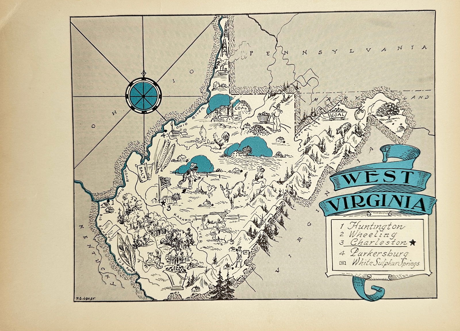
Paul Spener Johst - Animated map of West Virginia
Similar Sale History
View More Items in Maps & Atlases


![1876 Mitchell Map of Virginia, West Wirginia [verso]: Title/Content of Map: 1876 Mitchell Map of Virginia, West Wirginia [verso] New Jersey, Maryland, Delaware -- County Map of Virginia and West Virginia [verso] County Map of New Jersey [and] County Map](https://p1.liveauctioneers.com/5584/138985/70465971_1_x.jpg?height=310&quality=70&version=1554250661)


Related Maps & Atlases
![[MAP]. ORTELIUS, Abraham. Peregrinationis Divi Pauli Typus Corographicus. 1592.: [MAP]. ORTELIUS, Abraham (1527-1598). Peregrinationis Divi Pauli Typus Corographicus. Antwerp, 1592. Engraved map with hand-coloring. Matted, framed, and double glazed, visible area 381 x 533 mm (unex](https://p1.liveauctioneers.com/197/329395/177650535_1_x.jpg?height=310&quality=70&version=1715364962)


![South-west Europe. Swiss Savoy. British Hanover. THOMSON 1817 old antique map: TITLE/CONTENT OF MAP: [South-west sheet of] A map of Europe, with the political divisions after the Peace of Paris and Congress of Vienna The map shows south west Europe after the Congress of Vienna.](https://p1.liveauctioneers.com/5584/328641/177014448_1_x.jpg?height=310&quality=70&version=1715113718)


More Items in Maps & Atlases
View More

![[Maps] Martin Zeiler, Itinerarium Italiae, 1640: [Maps] Martin Zeiler, Itinerarium Italiae, 1640, Martini Zeilleri. Itinerarium Italiae Nov-Antiquae: oder, Raiss-Beschreibung durch Italien, Matthaus Merian, Frankfurt, 40 plates, most double-page, in](https://p1.liveauctioneers.com/188/326797/176317459_1_x.jpg?height=310&quality=70&version=1713847031)
![[Maps] Gio. Ant. Magnini, Italia, 1620: [Maps] Gio. Ant. Magnini, Italia, 1620, Giovanni Antonio Magnini. Italia, data in luce da Fabio suo figliuolo al Serenissimo Ferdinado Gonzaga Duca di Matoua edi Monserrato etc. Bologna, for Sebastian](https://p1.liveauctioneers.com/188/326797/176317457_1_x.jpg?height=310&quality=70&version=1713847031)


Recommended Transportation & Travel Collectibles
View More


Item Details
Description
Neat animated West Virginia picture map which features sketches of people, agriculture, industry, and more. This is an original, not a reprint, antique picture map which was carefully removed from a rare 1931 children's atlas by Paul Spener Johst.
Size: 19 cm x 25 cm
Size: 19 cm x 25 cm
Buyer's Premium
- 24%
Paul Spener Johst - Animated map of West Virginia
Estimate $100 - $200
1 bidder is watching this item.
Shipping & Pickup Options
Item located in Bromma, Stockholm, seOffers In-House Shipping
Payment

TOP