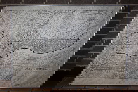
West Indies .-Wilkinson (Robert) Atlas of the West-Indies, 28 engraved maps, [c. 1795]
Similar Sale History
View More Items in Maps & Atlases
Related Maps & Atlases
More Items in Maps & Atlases
View MoreRecommended Transportation & Travel Collectibles
View More


![West Indies .-Wilkinson (Robert) Atlas of the West-Indies, 28 engraved maps, [c. 1795]](https://p1.liveauctioneers.com/5458/315136/168961327_1_x.jpg?quality=1&version=1704475016&width=486)
![West Indies .-Wilkinson (Robert) Atlas of the West-Indies, 28 engraved maps, [c. 1795]](https://p1.liveauctioneers.com/5458/315136/168961327_1_x.jpg?quality=80&version=1704475016)
Item Details
Description
West Indies.- Wilkinson (Robert) Atlas of the West-Indies, composite atlas with manuscript title and contents, 28 engraved maps and charts on 32 sheets, with four maps divided into North and South sheet sections, all with hand-colouring, many folding, various sizes between 490 x 620 mm (19 1/4 x 24 3/8 in) and the largest single map approx. 1640 x 940 mm (64 1/2 x 37 in), all with discolouration and browning to green copper pigment used, some splitting to old folds, numerous handling creases throughout, rather heavy surface dirt, half calf, spine with title 'Atlas of West Indies', elephant folio (595 x 530 mm), [circa 1795-1815]*** Important publisher's composite atlas with numerous large and early maps of the West Indies, including:- Delarochette (Louis) A Map of North America and the West Indies, engraved map in two sections, [1795-1825] - Speer (John Joseph) A General Chart of the West Indies, engraved map, 1796- Lempriere (Charles) [Sea Chart of Bermuda], engraved map, 1738 [but probably later]- Jefferys (Thomas) Three sheets from the 'West India Atlas' [covering the Coast of Yucatan, Island of Cuba, and the Windward Passage], engraved map, [c. 1775 or slightly later]- Browne (Patrick) A New Map of Jamaica, engraved map, 1797- Faden (William) Isle of St. Domingo or Hispaniola, engraved map, 1796- Laurie & Whittle Turks Islands, engraved map, 1794- Richmond (M.) A Map of the Caribbee, Granadilles and Virgin Isles, 1789- Jefferys (Thomas) The Virgin Islands from English and Danish Surveys, 1794- Faden (William) The Island of St Eustatius corruptly St Eustatia, 1795- Baker (Samuel) A New and Exact Map of the Island of St. Christopher in America, 1753- Baker (Robert) A New and Exact Map of the Island of Antigua in America, 1748- Jefferys (Thomas) Guadaloupe Done from Actual Surveys and Observations of the English, 1794- Jeffreys (Thomas) Martinico, 1794- Jefferys (Thomas) St. Lucia, 1794- Mayo (William) A New and Exact Map of the Barbadoes in America- Byres (John) ... His Majesty's Island of Dominica ..., 1794- Byres (John) Plan of the Island of Bequia, 1776 [but 1794]- Paterson (Lieut. Daniel) A New Plan of the Island of Grenada, 1796- Byres (John) Plan of the Island of Tobago, 1794- Delarochette (Louis) The Coast of Guyana, 1783- Anderson (John) Chart of the River and Sea Coast of the Colony of Demerary..., - Jefferys (Thomas) Curacao from the Dutch Originals..., c. 1795- Jefferys (Thomas) Ruatan or Rattan..., 1794- Faden (William) A Map of a Part of Yucatan or of that Part of the Eastern Shore within the Bay of Honduras Alloted to Great Britain for the Cutting of Logwood, 1787- Kitchin (Thomas) South America with Its Several Divisions, 1794
Buyer's Premium
- 26% up to £20,000.00
- 25% up to £500,000.00
- 20% above £500,000.00
West Indies .-Wilkinson (Robert) Atlas of the West-Indies, 28 engraved maps, [c. 1795]
Estimate £8,000 - £12,000
6 bidders are watching this item.
Shipping & Pickup Options
Item located in London, London, ukOffers In-House Shipping
Local Pickup Available
Payment

Auction Curated By

International Head of Books and Works on Paper

Modern First Editions and 20th Century Literature
TOP


![[MAPS]. HOMANN, Johann Baptist, HOMANN HEIRS, and Georg Matthäus SEUTTER. [Composite Atlas].: [MAPS]. HOMANN, Johann Baptist (1663-1724), HOMANN HEIRS, and Georg Matthäus SEUTTER (1678-1757). [Composite Atlas]. [Nuremberg, Augsburg, and others: Homann Heirs and others, maps dated between](https://p1.liveauctioneers.com/197/329395/177650530_1_x.jpg?height=310&quality=70&version=1715364962)


![[MAP]. TODESCHI, Pietro. [Nova et Acurata Totius Americae Tabula auct. G.I. Blaeu] America quarta: [MAP]. TODESCHI, Pietro. [Nova et Acurata Totius Americae Tabula auct. G.I. Blaeu] America quarta pars orbis quam plerunq, nuvum orbem appellitant primo detecta est anno 1492 a Christophoro Columbo...](https://p1.liveauctioneers.com/197/329395/177650542_1_x.jpg?height=310&quality=70&version=1715364962)


![[MAP]. ORTELIUS, Abraham. Turcici Imperii Descriptio.1592.: [MAP]. ORTELIUS, Abraham (1527-1598). Turcici Imperii Descriptio. Antwerp, 1592. Engraved map with hand-coloring. Matted, framed, and double glazed, sight 406 x 521 mm (unexamined out of frame). Decor](https://p1.liveauctioneers.com/197/329395/177650538_1_x.jpg?height=310&quality=70&version=1715364962)
![[MAP]. ORTELIUS, Abraham. Americae Sive Novi Orbis, Nova Descriptio. 1573.: [MAP]. ORTELIUS, Abraham (1527-1598). Americae Sive Novi Orbis, Nova Descriptio. Antwerp, 1573. Engraved map with hand-coloring. Framed and double glazed, visible area 375 x 521 mm (unexamined out of](https://p1.liveauctioneers.com/197/329395/177650534_1_x.jpg?height=310&quality=70&version=1715364962)


![[FLAGS]. 31-star American parade flag. Ca 1850-1859.: [FLAGS]. 31-star American parade flag. Ca 1850-1859. 22 x 36 1/2 in. cotton flag with 31 printed stars, configured in a double medallion surrounding a much larger central star, that is haloed in both](https://p1.liveauctioneers.com/197/329785/177758218_1_x.jpg?height=310&quality=70&version=1715625218)


