Bleau Map of New France
Similar Sale History
View More Items in Maps & AtlasesRelated Maps & Atlases
More Items in Maps & Atlases
View MoreRecommended Transportation & Travel Collectibles
View More


Item Details
Description
BLAEU, Willem Janszoon (1571-1638).
Extrema Americae versus Boream, ubi Terra Nova / Nova Francia.
Engraved map with original hand color.
Amsterdam, 1662.
21" x 25" sheet.
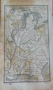
This handsome map of the Canadian Maritimes is based on Samuel de Champlain's great map of 1632, and augmented with place names from De Laet and Jansson. This is Blaeu's only map of Canada. It shows Nova Scotia, Newfoundland, the Gulf of St. Lawrence, Labrador and the Davis and Hudson Straits as well as the southern tip of Greenland and a portion of northern Maine. The elaborate cartouches symbolize the importance of the Grand Banks fisheries, which are boldly engraved on the map (Burden, 371).
Buyer's Premium
- 25%
Bleau Map of New France
Estimate $2,500 - $3,500
4 bidders are watching this item.
Shipping & Pickup Options
Item located in New York, NY, usOffers In-House Shipping
Local Pickup Available
Payment
Accepts seamless payments through LiveAuctioneers

Related Searches
TOP


![VAN DER AA - Map of America, Leiden 1720: VAN DER AA, Pieter (1659-1733). Nouvelle Carte de l'Amerique. Leiden: [circa 1720]. Copper-engraved map. Sheet size: 18 x 21 1/4 inches. (Expert restoration along the side margins). Decorative early 1](https://p1.liveauctioneers.com/7533/208644/106251140_1_x.jpg?height=310&quality=70&version=1624641782)


![Visscher Map of Middleburgh, Holland: VISSCHER, Nicolas II (1649-1702). Untitled [Middelburgh] Engraved map with original hand color. Amsterdam, c.1690 21 1/2" x 24 3/8" sheet. Antique Map showing the then Island of Middleburgh in Holland](https://p1.liveauctioneers.com/1968/297676/158406682_1_x.jpg?height=310&quality=70&version=1690906360)


![French Map of America Southeast [179304]: Northeastern American map published 1788 from a French cartographer. Map measures 9"x 13". Published during America's War of Independence from Great Britain (1176-1783), this map features the mid-Atla](https://p1.liveauctioneers.com/2699/331495/178785746_1_x.jpg?height=310&quality=70&version=1717094933)


![SELLER, JOHN. Two miniature hand-colored engraved maps: New England and New York [and] A New Mapp of: SELLER, JOHN. Two miniature hand-colored engraved maps: New England and New York [and] A New Mapp of the World. 5¾x6 and 5¾x6¾ inches each sheet size; double-page, blank versos; minor s](https://p1.liveauctioneers.com/199/332329/179231700_1_x.jpg?height=310&quality=70&version=1717450360)
![[MAPS]. HOMANN, Johann Baptist, HOMANN HEIRS, and Georg Matthäus SEUTTER. [Composite Atlas].: [MAPS]. HOMANN, Johann Baptist (1663-1724), HOMANN HEIRS, and Georg Matthäus SEUTTER (1678-1757). [Composite Atlas]. [Nuremberg, Augsburg, and others: Homann Heirs and others, maps dated between](https://p1.liveauctioneers.com/197/329395/177650530_1_x.jpg?height=310&quality=70&version=1715364962)
![[MAP]. TODESCHI, Pietro. [Nova et Acurata Totius Americae Tabula auct. G.I. Blaeu] America quarta: [MAP]. TODESCHI, Pietro. [Nova et Acurata Totius Americae Tabula auct. G.I. Blaeu] America quarta pars orbis quam plerunq, nuvum orbem appellitant primo detecta est anno 1492 a Christophoro Columbo...](https://p1.liveauctioneers.com/197/329395/177650542_1_x.jpg?height=310&quality=70&version=1715364962)

![[MAP]. ORTELIUS, Abraham. Americae Sive Novi Orbis, Nova Descriptio. 1573.: [MAP]. ORTELIUS, Abraham (1527-1598). Americae Sive Novi Orbis, Nova Descriptio. Antwerp, 1573. Engraved map with hand-coloring. Framed and double glazed, visible area 375 x 521 mm (unexamined out of](https://p1.liveauctioneers.com/197/329395/177650534_1_x.jpg?height=310&quality=70&version=1715364962)


![[MAP]. ORTELIUS, Abraham. Turcici Imperii Descriptio.1592.: [MAP]. ORTELIUS, Abraham (1527-1598). Turcici Imperii Descriptio. Antwerp, 1592. Engraved map with hand-coloring. Matted, framed, and double glazed, sight 406 x 521 mm (unexamined out of frame). Decor](https://p1.liveauctioneers.com/197/329395/177650538_1_x.jpg?height=310&quality=70&version=1715364962)
![Set of Twelve Satirical Anthropomorphic Maps of Europe: [SATIRICAL MAPS] A set of twelve satirical anthropomorphic maps of Europe. London: circa 1868. A set of 12 (believed complete) lithographed maps by Vincent Brooks, Day & Son, London, each offering](https://p1.liveauctioneers.com/292/330597/178279264_1_x.jpg?height=310&quality=70&version=1716409282)


![[MAP]. ORTELIUS, Abraham. Romani Imperii Imago. 1592.: [MAP]. ORTELIUS, Abraham (1527-1598). Romani Imperii Imago. Antwerp, 1592. Engraved map with hand-coloring. Matted, framed, and double glazed, visible area 381 x 521 mm (unexamined out of frame). 6 de](https://p1.liveauctioneers.com/197/329395/177650537_1_x.jpg?height=310&quality=70&version=1715364962)
![[MAP]. SPEED, John. A New Mappe of the Romane Empire. 1676.: [MAP]. SPEED, John (ca 1551-1629). A New Mappe of the Romane Empire. London: Basset & Chiswell, 1676. Engraved map with hand-coloring. Framed and double glazed, sight 419 x 559 mm. Decorative cartouch](https://p1.liveauctioneers.com/197/329395/177650541_1_x.jpg?height=310&quality=70&version=1715364962)
![[MAP]. ORTELIUS, Abraham. Aevi Veteris, Typus Geographicus. 1601.: [MAP]. ORTELIUS, Abraham (1527-1598). Aevi Veteris, Typus Geographicus. Antwerp, 1601. Engraved map with hand-coloring. Matted, framed, and double glazed, visible area 343 x 470 mm (unexamined out of](https://p1.liveauctioneers.com/197/329395/177650532_1_x.jpg?height=310&quality=70&version=1715364962)


