


Rare Original 16th Century Hand Colored Double Page Copper Engraved Map(s) from from Theatrum Orbis
Similar Sale History
View More Items in Maps & Atlases

![Double hemisphere world map by Ruscelli, 1561: Heading: Author: Ruscelli, Girolamo Title: Orbis Descriptio Place Published: Venice Publisher: Date Published: 1561-[1574?] Description: Double-hemisphere copper-engraved w](https://p1.liveauctioneers.com/642/139321/70635504_1_x.jpg?height=310&quality=70&version=1554323736)


![Hungariae Descriptio, Wolfgango Lazio Auct 16C Map: Hungariae Descriptio, Wolfgango Lazio Auct. 16th century map. Double-page engraved map of Hungary from Abraham Ortelius's Theatrum Orbis Theatrum, [1592]. Good condition, laid down. Image measures 14](https://p1.liveauctioneers.com/251/114624/58991515_1_x.jpg?height=310&quality=70&version=1515186604)
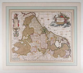


![Willem Bleau and Sons [Map of Wales]: Willem Bleau and Sons (Dutch 1571 - 1673), 'Wallia Principatus Vulgo Wales'. Double page, hand-colored copper engraving. Map features elaborate title cartouche and coat of arms, the ocean featuring sh](https://p1.liveauctioneers.com/5755/147592/74586087_1_x.jpg?height=310&quality=70&version=1565302309)

Related Maps & Atlases


![[MAP]. TODESCHI, Pietro. [Nova et Acurata Totius Americae Tabula auct. G.I. Blaeu] America quarta: [MAP]. TODESCHI, Pietro. [Nova et Acurata Totius Americae Tabula auct. G.I. Blaeu] America quarta pars orbis quam plerunq, nuvum orbem appellitant primo detecta est anno 1492 a Christophoro Columbo...](https://p1.liveauctioneers.com/197/329395/177650542_1_x.jpg?height=310&quality=70&version=1715364962)


![[MAP]. ORTELIUS, Abraham. Americae Sive Novi Orbis, Nova Descriptio. 1573.: [MAP]. ORTELIUS, Abraham (1527-1598). Americae Sive Novi Orbis, Nova Descriptio. Antwerp, 1573. Engraved map with hand-coloring. Framed and double glazed, visible area 375 x 521 mm (unexamined out of](https://p1.liveauctioneers.com/197/329395/177650534_1_x.jpg?height=310&quality=70&version=1715364962)
More Items in Maps & Atlases
View More

![[MAPS]. HOMANN, Johann Baptist, HOMANN HEIRS, and Georg Matthäus SEUTTER. [Composite Atlas].: [MAPS]. HOMANN, Johann Baptist (1663-1724), HOMANN HEIRS, and Georg Matthäus SEUTTER (1678-1757). [Composite Atlas]. [Nuremberg, Augsburg, and others: Homann Heirs and others, maps dated between](https://p1.liveauctioneers.com/197/329395/177650530_1_x.jpg?height=310&quality=70&version=1715364962)


![Set of Twelve Satirical Anthropomorphic Maps of Europe: [SATIRICAL MAPS] A set of twelve satirical anthropomorphic maps of Europe. London: circa 1868. A set of 12 (believed complete) lithographed maps by Vincent Brooks, Day & Son, London, each offering](https://p1.liveauctioneers.com/292/330597/178279264_1_x.jpg?height=310&quality=70&version=1716409282)


![[MAP]. ORTELIUS, Abraham. Turcici Imperii Descriptio.1592.: [MAP]. ORTELIUS, Abraham (1527-1598). Turcici Imperii Descriptio. Antwerp, 1592. Engraved map with hand-coloring. Matted, framed, and double glazed, sight 406 x 521 mm (unexamined out of frame). Decor](https://p1.liveauctioneers.com/197/329395/177650538_1_x.jpg?height=310&quality=70&version=1715364962)
![[MAP]. ORTELIUS, Abraham. Romani Imperii Imago. 1592.: [MAP]. ORTELIUS, Abraham (1527-1598). Romani Imperii Imago. Antwerp, 1592. Engraved map with hand-coloring. Matted, framed, and double glazed, visible area 381 x 521 mm (unexamined out of frame). 6 de](https://p1.liveauctioneers.com/197/329395/177650537_1_x.jpg?height=310&quality=70&version=1715364962)
![[MAP]. SPEED, John. A New Mappe of the Romane Empire. 1676.: [MAP]. SPEED, John (ca 1551-1629). A New Mappe of the Romane Empire. London: Basset & Chiswell, 1676. Engraved map with hand-coloring. Framed and double glazed, sight 419 x 559 mm. Decorative cartouch](https://p1.liveauctioneers.com/197/329395/177650541_1_x.jpg?height=310&quality=70&version=1715364962)
Recommended Transportation & Travel Collectibles
View More

![[FLAGS]. 31-star American parade flag. Ca 1850-1859.: [FLAGS]. 31-star American parade flag. Ca 1850-1859. 22 x 36 1/2 in. cotton flag with 31 printed stars, configured in a double medallion surrounding a much larger central star, that is haloed in both](https://p1.liveauctioneers.com/197/329785/177758218_1_x.jpg?height=310&quality=70&version=1715625218)


![[FLAGS]. 13-star American flag, possibly a US Navy boat flag. Ca late-19th century.: [FLAGS]. 13-star American flag, possibly a US Navy boat flag. Ca late-19th century. 35 x 71 1/2 in. hand-sewn and machine-sewn wool flag with 13 double-appliquéd cotton stars configured in 3/2/3/2/3](https://p1.liveauctioneers.com/197/329785/177758215_1_x.jpg?height=310&quality=70&version=1715625218)


Item Details
Description
A rare 16th Century double page engraved map(s) by ABRAHAM ORTELIUS (Flemish 1527-1598) | The left page map is entitled “Buchauiae siue Fuldensis Ditionis Typus,” and the right page map is entitled “Waldeccensis Comitatus Descripto Accuratissima,” each dated 1574 and 1575 respectively | Comprising a single folded hand colored copper engraved sheet, from “Theatrum Orbis Terrarium,” PARIS, 1584 (Latin Ed.) | Contributors: Wolfgang Regerwyl (active 1570-1590) and Joist Moers (c.1540-1625) (Engraver)| The Maps are of the district of Fulda (today in Hesse, Germany) and the county of Waldeck (today in Hesse and Lower Saxony, Germany), showing the principal towns and cities including Fulda, Waldeck, Korbach, and Neuhof.Approx. Dimensions: 20.75″ H x 26.75″ W.Artist or Maker: Abraham Ortelius.Display: Framed and matted under glass.Date: c.1574-1575.Notes: The Diocese of Fulda (Latin Dioecesis Fuldensis) is a Roman Catholic diocese in the north of the German state of Hessen. It is a suffragan diocese of the Archdiocese of Paderborn. The bishop’s seat is in Fulda Cathedral. During the reign of Prince-abbot Balthasar von Dernbach (1570-1576 and 1602-1606), the region was the site of extensive witch-hunts with 300 witch-trials carried out in three years. This number made Fulda one of the central areas of the early-modern European witch-hunts. The Principality of Waldeck was a state of the Holy Roman Empire and its successors from the late 12th century until 1929. In 1349 the county gained Imperial immediacy and in 1712 was raised to the rank of Principality. After the dissolution of the Holy Roman Empire in 1806 it was a constituent state of its successors: the Confederation of the Rhine, the German Confederation, the North German Confederation, the German Empire and, until 1929, the Weimar Republic. It comprised territories in present-day Hesse and Lower Saxony, (Germany). Other Translations: Antwerpen Ortelius A 1575 – “Buchaviae, siue Fuldensis Ditionis Typus” und “Waldeccensis Comitatus Descriptio Accuratissima”. Altkol. Kupf.-Ktn. von W. Reckwill, 1574 u. J. Moers, 1575. Bei A. Ortelius, 1584. Zwei Karten auf 1 Blatt. 31,5:46,5 cm. V. d. Broecke Nr. 98a,b – lat. Ausg. 1584 – Zeigt das Bistum Fulda und das Fürstentum Waldeck. – Fulda mit ausgem. Rollwerkskart u. Windrose, Waldeck mit ausgem. floral. Rollwerkskart.
Buyer's Premium
- 25%
Rare Original 16th Century Hand Colored Double Page Copper Engraved Map(s) from from Theatrum Orbis
Estimate $750 - $1,500
1 bidder is watching this item.
Shipping & Pickup Options
Item located in Gallatin (Nashville), TN, usOffers In-House Shipping
Local Pickup Available
Payment
Accepts seamless payments through LiveAuctioneers

TOP